M Bornong
Senior Member.
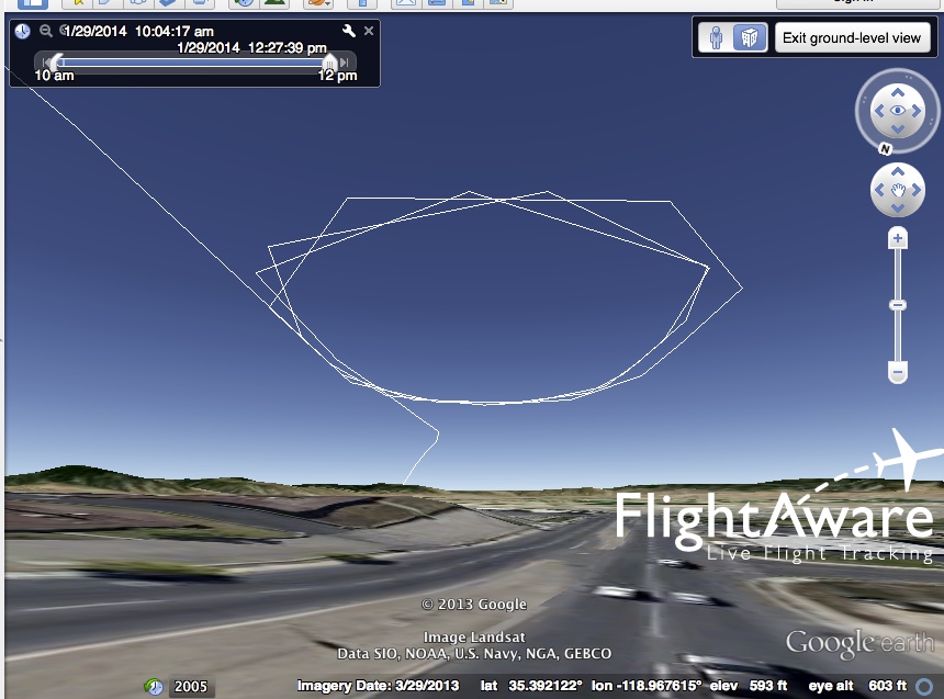
This morning 1/29/14, I was watching the sky and saw this contrail,

He made 3 passes,


Due to the haze I was not able to get a decent photo of the plane,

It was fairly simple to identify the flight pattern on Flightradar24

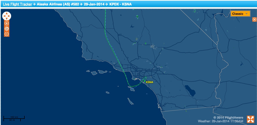
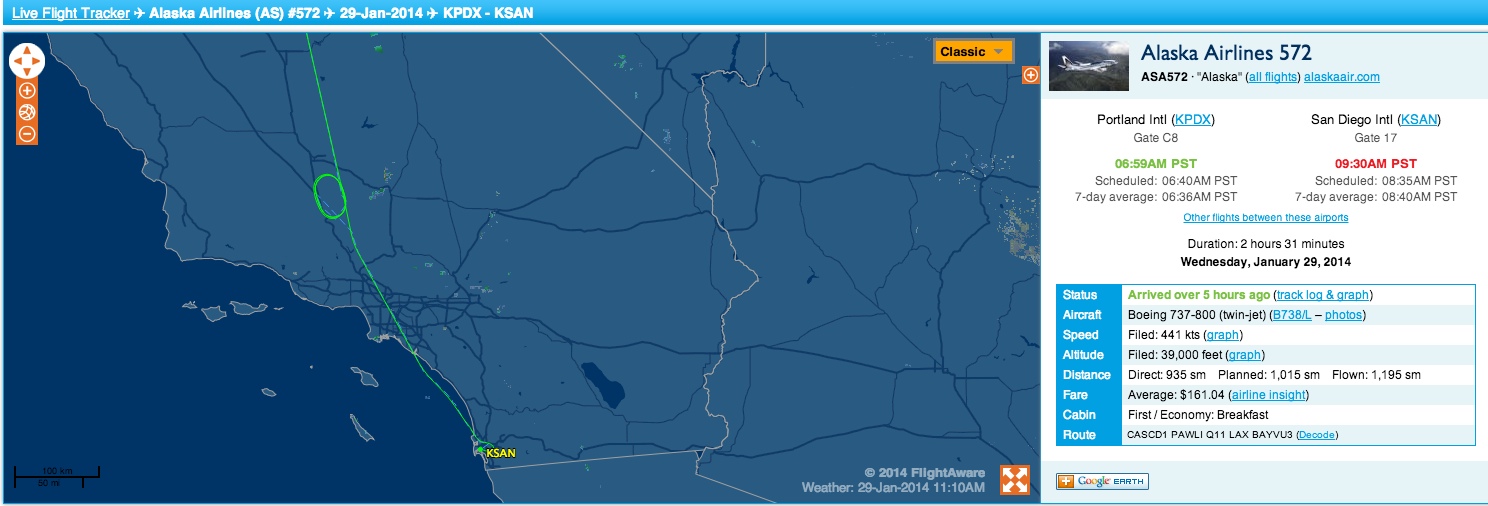
I was disappointed that there wasn't a call sign, and hoped I could identify the actual flight by where it landed. At about 17:15 UTC am, it passed between Huntington Beach and John Wayne Airport and continued over the ocean. I thought it might be heading towards San Diego and started checking arrivals. When I returned to Flightradar, the flight had simply vanished. I went back through the playback and saw that it went off the radar at approximately 17:26 UTC it disappears off the coast of Oceanside. Knowing it had to be a glitch, I checked back at John Wayne Airport and found,

http://www.ocair.com/flightinformation/arrivals/
I didn't find any other corresponding arrivals at the other LA area airports.
Do you think it's a fairly safe assumption that I was most likely watching Alaska Airlines Flight AS 582? I haven't spent too much time playing with flightradar, yet.
(Note: The exe on my photos will be one hour off. I never adjusted my camera for the fall time change.)
He made 3 passes,
Due to the haze I was not able to get a decent photo of the plane,
It was fairly simple to identify the flight pattern on Flightradar24
I was disappointed that there wasn't a call sign, and hoped I could identify the actual flight by where it landed. At about 17:15 UTC am, it passed between Huntington Beach and John Wayne Airport and continued over the ocean. I thought it might be heading towards San Diego and started checking arrivals. When I returned to Flightradar, the flight had simply vanished. I went back through the playback and saw that it went off the radar at approximately 17:26 UTC it disappears off the coast of Oceanside. Knowing it had to be a glitch, I checked back at John Wayne Airport and found,
http://www.ocair.com/flightinformation/arrivals/
I didn't find any other corresponding arrivals at the other LA area airports.
Do you think it's a fairly safe assumption that I was most likely watching Alaska Airlines Flight AS 582? I haven't spent too much time playing with flightradar, yet.
(Note: The exe on my photos will be one hour off. I never adjusted my camera for the fall time change.)