Why Were There Contrails Today, But Not Yesterday? It's the Weather!

EDC Contrails today vs. yesterday.jpg
Today (Thursday Oct 6th, 2016) marked the first significant contrail morning for several months here in El Dorado County, Northern California. The above photo on the right of criss-crossing contrails was taken at 7:30AM, and planes continued to leave trails for the next few hours. I took photos of the jets, and they were just regular air traffic, mostly Alaska or other regional jets flying north or south, often to or from Los Angeles. They were all in the range 36,000 to 39,000 feet.

Various Planes over EDC this morning.jpg


But it's Thursday, and the air traffic on Wednesday was pretty much identical. So why were there trails this morning, but not yesterday morning?

The answer is quite straightforward. It's the upper air weather!

Upper air weather is different to the weather on the ground. At 35,000 feet up it's very cold (usually below -40°F/-40°C), the air is thinner, and the winds are stronger (often 50 to 100mph). Contrails need two things to form and persist. They need cold air, and they need that air to be humid. So what was the difference in upper air weather?

A great resource here is http://www.instantweathermaps.com/ which can provide three days worth of maps of weather conditions in the upper atmosphere. To get the most recent map or RH at cruise atltitudes, just go to:
http://www.instantweathermaps.com/GFS-php/showmap-conusupper.php?var=RH&lev=300mb

That takes you directly to Maps/GFS/CONUS/Upper Air.
(GFS = Global Forecast System, the most commonly use weather forecast. CONUS = Continental United States), you can also get there via the home page on the menu:
20161006-101234-vjxi4.jpg


To get older maps from the past week you need to figure out the time. There are actually TWO things you have to select. Let's say we want 7AM this morning. First we need to convert to "Zulu" time, which is just GMT. We can do this with google, just type in "7AM PDT in Zulu", and it will tell you the Zulu time:
20161006-101832-a3goy.jpg

2PM, on the same day (sometimes it's already tomorrow in GMT, so you need to account for that). So that's 1400 hours, or 14Z. However the menu only lets us select in increments of six hours.
20161006-102052-shrz6.jpg


The reason for this is that the various physicals reading that the forecast is based on are only updated every six hours. After that it's "just" a forecast. We can adjust the time forecasted for, but we really only have the options of +0 hours, or +3 hours. So we pick the closest time and then (optionally) add three hours to it. In this case +3 will give us the closest, being equivalent to 8AM

So, select:
  • 2016010-06 12Z - The closest base time
  • Relative Humidity - The most important factor for contrails, we will look at temperature later.
  • 300mb - This is pressure. 300mb is about 30,000 feet. 250mb would be a bit more accurate, but is not available for RH (it is for temperature)
  • 3h - To get the time as close as possible. (Don't select "Loop" here unless you've paid for a subscription.)
  • View Map
20161006-102753-dzbxe.jpg


And here's the same map for the same time yesterday
20161006-103323-jo1wi.jpg


So what's the difference? We need to look at the precise location. I'm about midway between San Francisco (which you can see as the Bay), and Tahoe (which is at the 45° angle on the California/Nevada Border). I've marked it here on both maps with a red dot. yesterday morning is on the left, then this morning on the right
20161006-104104-9w20i.jpg


So yesterday, the humidity at 300mb (around 30,000 feet) was in the 10% to 20% range. Today it was in the 50% to 60% range. Quite a significant difference. And if we look at the 6h forecast we can see that the humidity was increasing:
20161006-104945-draul.jpg


Here I've recolored the 70% band to make it more clear.

Now 70% RH is often given as a rule of thumb for persistent contrails. But the actual value depends on the temperature (and to a very small degree the pressure/altitude). The colder it is, the less the RH needs to be. In fact at -40C you only need 67.5% RH, and at -50C you will get persistent contrails at just over 60% RH. So we also need to know how cold it is/was.

Now I'm using 300mb maps for the RH, because that's all that is available. But that's only around 30,000 feet, lower than most of the contrail leaving flight I observed. So for temperature I'm going to use the 250mb maps, which are around 34,000 feet. We could also use 200mb, which is around 38,000 feet, but 250 is probably a good average.

We have today's upper air temperature:
20161006-110406-vx3b3.jpg


And yesterday's
20161006-110450-h896y.jpg


Quite unambiguously -50C there, which is -58F. Today is a bit colder than yesterday, but not a lot. The significant change has been in humidity. The air was cold enough both days, but yesterday was too dry.

So the very simple answer as to why there are contrails today but not yesterday is that the upper air weather directly overhead changed a bit.


[Update Oct 9th 2016]

The change in the weather was noticed by chemtrail enthusiast John Knox, who posted videos of the sky over Los Angeles Coast on two consecutive days, Oct 7 and Oct 8 (2016).
20161009-105303-691is.jpg


In the second video (with no contrails) he says he assumes the conditions are "damn near the same". But are they?
No time was given so let's go with 1PM, or 18:00 Zulu, here are the weather maps for RH at 300mb (around 30,000 feet).
20161009-110614-dkwod.jpg


On the 7th Los Angeles is right in the 70% zone. Ideal conditions for contrails to form in a clear blue sky. On the 8th it's in the 10% to 20% zone. Blue sky conditions.

To visualize how much it can changed from one day to the next, here's 72 hours (three days) of 30,000 foot RH. Green areas are the contrail areas. Brown areas are no contrails.
ScreenFlow1.gif


An entire series of comparisons like this was made by @Trailblazer, who matched the RH maps with his location in the UK.
https://www.metabunk.org/contrails-versus-humidity-a-timelapse-project.t6180/

For a variety of ways of getting the RH readings, see:
https://www.metabunk.org/relative-h...udes-resources-and-contrail-prediction.t8084/
 
Last edited:
Back on topic, looks like another great contrail day over EDC today.

Bi-colored, probably shading as he was flying into the sun
Southwest 2933 @ 32,000 feet
20161007-073858-xdpq5.jpg


Some crosses and pentagram potential.
American Eagle AA6015, 37,000ft
20161007-073641-fwv7x.jpg


This guy was horizon to horizon:
Southwest 353, 39,000 feet
20161007-073713-klnv7.jpg
 
20161007_075818_001.jpg 20161007_075849.jpg

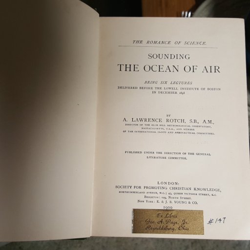
Here's my newest "old book" purchase...

...it describes "old" ways of measuring the upper atmosphere, using balloons and kites and old instrumentation. 1898
 
Last edited:
Which allows what? Persistent contrails need ice supersaturation regions at the altitude the plane is flying. The presence or absence of cirrus at some altitude does not mean there is or is not ice supersaturation at that or other altitudes
allows the trail to be seen all across the whole sky. As you pointed out when showing how trails can have breaks, there are breaks because the moisture isn't high enough to enable trails to last in some spots. So, if the trail was all the way across the sky, there were no spots where the moisture was lesser, creating gaps.
 
allows the trail to be seen all across the whole sky. As you pointed out when showing how trails can have breaks, there are breaks because the moisture isn't high enough to enable trails to last in some spots. So, if the trail was all the way across the sky, there were no spots where the moisture was lesser, creating gaps.

I'm still not entirely sure what your point is. But remember there are lots of altitudes. So something at 32,000 feet might not tell you anything about what is at 38,000 feet, or 45,000 feet.
 
I'm still not entirely sure what your point is. But remember there are lots of altitudes. So something at 32,000 feet might not tell you anything about what is at 38,000 feet, or 45,000 feet.
i think maybe he's thinking that if a contrail is persistent without gaps that means that the sky must be covered in cirrus, because that rhi would make cirrus clouds.

But @steve holmes clouds dont work that way.
1. cirrus clouds when present have gaps between them. ALL clouds most often have gaps between them. The sky isn't uniform from one location to the next.
and
2. a contrail, as i'm sure you've seen, can form when no clouds are in the sky. the byproduct of the exhaust of a plane includes water, it's this Extra water being ADDED to the borderline atmosphere that pushes the rhi over the limit to form a cloud. add: a contrail IS a cirrus cloud.
 
Mick, there are several scientific and logic errors in what you state above.

1. When using a 300 mb chart showing RH at 30.000 ft it has nothing in common with pictures showing airplanes leaving contrails/chemtrails at 36.000 - 39.000 ft.

2. Water vapor does not saturate before the RH is 100%.

[Mick: Other points removed until these two have been addressed]
 
Last edited by a moderator:
Mick, there are several scientific and logic errors in what you state above.

1. When using a 300 mb chart showing RH at 30.000 ft it has nothing in common with pictures showing airplanes leaving contrails/chemtrails at 36.000 - 39.000 ft.
It shows that contrails can form at 30,000 feet. Above that is unknown, but possible.

2. Water vapor does not saturate before the RH is 100%.
That's kind of a tautology, but it can saturate with respect to ice (100% RHi)at less than 100% RH with respect to water (RHw).

To convert RHw to RHi for a temperature t, a sufficient approximation in the temperature range -70C to -30C is:

RHi = RHw * (0.89 - (0.0148 * t))

Please confirm you agree with these points before we move on to other points.
 
@Chemtrail-Buster I removed the other claims you made until the first two have been addressed. Since they are related, we need to agree on a resolution for those before the others. Basically we need to agree on the relationship between RHw and RHi, and that ice supersaturation can occur at around 60% RHw (or if you think it's another number, then what is that number, or formula)
 
Last edited:
As a meteorologist, I loved going through this discussion. Yes, definitely humidity in the upper layers,. Generally associated with storms bringing it up, at least in my area, but not always.It depends on the plane as well, with some older jets putting out a huge plume. I'd also say that I've seen a decrease in "normal" cirrus clouds since the reduction in flights, probably due to lesser condensation nuclei. But I've never known how 'dirty' the upper layers are , by that including plane-made ice crystals, until this crisis. The last two moonrises were amazing, you can really see the difference. There was also a video, which I can't find anymore on YouTube, of contrails forming even at take-off, in extreme cold
 
Hey Stefan -

As Mick and you and so many others have pointed out, the atmosphere is an incredibly dynamic and visually amazing stage. I have a webcam that compiles a 24 hour video each night of the view of downtown PHX and the Sierra Estrella mountains behind. If there's any moisture in the sky, or the humidity at the various layers is just right, you can actually see some of the horizontal layer dynamics. It's common for me to see a lower layer of clouds moving one direction, and a middle layer moving a completely different direction, and maybe an upper layer doing something different as well. And the virgas! Of course, it's not so often that we have enough humidity to do anything visible...

Oh, I also have another webcam doing the same time-lapse thing, but pointed at the north celestial pole. The camera's not nearly as good, as it's barely sensitive enough to detect Polaris and Kochab; Polaris is more or less at the center of the FOV; Kochab makes a clean arc around the north pole. One of these days the camera will be significantly upgraded.

Cheers - Jon
 
Last edited:
Back
Top