Strange cloud formation in South Indian Ocean

Trailspotter

Senior Member.
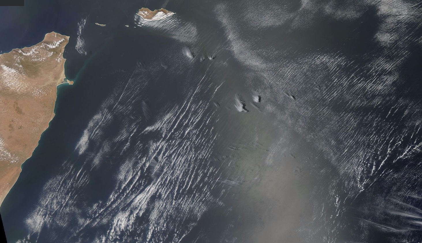
While looking for examples of contrails on NASA Worldview, I encountered an unusual cloud pattern above Indian Ocean near the Australian coast in the EOSDIS satellite images taken on August 27, 2014:
Screen shot 2015-04-19 at 00.08.19.png
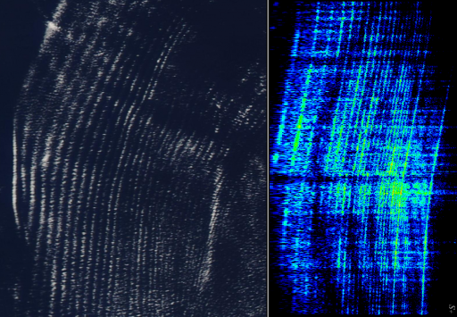
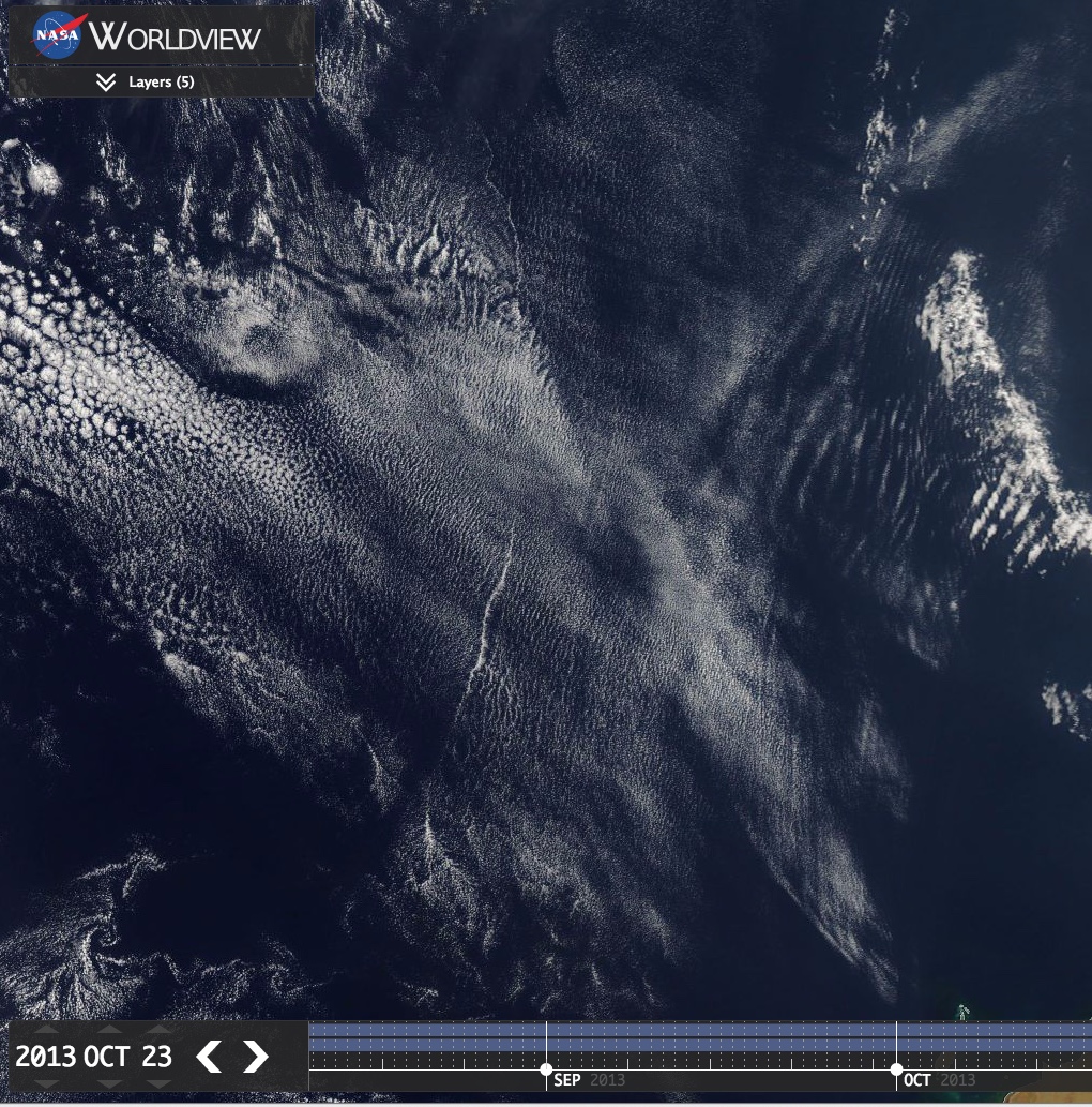
The approximate coordinates of the pattern's centre point are 25° S, 107° E. The Terra image on the left was taken at 03:25 UTC, the Aqua image on the right was taken nearly three hours later, at 06:10 UTC. During this time interval the pattern moved 70 miles (100 km) South. It retained almost all old lines and acquired a few new ones. Zooming into the images show the pattern's fine structure - its south and north wings are made of parallel dotted lines, like if it were made with a giant dotted printer:


This pattern does not appear to be a natural formation. Giving its geographical location, I guess it could have resulted from some large scale operation related to the search for missing MH370, but I have not checked yet if there was such an activity in that area on that day.

Edit:
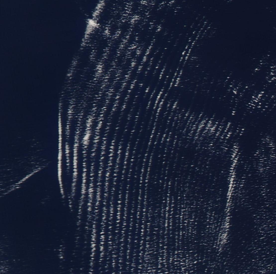
Here is a comparison of the Terra and Aqua images of the pattern made by larger streaks (ship trails?). The latter was scaled and rotated a bit to improve the match:
 
Last edited:
It looks like intersecting gust fronts to me. There's a dissipating storm in the NE corner of the first picture throwing one off.
 
This pattern does not appear to be a natural formation.
The ripple structure looks natural to me. It's an unusually regular area, but certainly not unprecedented. Compare with these off the horn of Africa Sept 5th 2014:
https://earthdata.nasa.gov/labs/wor...3267985,63.007463107599584,13.598347595767985


For the larger streaks, my first thought was ship trails. The clouds are low altitude, so unlikely to be related to contrails. But intersecting fronts also sounds plausible.
 
Last edited:

It looks like this but with cumulus rows instead of a stratus layer. You can see something similar near the bottom of this image. Ship streaks seem reasonable for at least some of the formations.
 
The ripples are indications of gravity waves between two layers of air. Probably a shallow thermal inversion with wind in the two layers moving in different directions. It is like standing waves in a river. A warm layer of air is flowing over a cooler layer and clouds are showing you where the waves are forming.

The curved features likely reflect zones of converging surface winds, likely gust fronts from collapsed convection, convection that occurred a long way north of where the ripples are located in the image.

Perhaps hot air flowing from the east off of Northern Australia riding over top of a shallow cooler marine layer of air flowing south at the surface?
 
Could also just be cloud streets. See attached from "Spacious Skies", Scorer&Verkaik, 1989 (Satellite image from 1980)
Spacious Skies Streets.jpeg
Spacious Skies Streets 1.jpeg
 
This pattern does not appear to be a natural formation.
Thanks all for comments and explanations. In the above, I actually meant the pattern of the larger streaks. I thought these might be ship trails too, but wanted to hear other opinions. The close up images were to show some of those streaks were modulated by the same atmospheric conditions that created ripples/cloud streets in the area. I should have emphasised this in OP. My lame excuse is that I posted it without further editing well past midnight of my local time, just before going to bed.
 
Some similar structures here.
https://earthdata.nasa.gov/labs/wor...6213958,123.3134374098131,-12.066453431213958


The OP seems like a combination of ship trails and the thicker linear clouds that sometimes form along the edge of a region of air. It does seem like a "folding" together of such regions.

There don't seem to be many ship trails in that area normally, so MH370 search ships seems plausible (but would they be big enough?). I must admit I initially read your posts as leading to some newcomer's suggestion that "HAARP Scalar Kirlian radar" was being used to search for the plane, and was surprised to realize it was you :)
 
Some similar structures here.
https://earthdata.nasa.gov/labs/wor...6213958,123.3134374098131,-12.066453431213958

The OP seems like a combination of ship trails and the thicker linear clouds that sometimes form along the edge of a region of air. It does seem like a "folding" together of such regions.

There don't seem to be many ship trails in that area normally, so MH370 search ships seems plausible (but would they be big enough?). I must admit I initially read your posts as leading to some newcomer's suggestion that "HAARP Scalar Kirlian radar" was being used to search for the plane, and was surprised to realize it was you :)

There were more similar "cloud streets" structures northeast of the OP pattern on that day, the directions of which correlate well with the wind directions forecasted for 700 hPa:
http://earth.nullschool.net/#2014/0...tive_humidity/orthographic=101.54,-22.98,1339
Screen shot 2015-04-19 at 17.55.26.png
The wind speeds were also quite low over a large area of the ocean, that may explain why the pattern of larger streaks remained largely unchanged for at least three hours. I have updated the OP with the pattern's comparison at the different time after compensation for the wind displacement and minor rotation and expansion.

The pattern's coordinates are in the original search area, where the black boxes' signals had been supposedly detected, but this was in the beginning of April 2014. I wonder if Malaysian or Chinese or someone else were searching there again in August.
 
I have put up a comparison of the Indian Ocean Cloud formation with the Sound Pattern of a 52 second "alleged" UFO sound. They are very similar!
 

Attachments

  • CloudsFooSound.png
    CloudsFooSound.png
    970.8 KB · Views: 595
I guess, except one is a representation of vertical motion of moisture on a (physical) graph of with north-south and east-west axes, and the other is a representation of sound amplitude on a (digital) graph with frequency and time axes.

So, no, not really.
 
I have put up a comparison of the Indian Ocean Cloud formation with the Sound Pattern of a 52 second "alleged" UFO sound. They are very similar!
A regular pattern of many long parallel rows of small clouds is not uncommon and is probably the same as "cloud streets" above (#6). By the "strange formation" I meant a pattern of a larger streaks, some of which reside with those regular linear patterns and, at a higher resolution, appear to be split into slightly bigger/brighter clouds within the same cloud rows. It reminded me about old dot matrix prints, like this:
 
I was told the UFO sound was a Jet Turbine. Of course, you don't have to reproduce this Sound form because I am probably banned forever anyways.
 
Back
Top