From this site (but likely not to stay on this page)
http://netall.ru/gnn/photo_day/
The original text is:
Here's my initial take on it, as posted on ATS:
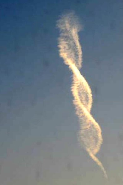
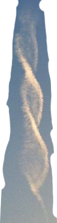
[UPDATE] It seems almost certain that this is a very long twisted contrail viewed end on, see below.
http://netall.ru/gnn/photo_day/
The original text is:
TranslationExternal Quote:
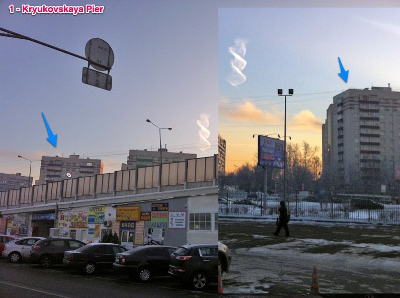
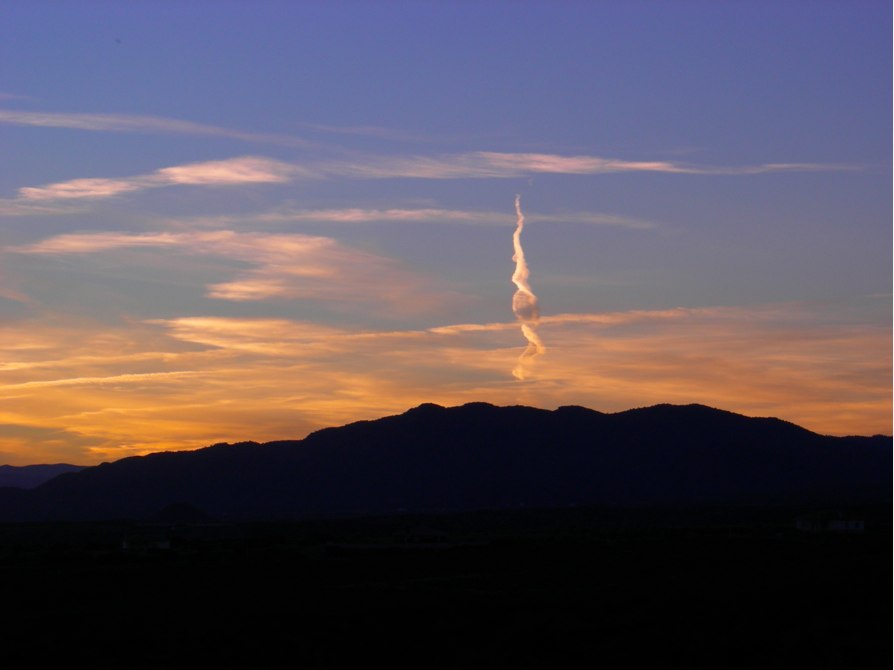
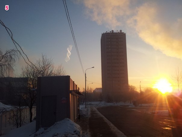
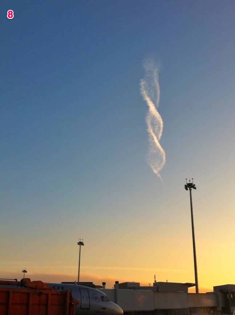
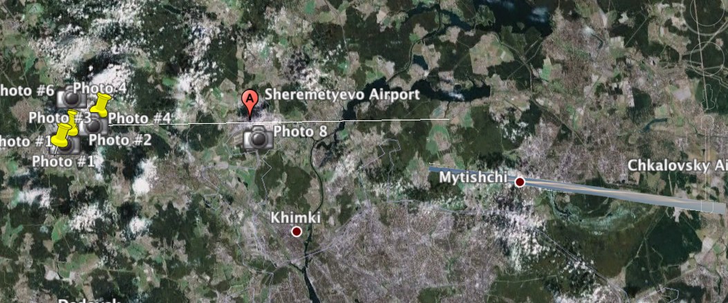
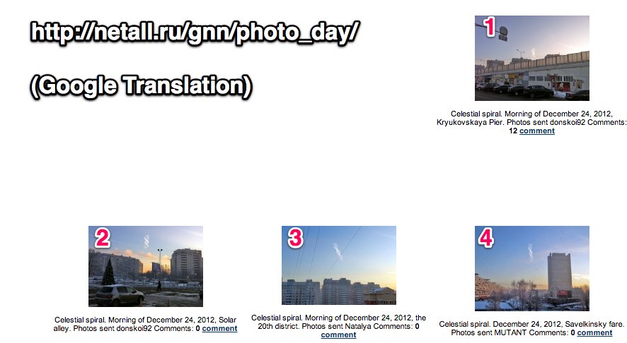
1- Небесная спираль. Утро 24 декабря 2012 года, Крюковская эстакада. Фото прислал donskoi92
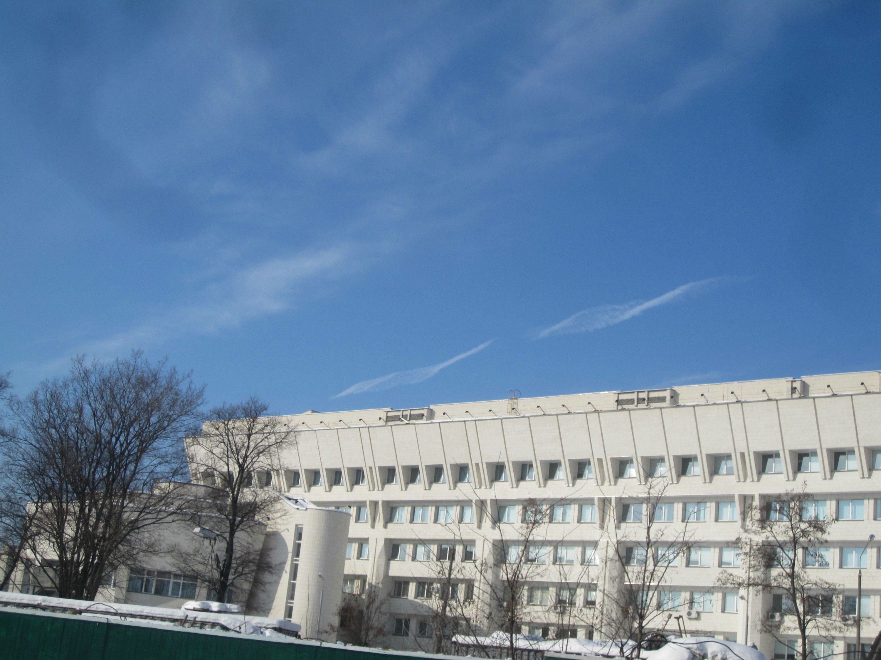
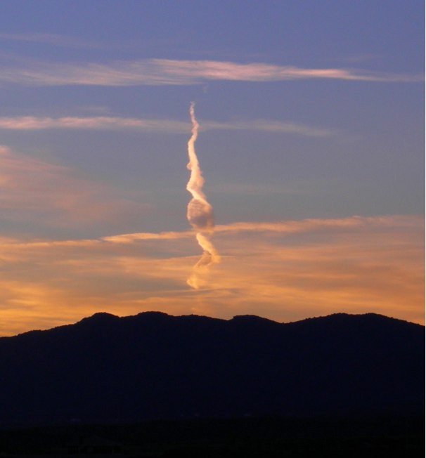
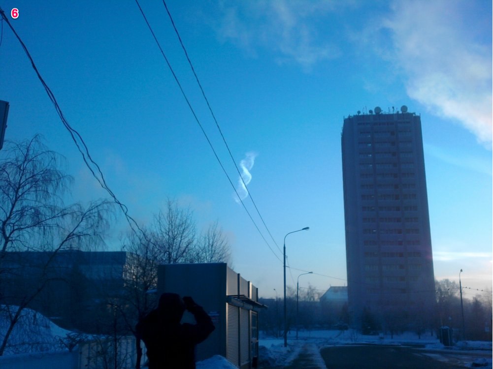
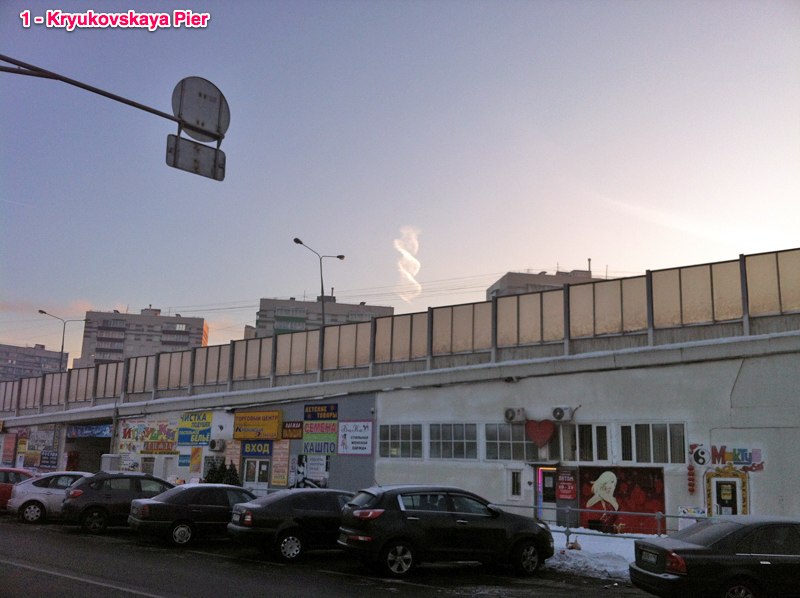
2 - Небесная спираль. Утро 24 декабря 2012 года, Солнечная аллея. Фото прислал donskoi92
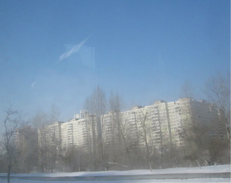
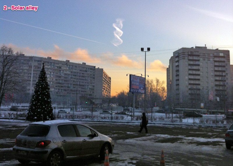
3 - Небесная спираль. Утро 24 декабря 2012 года, 20-й микрорайон. Фото прислала Наталья
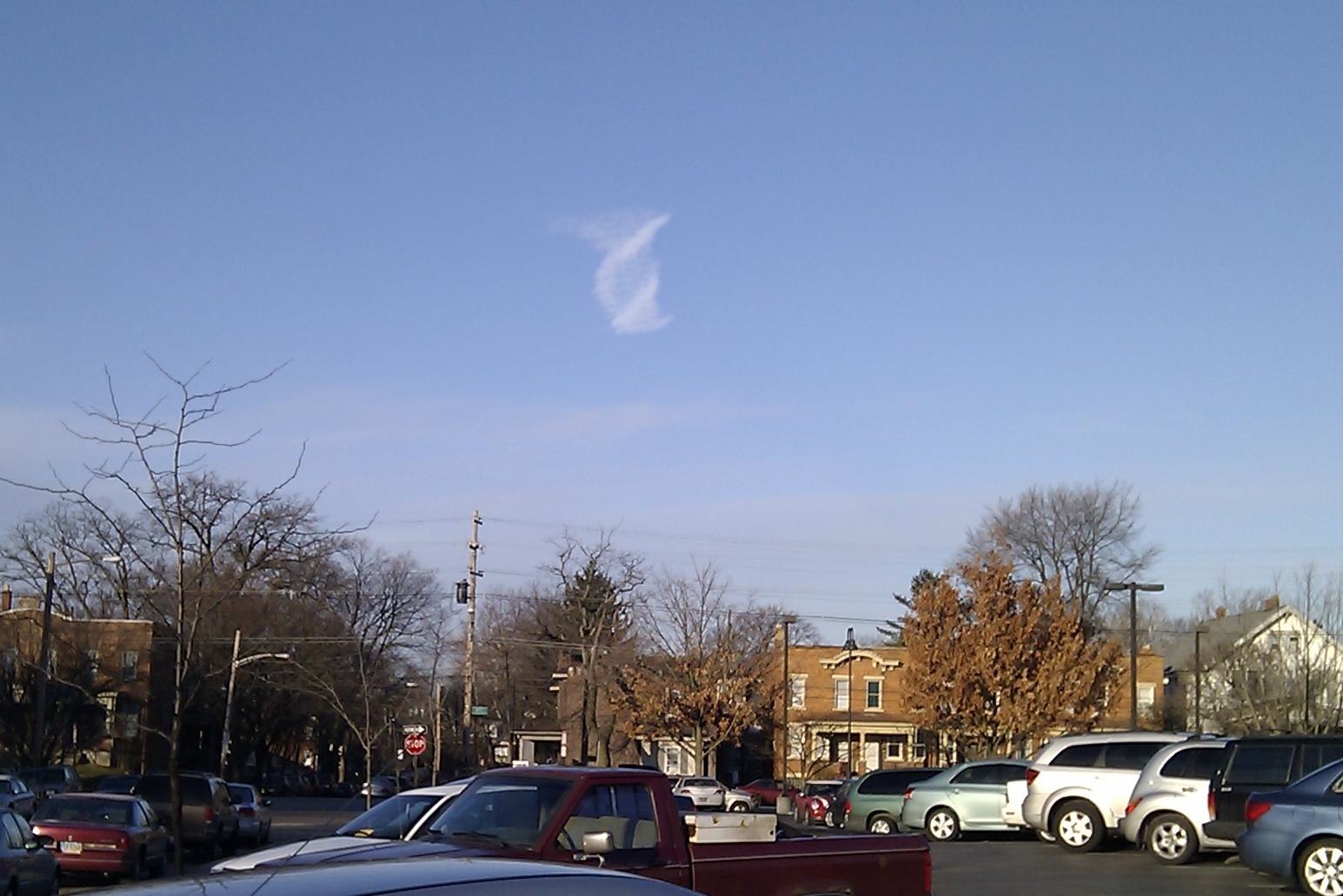
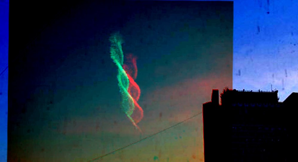
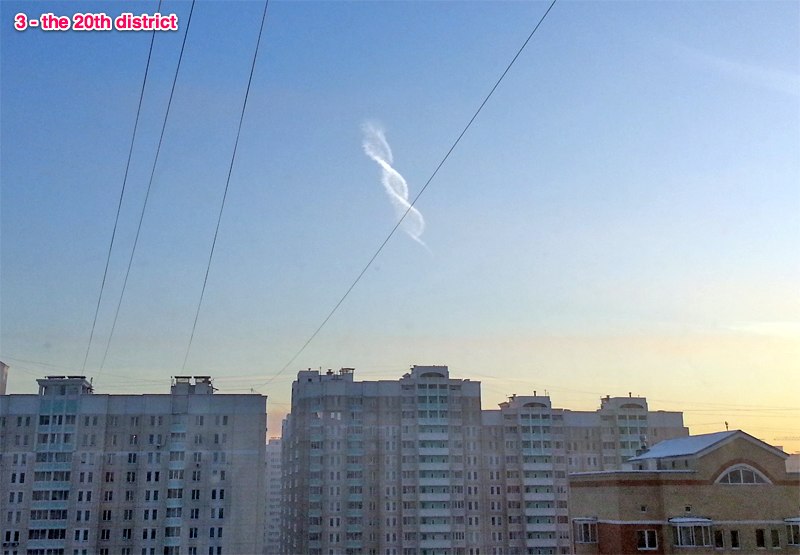
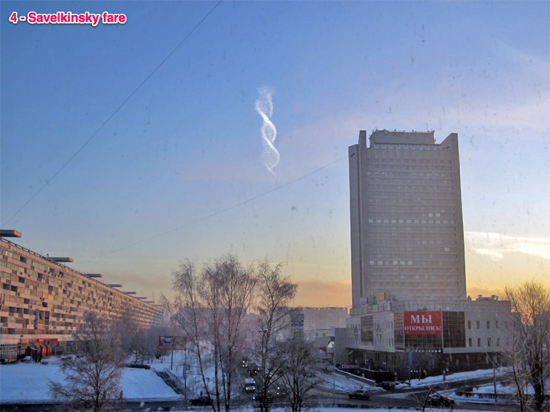
4 Небесная спираль. 24 декабря 2012 года, Савелкинский проезд. Фото прислал MUTANT
External Quote:1 - Celestial spiral. Morning of December 24, 2012, Kryukovskaya Pier. Photos sent donskoi92
2 - Celestial spiral. Morning of December 24, 2012, Solar alley. Photos sent donskoi92
3 - Celestial spiral. Morning of December 24, 2012, the 20th district. Photos sent Natalia
4 Celestial spiral. December 24, 2012, Savelkinsky fare. Photos sent MUTANT
Here's my initial take on it, as posted on ATS:
I'm not sure what this is. Any more suggestions?External Quote:
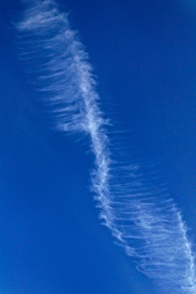
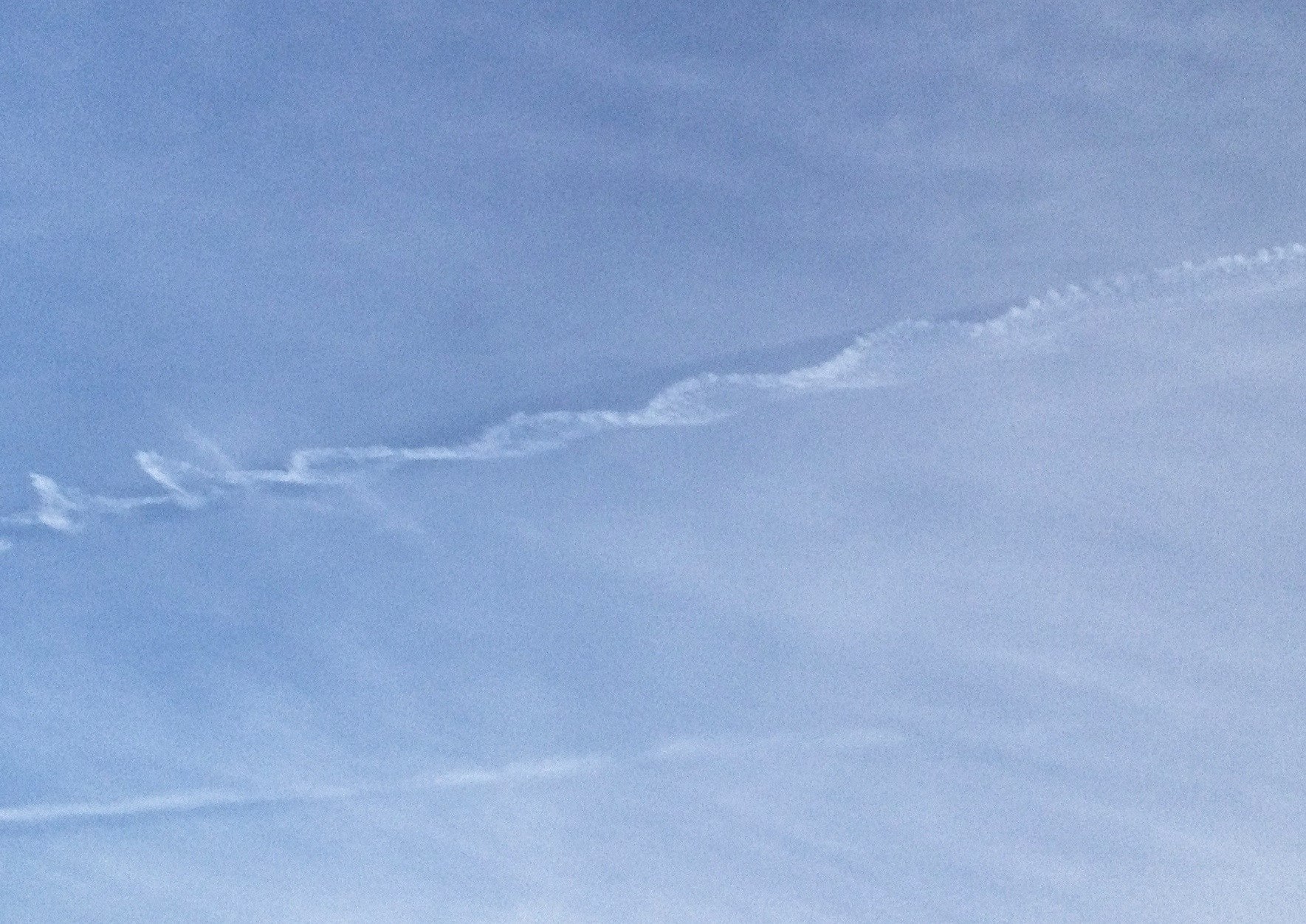
That's a very interesting contrail.
One of the common mistakes people make when looking at contrails is to assume that the way it ends up is the way that it started. Contrails do NOT mark the track of a plane, unless the air is perfectly still and calm, which it never is. Contrails are blown sideways by the wind so they are at an angle to the actual track of the plane. They also sink so they are below the track of the plane. They spread out to cover an area much wider than the track or the plane.
And sometimes they rotate. They rotate, not because the plane is rotating, or flying in a spiral path, but because the AIR is rotating. Air is a fluid, an it acts like a giant ocean. Sometimes you get waves in this ocean, which contain huge rotating regions.

If a plane flies through such a region of rotation, then the contrail, which starts out straight, will end up twisted, if it stays in it long enough, then it might twist more that once. Normally these twists are fairly long.
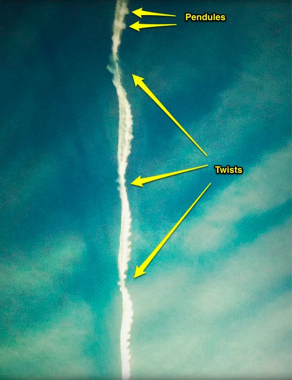
I don't know if such a rotating region of air formed the Moscow twist. It does look like there are two contrails. However it could just be that the bottom edge of a sinking contrail was thick enough to look like a separate contrail. It could be that two jets were flying together (not in a spiral), and then the rotating air wrapped their contrails together.
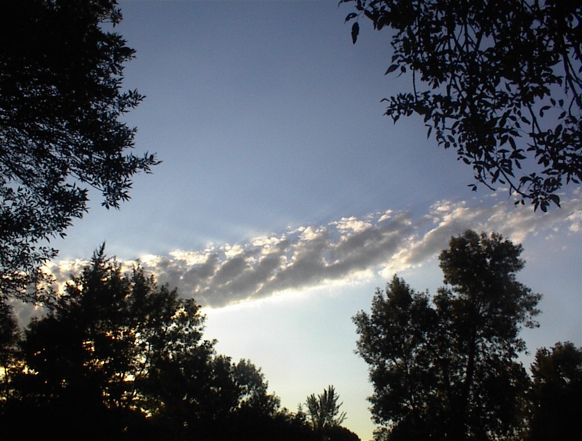
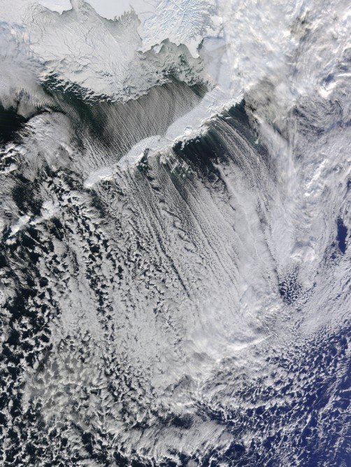
Have a look at these clouds. You can see the huge rotating regions of air because they are above a fog layer, and the fog layer gets sucked up into these wave shapes:
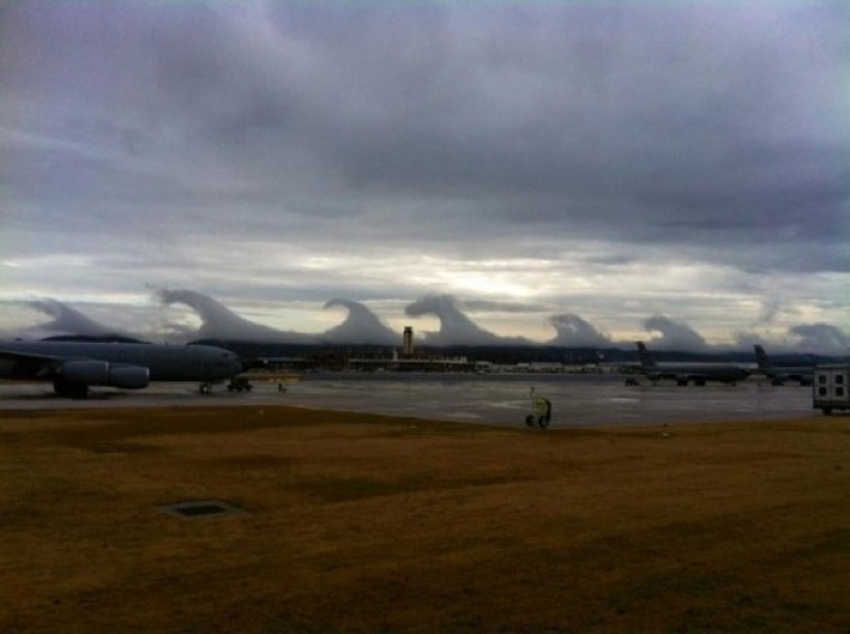
But then imagine this scene is much higher up, and there are no clouds there. But the "waves" are still there, the air is still rotating, you just can't see it. Then a plane (or maybe two) flies right through the middle of one of those regions, hits a spot of higher humidity, and leaves a short contrail, which gets twisted, maybe ending up like the Moscow twist.
[UPDATE] It seems almost certain that this is a very long twisted contrail viewed end on, see below.
Last edited: