Seen on Facebook:
https://www.facebook.com/alertachil...260138990451/1705302796352850/?type=2&theater

Here is the video:
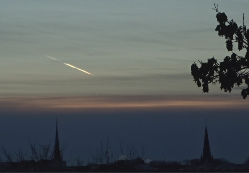
No detail of the time, but it looks like close to sunset or sunrise.
https://www.facebook.com/alertachil...260138990451/1705302796352850/?type=2&theater
Here is the video:
No detail of the time, but it looks like close to sunset or sunrise.
") )
)