 FOLLOW
What Are These Strange, Beautiful Clouds Over Tunisia?
FOLLOW
What Are These Strange, Beautiful Clouds Over Tunisia?
29,193
18
Dennis Mersereau
ProfileFollow

Dennis Mersereau
Filed to:
DISTRAIL
EXPAND
12
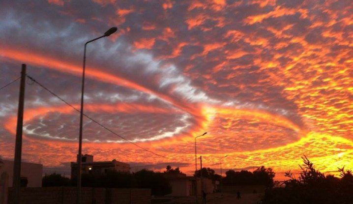
A gorgeous picture of a sunset painting brilliant colors over dramatic spirals in a wavy deck of clouds is making the rounds on social media this afternoon. The picture—purportedly taken in Tunisia—is so spectacular that it almost looks photoshopped. Here's an explanation for how these incredible clouds formed.
The origins of the photo are sketchy, but it appears that it was taken in Tunisia at some point within the past month. Since it cropped up, the photo has quickly spread through Facebook, mostly a result of conspiracy theorists using it as "proof" of
a thoroughly-debunked conspiracy theory.
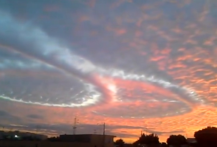
If, like I was at first, you're concerned that the photo is altered or a fake, there's video evidence to support the existence of the formation:
The photo shows a deck of altocumulus clouds sitting against the sunset, producing a beautiful palette of oranges fading to pink and red. Through the center of the clouds, a dramatic set of three spiraling loops appears, with a fuzzy stream of clouds in the middle flanked by peeks of a blue sky, much like a moat protecting the delicate formation. This spectacular formation through the clouds is something known as a "distrail."
We're most familiar with contrails, short for "condensation trails," or the wispy trails of clouds that form behind high-flying aircraft as a result of warm, moist jet exhaust condensing when it meets the extremely cold upper-atmosphere. "Distrail" is short for a "dissipation trail," and while they're similar to contrails, they form through a difference process. Altocumulus clouds often consist of supercooled water droplets—which are water droplets that are still liquid below freezing—but lack a nucleus (like a speck of dust) around which it can freeze into an ice crystal. These supercooled water droplets stay liquid until an impurity is introduced that allows the water to freeze—in this case, the impurity was jet exhaust.
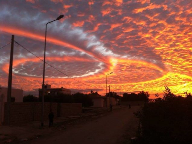
The most likely explanation for the photo is that a military jet flew patterns through the altocumulus deck, expelling jet exhaust that gave the supercooled water droplets a nucleus around which to crystallize. Once these droplets froze into ice crystals, they began to precipitate and evaporate, causing a chain reaction much like we see with
fallstreak holes. The result is a spectacular sight, with the clouds bisected (or looped, in this case) by a trail of ice crystals precipitating from the deck.
EXPAND
3
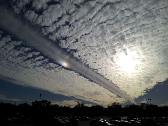
Distrails are pretty rare to see since they require aircraft to fly directly through the deck, which is a matter of timing and luck. I witnessed something similar earlier this year while waiting for a bus in Mobile, Alabama. The feature produced a once-in-a-lifetime shot, as a
sundog appeared within the distrail. It was spectacular, and for months after I took this picture (and wrote a post about it
at the Capital Weather Gang), I was harassed by conspiracy theorists (but what's new?).
While they look spectacular from the ground, fallstreak holes and dissipation trails in decks of altocumulus clouds are also a sight to see on satellite imagery.