Natick "Drone" Sightings, 2024

Mick West

Administrator
Staff member
From this Technology review article https://www.technologyreview.com/2025/08/26/1121458/ufo-hunters-mystery-drone-invasion/ (Archive: https://archive.ph/qwiMp )
External Quote:

On a Friday evening last December, every tier of US law enforcement—federal, state, and local—was dispatched to the US Army Natick Soldier Systems Center, a military research installation outside Boston. A squadron of about 15 to 20 drones had been spotted violating the base's restricted airspace. The culprits could not be found.
One retired major with the Massachusetts State Police, who had been dispatched to help investigate that night, called these unidentified aircraft "the strangest thing he's ever seen," according to Brian Lauzon, deputy chief of Natick's municipal police department. When Lauzon arrived on base later that weekend, he says, he saw drones that were larger than traditional consumer models (most of which are pre-programmed to respect US military airspace these days anyway). By the end of this weekend-long breach, base police not only had called in local law enforcement for backup but were coordinating with the FBI and US Army commanders as well.
Gives us this FOIA request:
https://cdn.muckrock.com/foia_files/2025/05/28/Drone_3.pdf
(all files attached)

The meat being this narrative:
External Quote:

Natick Police Department Page: 1
NARRATIVE FOR SERGEANT JAMIE L VERNER 05/27/2025
Ref: 24-1757-OF
On Friday, December 13, 2024, I Sergeant Verner was assigned as the patrol supervisor (PS74) for the
evening shift (1600-0000 hours). At approximately 1919 hours, Lt. Delehanty called me via phone and informed
me that Dispatch had received a call from the Natick Army Labs about several drones flying over the facility. Lt.
Delehanty informed me that dispatch had previously received a call at 1928 hours (call #24-21250) about 7
drones hovering over Route 30 on the Weston/Wayland line. Lt. Delehanty requested that I respond to the Labs
to investigate.
I arrived at the main gate at approximately 1923 hours and was met by two military police officers. These
officers explained that they had observed 15-20 drones overhead for the last several minutes. They informed me
that their chief, James Santoro was en route to the scene. As we stood at the gate, I observed several large
drones flying overhead directly over the Army Lab property. In addition, there were several smaller drones that
appeared to be hovering stationary position to the east of Route 27.
A short time later, Santoro arrived and took command of the scene. He informed me that he could see
several drones on his commute to the Labs. I asked if he was aware of any similar activity at Hanscom and he
said there was not. I then cleared the gate and began driving the immediate vacinity to check for a possible
source of the drones. I drove Route 27 to Washington Ave to West Central Street and stopped in the area of 109
West Central (the dog park) and observed the drone activity over the Labs property. I observed several drones
overhead. There appeared to be 2 large ones on the west side of the property and 2 large ones on the east side of
the property when viewing it from across the lake.
I then returned back to the Labs property where Santoro and his other units had set up inside the base in
parking lot A to observe the drone activity. I remained in these area as Santoro was in contact with the
Massachusetts State Police, FBI, and U.S. military commanders about the incident. Santoro was advising that all
we could do at this point is observe.
Several MSP Troopers arrived on scene. One inquired if we had any infrared technology that could be
brought to the scene. Natick Fire C2 responded to the scene with a thermal imaging device and showed me how
to use it. I attempted to use the device to investigate the size of the drones above, but they were too far away and
did not produce a heat signature.
As I remained on scene, the other officers from the shift continued to check the parking lots around town
to look for a possible source vehicle. While on scene, it appeared that the drone activity was moving to the west.
This was confirmed by officers in the area of the Natick Mall who were seeing increased drone activity.
At approximately 2130 hours, Santoro went inside the police building on base to make phone calls and
reports. I remained in contact with his staff. There continued to be occasional drones flying overhead, but the
overall activity had decreased significantly since the initial call. I checked with Santoro's staff if they needed
anything more from NPD and was told they would be in touch if they needed anything.
I cleared the Labs property at approximately 2245 hours, but remained in the area to observe. At
approximately 2311 hours, I learned that news outlets were reporting drone sightings all over the state.
Respectfully submitted,
Sergeant Jamie Verner #47139
19:23 EST is 19:23 + 5 hours = 00:23 UTC on December 14, 2024
ADS-B Exchange Playback Link: ADS-B Exchange
FlightRadar24 Link: FlightRadar24
Google Maps Link: Google Maps
Sitrec Link: Sitrec

The dog park to the south of the base:
42.2830336,-71.3641195
https://www.google.com/maps/place/109+W+Central+St,+Natick,+MA+01760/@42.2871998,-71.3645871,2119m/data=!3m1!1e3!4m6!3m5!1s0x89e387c929678141:0xc30a8cc542828c45!8m2!3d42.2830555!4d-71.3642166!16s/g/11g8dh5_4r?entry=ttu&g_ep=EgoyMDI1MDgyNS4wIKXMDSoASAFQAw==

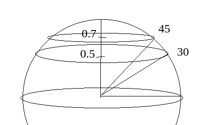
Lots of planes in the area, including "hovering" planes to the East.

2025-08-28_10-32-33.jpg


Hard to be exact from the narrative, but it seems almost certain that many of the sightings were actually planes.
 

Attachments

Last edited:
Police officer descriptions like this, of the drones they reported seeing, certainly raises red flags:

External Quote:
Officer states it appears at least one drone has flashing red and green lights with a jet stream out the back of it.

https://cdn.muckrock.com/foia_files/2025/05/28/Drone_3.pdf

(this probably needs a separate thread)

Chris Grooms, also featured in the article, was a police officer in Nebraska who along with another officer presented a video of drones on Matt Ford's show that definitely couldn't be airplanes because they ruled out airplanes on FlightRadar24, which turned out to in fact just be airplanes that were on FlightRadar24. Police were among the people making these sorts of plane misidentifications. And their reports may have been taken more seriously and not questioned, because they were police.
 
Last edited:
Here is all 6 PDFs transcribed to plaintext/md including the location, date, timestamps, and log descriptions. Reordered to chronological, but with the post-incident report for 12-13 at the end. I typed it manually and had claude code check for correctness and it found one date I had typed as 2025 instead of 2024. I then checked it again manually to make sure it all matched.

(All timestamps assumed EST. EST is consistent with mid-late evening times, all of which would be full darkness in Boston In December. UTC much less likely as the latest time 2311 would be 3:11 AM local time for that ABC news report. And the times (1600-0000) for the evening shift in 24-1757-OF doc only make sense for EST.)

External Quote:
### 2024-12-13 (Friday)
File: Drone_5.pdf
Location: US Army Natick Soldier Systems - General Greene Ave

2024-12-13 1927
Caller reports 15-20 Drones are flying over the Army base.

2024-12-13 1945
Sgt Verner is clear the call and will remain in area to see if she can find the origin location of the drones.

### 2024-12-13 (Friday)
File: Drone_4.pdf
Location: Wayland Weston Line - Commonwealth East Rd

2024-12-13 1932
Caller reports in the area of the Wayland/Weston town lines there were 7 drones hovering. Calls placed to Wayland and Weston who report the drones do not belong to them.

### 2024-12-13 (Friday)
File: Drone_3.pdf
Location: vicinity of Natick Labs

2024-12-13 2027
Caller reports 15-20 drones flying above the labs.

2024-12-13 2028
Fusion center was notified @1925

2024-12-13 2028
State Police notified - Lt. Driscoll. State police will be responding to assist.

2024-12-13 2029
Command page sent.

2024-12-13 2031
Two units to check Dick's Sporting Goods parking lot after a possible spotting of the drones landing.

2024-12-13 2039
Framingham PD notified about drones flying over Logan Express. They will notify Massport.

2024-12-13 2044
Sgt. Hess MSP responding from Weston barracks to assist.

2024-12-13 2053
MSP 565, 951, and 1240 on scene.

2024-12-13 2057
Contact made with Lt. Colonel Compton from National Guard Readiness center about drones flying over.

2024-12-13 2102
C2 to meet with Sgt Verner at the army labs with thermal imaging.

2024-12-13 2122
Officer reports drones flying over ABI Labs.

2024-12-13 2126
Officer states it appears at least one drone has flashing red and green lights with a jet stream out the back of it.

2024-12-13 2311
ABC News 5 broadcast reports similar sightings across multiple states.

### 2024-12-14 (Saturday)
File: Drone_2.pdf
Location: redacted, Natick

2024-12-14 1850
Caller reports there was a Drone sighting in the area. Officer dispatched to confirm.

2024-12-14 1853
Officer reports nothing found.

### 2024-12-15 (Sunday)
File: Drone_1.pdf
Location: Natick Labs - 15 General Greene Ave

2024-12-15 1733
Caller reports a single drone sighted in the area

2024-12-15 1743
Second drone reported in area of North Main. Flying separate from first drone reported.

2024-12-15 1746
Report of one hovering at Bacon/Park Ave.

2024-12-15 1801
Officers checking business lots and areas for any activity.

2024-12-15 1825
3 drones reported hovering over Nonesuch Pond/Winter St.

### 2024-12-13 Incident report
Report for 2024-12-13 incident
Report date: 2024-12-18
File: 24-1757-OF.pdf

On Friday, December 13, 2024, I Sergeant Verner was assigned as the patrol supervisor (PS74) for the evening shift (1600-0000 hours). At approximately 1919 hours, Lt. Delehanty called me via phone and informed me that Dispatch had received a call from the Natick Army Labs about several drones flying over the facility. Lt. Delehanty informed me that dispatch had previously received a call at 1928 hours (call `#24-21250`) about 7 drones hovering over Route 30 on the Weston/Wayland line. Lt. Delehanty requested that I respond to the Labs to investigate.

I arrived at the main gate at approximately 1923 hours and was met by two military police officers. These officers explained that they had observed 15-20 drones overhead for the last several minutes. They informed me that their chief, James Santoro was en route to the scene. As we stood at the gate, I observed several large drones flying overhead directly over the Army Lab property. In addition, there were several smaller drones that appeared to be hovering stationary position to the east of Route 27.

A short time later, Santoro arrived and took command of the scene. He informed me that he could see several drones on his commute to the Labs. I asked if he was aware of any similar activity at Hanscom and he said there was not. I then cleared the gate and began driving the immediate vacinity to check for a possible source of the drones. I drove Route 27 to Washington Ave to West Central Street and stopped in the area of 109 West Central (the dog park) and observed the drone activity over the Labs property. I observed several drones overhead. There appeared to be 2 large ones on the west side of the property and 2 large ones on the east side of the property when viewing it from across the lake.

I then returned back to the Labs property where Santoro and his other units had set up inside the base in parking lot A to observe the drone activity. I remained in these area as Santoro was in contact with the Massachusetts State Police, FBI, and U.S. military commanders about the incident. Santoro was advising that all we could do at this point is observe.

Several MSP Troopers arrived on scene. One inquired if we had any infrared technology that could be brought to the scene. Natick Fire C2 responded to the scene with a thermal imaging device and showed me how to use it. I attempted to use the device to investigate the size of the drones above, but they were too far away and did not produce a heat signature.

As I remained on scene, the other officers from the shift continued to check the parking lots around town to look for a possible source vehicle. While on scene, it appeared that the drone activity was moving to the west. This was confirmed by officers in the area of the Natick Mall who were seeing increased drone activity.

At approximately 2130 hours, Santoro went inside the police building on base to make phone calls and reports. I remained in contact with his staff. There continued to be occasional drones flying overhead, but the overall activity had decreased significantly since the initial call. I checked with Santoro's staff if they needed anything more from NPD and was told they would be in touch if they needed anything.

I cleared the Labs property at approximately 2245 hours, but remained in the area to observe. At approximately 2311 hours, I learned that news outlets were reporting drone sightings all over the state.

Respectfully submitted,
Sergeant Jamie Verner `#47139`

My takeaway. Some sounds a lot like misidentified planes. Other parts sound like misidentified planes as well but raises more concerning questions about priming and error-proneness of credentialed officials. The parts where Army staff reported seeing drones does raise to a higher credibility level over the ones from members of the public (hard to say, since it's redacted, but where the report source is redacted and not explicitly from Army staff or police I would assume it is a member of the public), however we have seen that is important to not take those claims for granted and assumed to be 100% accurate. Hanscom AFB is not far away and they saw no unusual activity.

If there were videos that would give us more to look into, if they could provide aircraft lighting info, and precise location, and a sense of compass direction and elevation angle and trajectory. But as it stands I personally would write it off as likely all misidentifications, unless other information comes up that challenges that.
 
Lt. Delehanty informed me that dispatch had previously received a call at 1928 hours (call `#24-21250`) about 7 drones hovering over Route 30 on the Weston/Wayland line.

So that's 0028 UTC on 14 Dec.

The flight path of departing aircraft from Boston heading west lines up pretty well with Route 30 on the Weston/Wayland line. And aircraft heading south also face west before turning away. I count at least seven planes on that alignment, plus a helicopter in the area, between 0016 and 0027 that morning. Example screenshot here. MA Route 30 crosses the town line just near the "I 90" label in the lower left.

1756787835845.png
 
The Sitrec link doesn't show any of the planes for me. Is it the correct link?

I think that link is made by the sitrec Help Wizard. It just sets the parameters for location, date & local time ready for the user to drag & drop ADSB kml files on top.
 
I think that link is made by the sitrec Help Wizard. It just sets the parameters for location, date & local time ready for the user to drag & drop ADSB kml files on top.
Thanks, I did wonder if that was the case. Just laziness
 
As someone who has spent a significant amount of time filming airplanes and tracking them on flight tracking apps in the Boston / Eastern Massachusetts region, I am extremely skeptical of this claim Phelan is echoing from Natick's deputy chief of police, that many commercial planes heading towards Boston do not show up on ADSB tracking platforms. The ADSB receiver/feeder coverage for the greater Boston region is dense, with coverage sufficient for MLAT as well, and I have never seen a plane there that I could not also see on FlightRadar24 or ADSB Exchange. Even small private jets commonly operating out of Bedford/Hanscom show up. I see military helicopters sometimes fly over too, and at least those I have seen, show up on trackers as well. Granted I do not attempt to identify every plane I see with my eyes, since I see dozens every day, but of the hundreds I have looked up over the years, I have never seen one that did not show up on trackers.


Source: https://x.com/CBMDP/status/1961091990260420754
 
From my experience on reddit, the two most prominent mistakes I see people make when using flight tracking apps are
  1. Zooming in too much and underestimating how far away a plane can be seen in the right conditions
  2. Not realizing the time is on UTC and therefore looking at a completely different time
It's also very hard to judge how a plane would have looked from the ground purely with a top-down map. I have identified quite a few flights, and I still sometimes get surprised when I open some KMLs on google earth and see how the flightpath looks from the ground.
 
As someone who has spent a significant amount of time filming airplanes and tracking them on flight tracking apps in the Boston / Eastern Massachusetts region, I am extremely skeptical of this claim Phelan is echoing from Natick's deputy chief of police, that many commercial planes heading towards Boston do not show up on ADSB tracking platforms. The ADSB receiver/feeder coverage for the greater Boston region is dense, with coverage sufficient for MLAT as well, and I have never seen a plane there that I could not also see on FlightRadar24 or ADSB Exchange. Even small private jets commonly operating out of Bedford/Hanscom show up. I see military helicopters sometimes fly over too, and at least those I have seen, show up on trackers as well. Granted I do not attempt to identify every plane I see with my eyes, since I see dozens every day, but of the hundreds I have looked up over the years, I have never seen one that did not show up on trackers.


Source: https://x.com/CBMDP/status/1961091990260420754

When I asked him about his piece on the Tedesco brothers not making any mention of their Long Island direction snafu and subsequent double down and social media meltdown he started deflecting to this idea that a lot of planes are not on ADSB, I was annoyed by the deflection, but this seems fairly easy to prove if true with video with DTL, the same as evidence for 'drones'

As we know though mapping ADS-B data to real world situations can be tricky and there's also the AR version of FR24 mobile that can be very flaky and confuse people.

Again the real "story" seems to be to be the wishful thinking and competence or lack there-of of some of those people "on the ground" looking at this "drone" situation.
 
Last edited:
From my experience on reddit, the two most prominent mistakes I see people make when using flight tracking apps are
  1. Zooming in too much and underestimating how far away a plane can be seen in the right conditions
  2. Not realizing the time is on UTC and therefore looking at a completely different time
It's also very hard to judge how a plane would have looked from the ground purely with a top-down map. I have identified quite a few flights, and I still sometimes get surprised when I open some KMLs on google earth and see how the flightpath looks from the ground.
Yeah, other common ones causing some confusion were:
1. saying the aircraft they saw was was "low", when if you do the trig to a plane where they were looking, it was like a ~5-15º incline angle.
2. saying the aircraft flew directly overhead, when if you do the trig to a plane that flew over a couple lateral miles away, it was like a ~60º incline angle.

It's hard to mentally estimate what angle you are looking. I think if you see something right over a tree line or way off in the distance, people often underestimate how high it is, and if it's at a steeper angle as you have to bend your neck to look, everything starts to look like 90º, "directly overhead".
 
there's also the AR version of FR24 mobile that can be very flaky and confuse people
When I was discussing with someone and I found out they were using the FR24 AR mode, I told them not to use it because of how misleading it can be especially for distant planes. Phone compasses and tilt sensors can be off by many degrees. I know just from using google maps walking/biking around, the direction google maps thinks I'm facing can be pretty different from where I'm actually facing, unless it was calibrated like 5 minutes beforehand. Even within a few hours my phone's compass can get uncalibrated.
 
Yeah, other common ones causing some confusion were:
1. saying the aircraft they saw was was "low", when if you do the trig to a plane where they were looking, it was like a ~5-15º incline angle.
2. saying the aircraft flew directly overhead, when if you do the trig to a plane that flew over a couple lateral miles away, it was like a ~60º incline angle.

It's hard to mentally estimate what angle you are looking. I think if you see something right over a tree line or way off in the distance, people often underestimate how high it is, and if it's at a steeper angle as you have to bend your neck to look, everything starts to look like 90º, "directly overhead".
Yup, what people think is 45o is more like 30o in reality:
halfwayup.png

See: https://www.metabunk.org/threads/so...in-the-sky-the-star-antares.13078/post-296706
 
When I was discussing with someone and I found out they were using the FR24 AR mode, I told them not to use it because of how misleading it can be especially for distant planes. Phone compasses and tilt sensors can be off by many degrees. I know just from using google maps walking/biking around, the direction google maps thinks I'm facing can be pretty different from where I'm actually facing, unless it was calibrated like 5 minutes beforehand. Even within a few hours my phone's compass can get uncalibrated.
I find the AR view is useful to identify a single plane fairly close by, but for anything near the horizon there is usually far too much clutter and it's impossible to see what is what.

Even with a single plane the arrow on the screen rarely points directly at the plane, but it's usually good enough.

1756999349382.jpeg


Note that in this example, looking "straight up" over the house roof, the plane is still 17km (over 10 miles) away.
 
Yup, what people think is 45o is more like 30o in reality
I think this does not only happen when looking at the sky, but also when estimating the incline of a steep slope: even when you're on it, it always looks steeper than it is. At least, this is the impression I've always had when mountaineering: one can think he's walking on a 45 degrees slope while it's just 25, and you realize that when you try a true 45 degree slope and see how incredibly steeper it is. A 60 degree one is so steep I bet most people would say it's just below 90. We're just not used to angles so high.
 
When I was discussing with someone and I found out they were using the FR24 AR mode, I told them not to use it because of how misleading it can be especially for distant planes. Phone compasses and tilt sensors can be off by many degrees. I know just from using google maps walking/biking around, the direction google maps thinks I'm facing can be pretty different from where I'm actually facing, unless it was calibrated like 5 minutes beforehand. Even within a few hours my phone's compass can get uncalibrated.
I wonder if those magnetic stands/chargers leave a residual magnetic field that would effect the magnetometer/compass. (Apple calls it MagSafe but a lot of android phones with wireless charging also have cases that incorporate a metallic ring and also work with them.) I would think they do to some extent.

1757017614819.png


I use a little usb-c adapter thingy on my android phone that magnetically couples with the charging cable to allow quick connect/disconnect and the residual field definitely effects the compass (it always shows low accuracy and is biased toward to usb-c port at the bottom by several degrees even with the cable disconnected and after calibration).

1757017457033.png
 
I think this does not only happen when looking at the sky, but also when estimating the incline of a steep slope: even when you're on it, it always looks steeper than it is. At least, this is the impression I've always had when mountaineering: one can think he's walking on a 45 degrees slope while it's just 25, and you realize that when you try a true 45 degree slope and see how incredibly steeper it is. A 60 degree one is so steep I bet most people would say it's just below 90. We're just not used to angles so high.
Absolutely true. I've never been much for mountaineering, but did a lot of hiking in a hilly national park that's nearby. I have a driveway that slopes only about 2°; in other words, almost completely flat. At my current age I can definitely feel the difference when walking! (So can the car, if it's at all icy.)
 
Yeah, the steepest road in NC lies between me and the town of Spruce Pine (where we have a family vacation spot) hits a 14% grade in a few points. It is a wildly steep road to drive down.

delme.jpg


I was very surprised just now to convert that into degrees -- it's about 8° and is all the slope I ever hope to drive on. By the feel of it, I would have guessed 25°, which it turns out would be ridiculously steep -- the steepest street in the world in Dunedin, NZ is 30° https://en.wikipedia.org/wiki/Baldwin_Street. So yeah, my ability to estimate angles out in the real worked is not great!

(To be fair to me, which I think we should all always strive to do, I am much better at estimating angles in the sky, having learned to work in "finger or hand widths" at arm's length until I had a decent feel for it. Close enough for MY needs anyway. But in my memory, exciting things like eclipses are bigger than they were in real life...)
 
the steepest street in the world in Dunedin, NZ is 30° https://en.wikipedia.org/wiki/Baldwin_Street.
Actually, it's officially 35% which is just 19°. (At one time it was claimed to be a lot steeper but that was based on a typo, 1:1.286 rather than the correct 1:2.86.)

I visited Baldwin Street on my round the world trip many years ago and was somewhat underwhelmed. There are a few streets in Cornwall signposted 1 in 3 which seem just as steep, and in fact are probably somewhat steeper on the inside of the bends: you can barely stand on the tarmac.

Measuring from photos I took at Baldwin Street the very steepest short stretch seems to about 22 degrees which is similar to Vale Street in Bristol. The bottom few yards of Vale Street are over 25 degrees.

But I fear this is going way off topic.
 
Back
Top