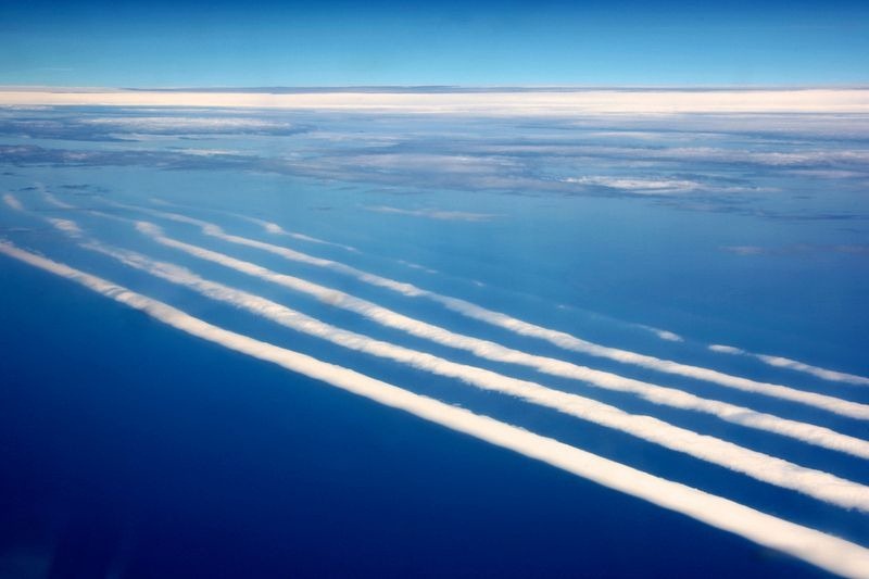
Recently the airline Virgin Australia posted some photos on Facebook that had been taken by a passenger on board a flight from Perth to Adelaide:

Photos below:
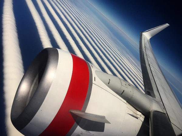
At the time of writing, the thread has almost 500 comments, many of them as a result of the post being shared on chemtrail groups, with claims that the clouds are somehow artificial or linked to spraying from aircraft.
In fact, the clouds are a natural formation.
We can find them on satellite images:
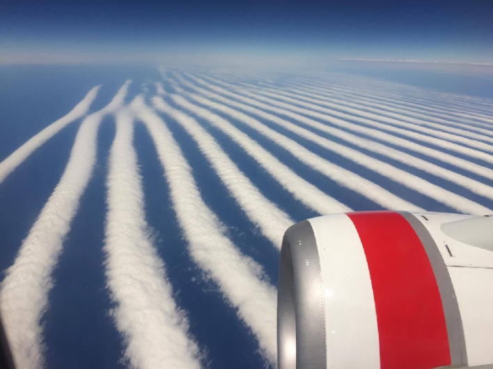
The pictures were first posted on Instagram on January 6 by Ilya Katsman (@theonlyilya), here:
Source: https://www.instagram.com/p/BO6VNmEDrcy/?taken-by=theonlyilya
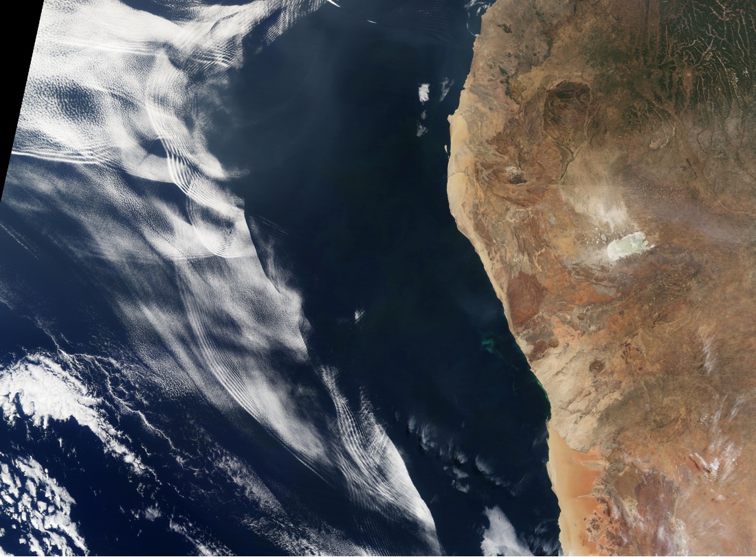
Fortunately, Australia is in the field of view of the Japanese weather satellite Himawari-8, which posts high-resolution full-colour images every 10 minutes, at http://himawari8.nict.go.jp/
Looking at the satellite imagery for January 6 quickly shows an area of linear clouds off the south coast of Australia:

Using FlightRadar24, we can see that the Virgin Australia flight, VA714, crossed the area of the clouds at about 2:00 UTC (10am Perth time):
[compare]


[/compare]
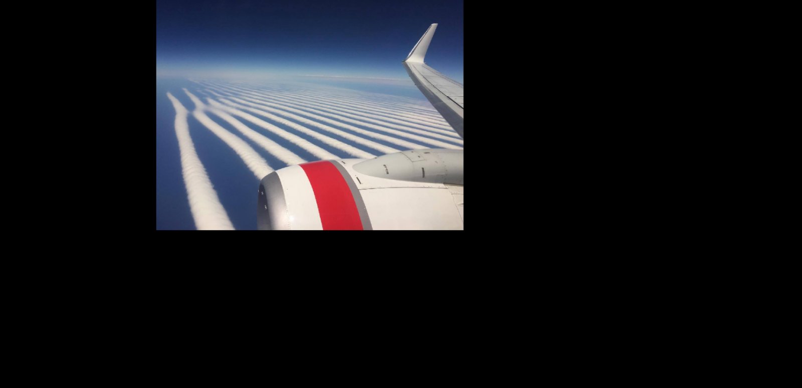
Overlaying a crop from the satellite image onto the photo from the plane, and adjusting for perspective, gives a good match, showing where the waves intersect in a Y shape on the eastern side of the formation:

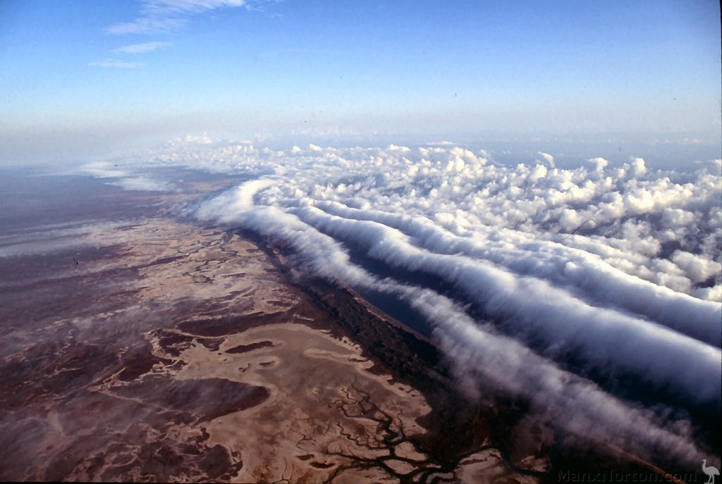
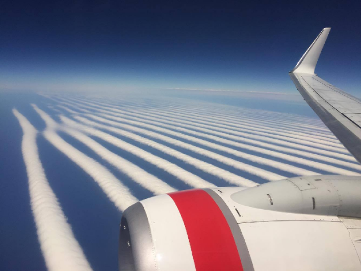
The clouds are in fact a well-known phenomenon called the "morning glory", where a series of "roll clouds" form due to standing waves of wind in the atmosphere. Wikipedia describes the most well-knowm occurrence, which forms on a regular basis in the north of Australia:
Photos below:
At the time of writing, the thread has almost 500 comments, many of them as a result of the post being shared on chemtrail groups, with claims that the clouds are somehow artificial or linked to spraying from aircraft.
In fact, the clouds are a natural formation.
We can find them on satellite images:
The pictures were first posted on Instagram on January 6 by Ilya Katsman (@theonlyilya), here:
Source: https://www.instagram.com/p/BO6VNmEDrcy/?taken-by=theonlyilya
Fortunately, Australia is in the field of view of the Japanese weather satellite Himawari-8, which posts high-resolution full-colour images every 10 minutes, at http://himawari8.nict.go.jp/
Looking at the satellite imagery for January 6 quickly shows an area of linear clouds off the south coast of Australia:
Using FlightRadar24, we can see that the Virgin Australia flight, VA714, crossed the area of the clouds at about 2:00 UTC (10am Perth time):
[compare]
[/compare]
Overlaying a crop from the satellite image onto the photo from the plane, and adjusting for perspective, gives a good match, showing where the waves intersect in a Y shape on the eastern side of the formation:
The clouds are in fact a well-known phenomenon called the "morning glory", where a series of "roll clouds" form due to standing waves of wind in the atmosphere. Wikipedia describes the most well-knowm occurrence, which forms on a regular basis in the north of Australia:
The geography here is slightly different but the result is the same: sharply defined parallel bands of cloud forming in the morning.The air descending from the peninsula to the east goes underneath the inversion layer and this generates a series of waves or rolling cylinders which travel across the gulf. These cylinders of air roll along the underside of the inversion layer, so that the air rises at the front of the wave and sinks at the rear. In the early morning, the air is saturated enough so that the rising air in the front produces a cloud, which forms the leading edge of the cylinder, and evaporates in the back, hence forming the Morning Glory cloud. The cloud lasts until the surface inversion disappears with the heating of the day.
Last edited: