Split from: https://www.metabunk.org/threads/bl...e-netherlands-contrail-shadow-at-sunset.5144/
Some similar elements here:

Some similar elements here:
Last edited:

") )
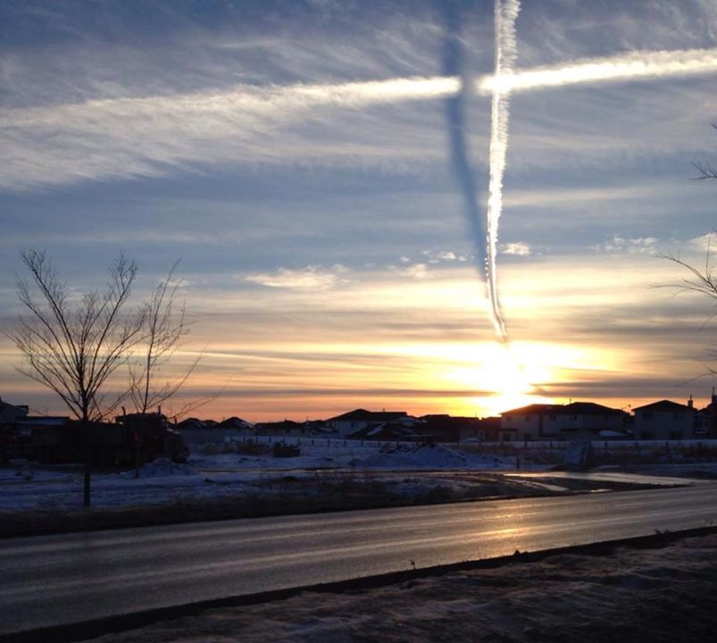
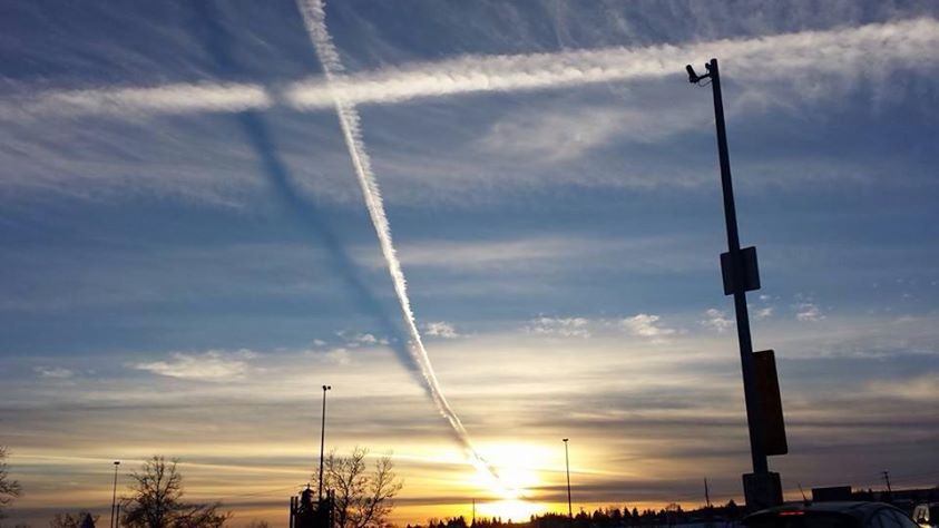
)It looks like the plane is heading west, as the trail right at the top of Gemma Lynne's picture looks more dispersed. But that could just be an illusion due to winds etc.A bearing of 239 from Calgary, if magnetic variation is accounted for, is just barely WSW on the map. A common routing between Vancouver and Calgary is via the ADSIX intersection (ripped from WJA544 on flight aware: ADSIX CILLI Q983 NORET IGVEP3), which is precisely on a heading of 239 degrees from Calgary Airport. ADSIX is nearer to Vancouver, so just using that as a reference.
Not saying that this is a flight from Calgary, but given that it overflew the city, there is a higher probability that the flight was either going to Vancouver, or from Vancouver. A direct track from Calgary to Vancouver is on a magnetic heading of 241 degrees.
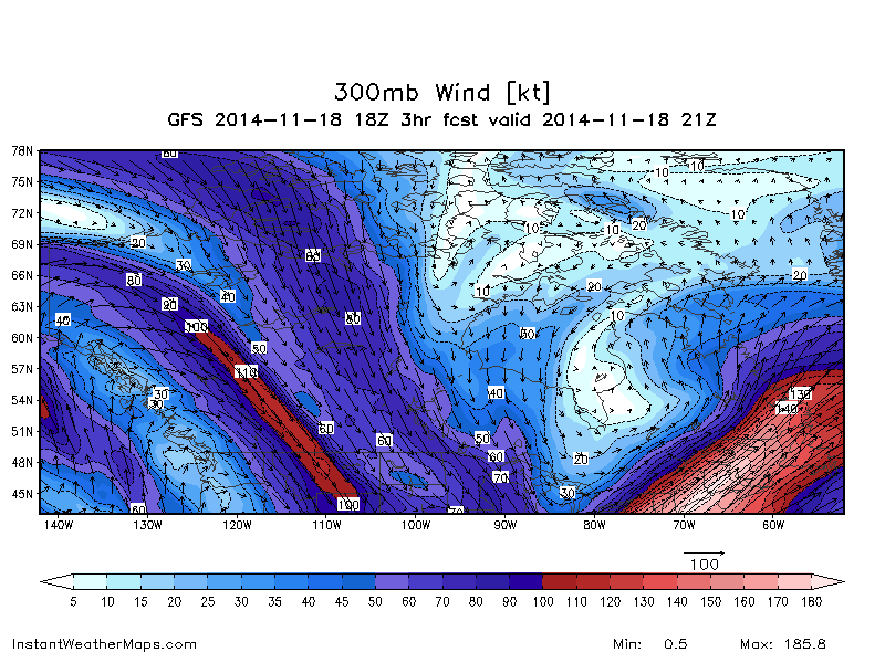
Very strong upper winds blowing from the NW at that time.I'm not sure what the upper winds were yesterday, but the winds were forecast to be coming from 320 degrees true (around 305 magnetic), at 79 knots from 1700Z this morning, at 39,000 feet which is decently strong. That may be a factor perhaps?
A bearing of 239 from Calgary, if magnetic variation is accounted for
It looks like the plane is heading west, as the trail right at the top of Gemma Lynne's picture looks more dispersed. But that could just be an illusion due to winds etc.
This flight from Seattle to Frankfurt passed over just to the north of Calgary at 4.10 local time.
At the same time, this one from Toronto to Vancouver was heading west having passed just south of the city.
But neither of them look quite right to me.
The north-south trail is tricky, too. This one passed by around the right time, but too far east.
Given the conditions, the trails could be older I suppose.
.You guys are amazing. Perhaps the "Trail" in front of your names is there for good reason?
I am a little bit confused on how you derived the wind direction and speed (especially as it pertains to AWE509), however. A 60 degree split just seems like a bit of a stretch, particularly as I look at 300 mb graph in post #8. I'm curious just from an inquisitive standpoint, as it is a little bit over my head right now