The times are the same, my times are in UTC and yours are in EDT (UTC -4h). FlightAware displays data in the user's local time. If you check the times at Aware site now, you probably will see them in EST (5h) after you local time has been switched back to Eastern Standard Time.
You can display and explore the trails on Google Earth; the flight tracks are available in KML format from the the FlightAware site. To download click on the Google Earth link (encircled in purple) near the bottom right corner of the map:
View attachment 9984
I've also attached the KML files for both flights to this post.
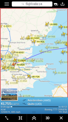
As you can see, the trails crossed at about 12:01 EDT, 16 minutes before your first pictures were taken. In that period of time they moved east so that the FFT1121 trail was pointing right toward you and appeared 'vertical'. Note that the high altitude wind normally moves a vast layer of air in the same direction with the same speed and carries the embedded trails across the sky parallel to their original orientations. By the time you set up your video, the trails were even further east and continued their movement in easterly direction during filming.
Your video actually allows identification of the location of the trails at a known moment of time. Using provided information, the camera location and orientation can be deduced and added to Google Earth with a high precision. After that the trails can be modelled and positioned so to match their image in the video frame. The timing of video also can be deduced due to an accidental capture of a plane flying across the frame (entering at 2:40 at the right hand side). This flight,
AAL1114 (from Dallas to New York), has deviated from its usual route presumably to avoid bad weather, or, possibly, to appear in your video to allow me its identification

. The KML file with its track is also attached. (Note that AAL1114 had flown at 39,000 ft, a few miles further south and 2000 ft higher than the two other planes, so it should not be surprising that it had not left a persistent trail).
Here is a fit of your camera frame on Google Earth with the added model of the trails and AAL1114 track:
View attachment 9988
The AAL1114 track is shown in a default view, extended to the ground. The junction between the transparent and opaque panes corresponds to the plane position at 16:31:34 UTC (12:31:34 EDT). The purple angled line represents the position of the trails at about the same time.
A view from the above shows all three tracks: the FTT1121 track goes S-N, whereas the other two tracks go SW-NE at about 60° to it. The yellow pin marks the AAL1114 plane position at 12:31:34 EDT. (The plane markers can be moved along the tracks to a different time by the slider tool in the upper left corner of Google Earth window.) The FTT1121 and DAL1200 trails at the above time are modelled in the same orientations as their tracks at the original junction but are displaced to the east along the yellow line by about 45 km (28 miles):
View attachment 9990
(Note: this gives an estimate of the wind speed of 90 km/h or 55 mph, which is in the middle of the range of speed values for high altitude winds.)
Again, the times and locations are in a good agreement. In 30 minutes after the the trails made the crossing they moved twice the distance they did by the time of the first photos.
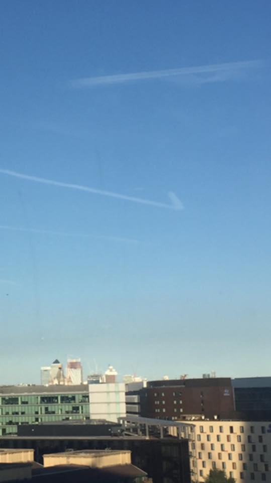
And the last evidence for two planes. In your video, there are similarly shaped trails on the left. The longer trail (red arrow) is parallel to the longer 'vertical' trail on the right, whereas a shorter faint trail (green arrow) is parallel to the shorter trail on the right. Unlike the trails on the right, the trails on the left are not joint together.
View attachment 9991
This is fully consistent with the FR24 playback showing the planes in your area flying along the two major routes: N-S and NE-SW. Also, as seen in your video, the non-persistent trail of AAL1114 on a parallel route to DAL1200 is parallel to both shorter trails.


 .
.")


")