In the absence of weather systems they would be, but there's up to a ~100mb range between the highest and lowest sea-level pressures encountered in the atmosphere, which means that a given flight level will vary in actual altitude above the ground by a couple of thousand feet or more depending on where the aircraft is flying in relation to those weather systems.
You can think of the high and low pressure systems as like "hills and valleys" that the aircraft will follow as it maintains a given pressure altitude, just like a car driving over hills and valleys while staying on the ground.
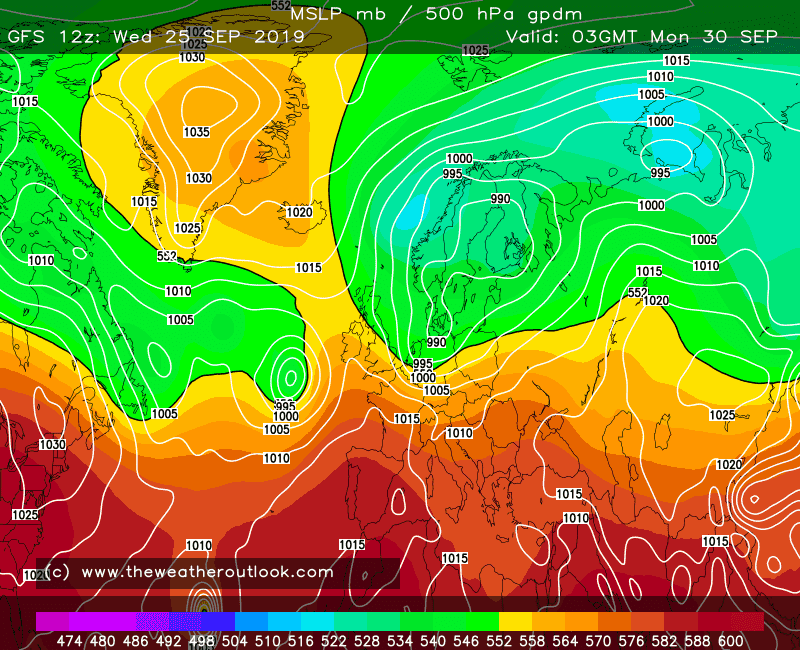
Weather maps often show the "geopotential height", eg on this chart the main colours indicate the height of the 500 millibar pressure level above sea level:
The scale at the bottom shows the geopotential height in decametres (tens of metres).
So for instance if a plane was following a flight level that corresponded to a pressure of 500 millibars, then it would be around 5,900 metres above sea level in north Africa, but only about 5,200 metres above sea level off the coast of Norway.
Generally these geopotential heights roughly correspond to the sea-level weather systems, but not always and not exactly, as the temperature of the air also affects the height. So for instance you can see that the highest and lowest sea-level pressures (shown by the white isobars labelled with black numbers) approximate but don't exactly match the highest and lowest 500mb heights.


")
")