Supreme Logic
New Member
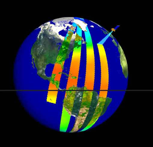
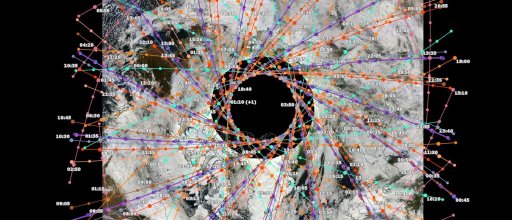
Can anyone explain the reason as to why NASA would launch 2 polar orbiting satellites, but NOT scan the very center? where HE theorists believe the entrance is....
Here are some links to NASA that show what they call the "Polar Hole". They use this term in more than one PDF file, but I cant find the other one anymore....
They go further by describing how they simulate a scan of the center by using "interpolation" and "Gaussian kernal".
http://icesat.gsfc.nasa.gov/icesat2/publications/pubs_2010/abdalati_et_al_2010.pdf
(scroll to page 8)

http://celebrating200years.noaa.gov/visions/satellites/welcome.html#collab
(another example of the "polar hole")

http://www.nasa.gov/centers/goddard/news/topstory/2003/1209icesat.html
(general info)
https://science.nasa.gov/missions/icesat
http://visibleearth.nasa.gov/view.php?id=86036
http://lasp.colorado.edu/home/mag/research/polar-mesospheric-clouds/
(more polar holes)

Here are some links to NASA that show what they call the "Polar Hole". They use this term in more than one PDF file, but I cant find the other one anymore....
They go further by describing how they simulate a scan of the center by using "interpolation" and "Gaussian kernal".
http://icesat.gsfc.nasa.gov/icesat2/publications/pubs_2010/abdalati_et_al_2010.pdf
(scroll to page 8)
http://celebrating200years.noaa.gov/visions/satellites/welcome.html#collab
(another example of the "polar hole")
http://www.nasa.gov/centers/goddard/news/topstory/2003/1209icesat.html
(general info)
https://science.nasa.gov/missions/icesat
http://visibleearth.nasa.gov/view.php?id=86036
http://lasp.colorado.edu/home/mag/research/polar-mesospheric-clouds/
(more polar holes)
Last edited by a moderator:
")


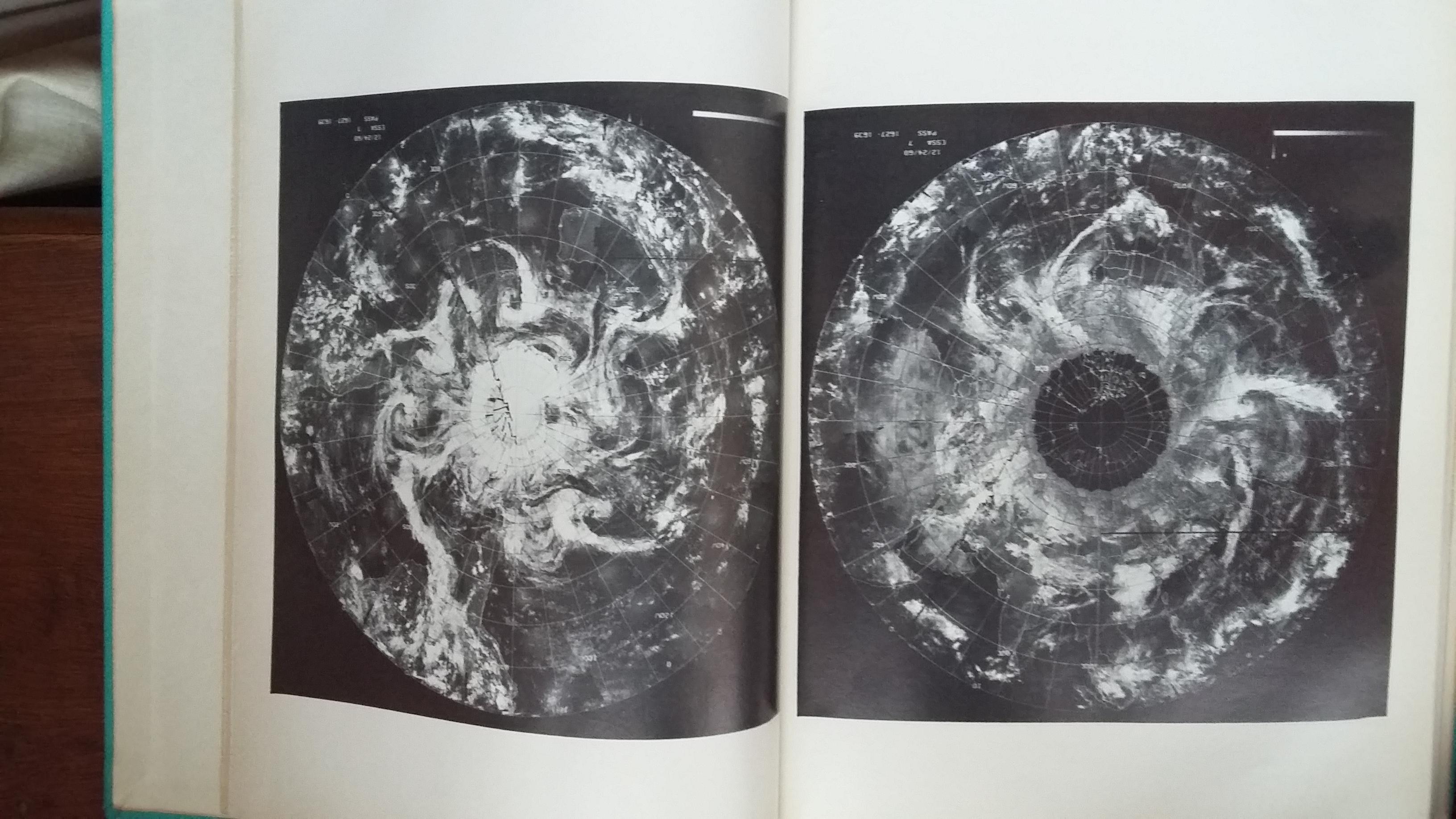
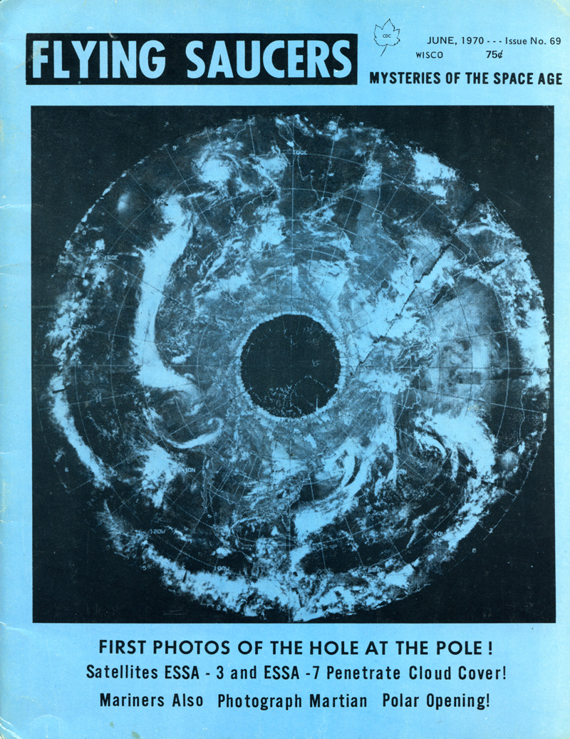
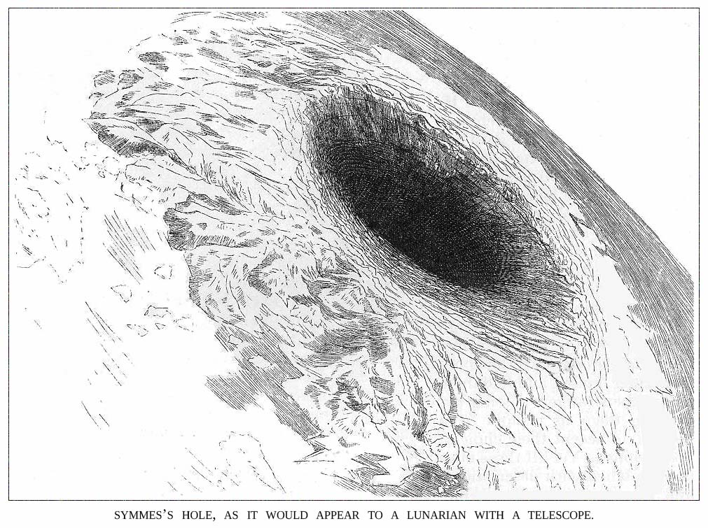
") , are hiding something at the poles) became popular for a while amongst people who are fans of the idea of a hollow Earth thanks to photos like this:
, are hiding something at the poles) became popular for a while amongst people who are fans of the idea of a hollow Earth thanks to photos like this: