
You are using an out of date browser. It may not display this or other websites correctly.
You should upgrade or use an alternative browser.
You should upgrade or use an alternative browser.
90 Degree plane trail?
- Thread starter Marine0811
- Start date
-
- Tags
- plane trail
It looks to me like two incomplete trails, meeting at right angles. Do you have a wider view?
Marine0811
Active Member
It looks to me like two incomplete trails, meeting at right angles. Do you have a wider view?
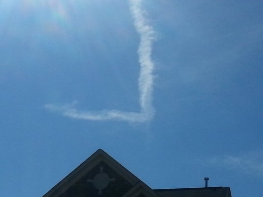
Yes, it is posted in the attachment. Sorry, I forgot to enlarge it earlier.
It looks like there is a faint portion of the vertical trail extending past the intersection. They both look like rather old trails that have been battered about by the wind.
Marine0811
Active Member
It looks to me like two incomplete trails, meeting at right angles. Do you have a wider view?
It looks like a single trail to me because of how it thickens after the turn.
Trailspotter
Senior Member.
I took some pics today of
a plane trail that looks to have a 90 degree angle.
How and why does the trail look like this?
View attachment 9905
Where and when exactly these pictures were taken?
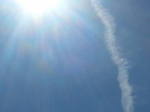
It could be. Certainly contrails can appear to have a sharp bend when it is really just a gentle curve, as seen here:You can't see how far it is foreshortened - it looks like a single trail with a bit of a curve - but because you are looking at it from an angle much of the effect of the curve is lost.
https://www.metabunk.org/threads/so...th-ufo-contrail-private-jet-perspective.4559/
But in this case I think it really is two trails. If you boost the contrast you can see what looks to be a faint extension of the vertical trail:
MikeC
Closed Account
looks to me as if that "extension" also goes a bit to the left - the left part of your ellipse goes through it - which makes me think that it's part of the "horizontal" trail rather than the "vertical" one
IMO it still looks more like a single trail - but I'm not going to die in a ditch over it")
IMO it still looks more like a single trail - but I'm not going to die in a ditch over it
Could be. If we got the time and location we could maybe identify it, although the trail(s) could have been formed a long time before and a long way away from that location.looks to me as if that "extension" also goes a bit to the left - the left part of your ellipse goes through it - which makes me think that it's part of the "horizontal" trail rather than the "vertical" one
IMO it still looks more like a single trail - but I'm not going to die in a ditch over it
M Bornong
Senior Member.
Try making a turn that sharp at 50 mph in your car. Do you think you'd make the turn, or would your car be on it's top? Although, I did see an F-22 make some very bizarre maneuvers at an Air Show at Edwards Air Force Base a couple of years ago, but it made an amazing turn at the top of a climb when it seemed to hover for a couple of moments.If a plane did make a 90 degree turn that sharp, how many g's would it be pulling? Would the plane even survive?
Just found this video of a Raptor at a Miramar Air Show. The flying starts just before the 13 minute mark, I still don't think it can do a 90 degree turn. Some nice aerodynamic contrails.
Last edited:
WeedWhacker
Senior Member
If a plane did make a 90 degree turn that sharp, how many g's would it be pulling? Would the plane even survive?
The reality of physics really requires that such an actual turn like that, by a large airplane is impossible (given our current technology).
The F-22 video shows example of extreme tech, such as thrust vectoring, but still at a high speed there will be very high G-forces (absent some sort of "Star Trek" type "inertial damper", or some such currently unknown device).
On-line turn radius and G-force calculator:
http://www.csgnetwork.com/aircraftturninfocalc.html
Rico
Senior Member
The Sukhoi's are known for some wild maneuvers, such as the famous Cobra technique.
That said, yeah, you won't see most aircraft doing sharp turns anytime soon. It not only gives the aircraft enough loading to bend a few things, but it's also hard on the human body as well.
http://en.wikipedia.org/wiki/G-LOC
That said, yeah, you won't see most aircraft doing sharp turns anytime soon. It not only gives the aircraft enough loading to bend a few things, but it's also hard on the human body as well.
http://en.wikipedia.org/wiki/G-LOC
Trailspotter
Senior Member.
It is almost certainly two separate trails. They may look like being joint together at the corner, but they are not, as they are at different altitudes. The two photos are six minutes apart, as suggested by their titles, 20141028_121743 and 20141028_122352, apparently derived from the date and times they were taken. The 'vertical' trail in the earlier photo is in fact horizontal; it is directed straight toward the camera with its nearest end looking the highest. Between the two shots, the trails were carried by wind a few miles to the left, so in the later photo the 'vertical' trail is viewed from the side and makes a different angle. In contrast, the 'horizontal' trail is viewed in essentially the same orientation.
Both 'horizontal' and 'vertical' trails show some internal structures that changed little between the two shots. I have aligned the 'horizontal' trail features to demonstrate the scissors-like arrangement of the two trails relative each other:

The 'horizontal' trail stays in the front of the 'vertical' trail, meaning that the latter goes above the former. If they were at the same level, as in the case of a single trail with a turn, the 'horizontal' part would appear behind the 'vertical' part, which is closer to the camera.
Also, a faint protrusion below the corner rotated by the same angle, as the 'vertical' trail did, meaning it is an extension of this trail.
Both 'horizontal' and 'vertical' trails show some internal structures that changed little between the two shots. I have aligned the 'horizontal' trail features to demonstrate the scissors-like arrangement of the two trails relative each other:
The 'horizontal' trail stays in the front of the 'vertical' trail, meaning that the latter goes above the former. If they were at the same level, as in the case of a single trail with a turn, the 'horizontal' part would appear behind the 'vertical' part, which is closer to the camera.
Also, a faint protrusion below the corner rotated by the same angle, as the 'vertical' trail did, meaning it is an extension of this trail.
Last edited:
Pete Tar
Senior Member
That's what I was thinking, so it either eliminates it as being a single trail making a 90 degree turn and proves it's a composite, or we're into secret anti-gravity field black op alien tech propulsion.The reality of physics really requires that such an actual turn like that, by a large airplane is impossible (given our current technology).
Pretty much. If it was a single photo then it could be a trick of perspective, making a gradual turn appear much sharper, but with two pictures from different angles that looks quite unlikely.That's what I was thinking, so it either eliminates it as being a single trail making a 90 degree turn and proves it's a composite, or we're into secret anti-gravity field black op alien tech propulsion.
Marine0811
Active Member
It looks to me like two incomplete trails, meeting at right angles. Do you have a wider view?
It looks like a single trail to me because of how it thickens after the turn.
It looks like there is a faint portion of the vertical trail extending past the intersection. They both look like rather old trails that have been battered about by the wind.
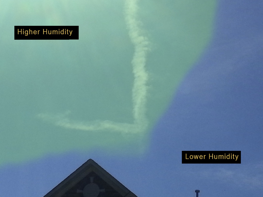
I think that is sun glare or wind disturbance. The trails appear lar
Could be. If we got the time and location we could maybe identify it, although the trail(s) could have been formed a long time before and a long way away from that location.
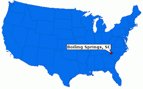
It was yesterday in Boiling Springs, SC around 11am or 12. There were a ton of planes in the air and a lot of trails, but none like that. I have more pics of it when I can get my Wifi to work.
Rico
Senior Member
Boiling Springs covers a bit of area, so the more information you can provide as to where you took the pictures, the better. A cardinal direction as to which direction you are facing would also help. Also, sometimes the best way to identify an aircraft is to actually capture the actual aircraft itself, and note the precise time.
If the clock in your camera is to believed, then it's likely you took those pictures between 12:17 and 12:23 local... does that sound about right?
I just checked flightradar for that time frame of 11:45-12:30, and there does appear to be quite a bit jet traffic. Much of this traffic appears to crisscross east, and south east of Boiling Springs, though I'm a little unsure what the upper winds are for that day, which may make a trail appear elsewhere. The trails in the photos appear old. It will be difficult to pinpoint the origins without more information.
I would examine Trailspotter's explanation again, because based on the file names you posted, your photos are six minutes apart, and the way the trails change, particularly in perspective, is indicative of possibly two different trails at different altitudes.
You also have to reconcile the issue that if it were in fact a single trail, what kind of airplane can possibly do such a sharp turn? This has been discussed in detail above. The only outcome to come out of this is either there is some optical illusion going on, or it is in fact more than one trail.
Pete Tar
Senior Member
Just for reference are you able to show a normal right angle turn (ie one that's physically possible) and then manipulate it in google earth to show what it would look like placed to resemble this one? I have a hard time believing there's any viewpoint from which it would look like the angle in the picture, there's no way it can be fore-shortened enough.Pretty much. If it was a single photo then it could be a trick of perspective, making a gradual turn appear much sharper, but with two pictures from different angles that looks quite unlikely.
Marine0811
Active Member
Boiling Springs covers a bit of area, so the more information you can provide as to where you took the pictures, the better. A cardinal direction as to which direction you are facing would also help. Also, sometimes the best way to identify an aircraft is to actually capture the actual aircraft itself, and note the precise time.
If the clock in your camera is to believed, then it's likely you took those pictures between 12:17 and 12:23 local... does that sound about right?
I just checked flightradar for that time frame of 11:45-12:30, and there does appear to be quite a bit jet traffic. Much of this traffic appears to crisscross east, and south east of Boiling Springs, though I'm a little unsure what the upper winds are for that day, which may make a trail appear elsewhere. The trails in the photos appear old. It will be difficult to pinpoint the origins without more information.
I would examine Trailspotter's explanation again, because based on the file names you posted, your photos are six minutes apart, and the way the trails change, particularly in perspective, is indicative of possibly two different trails at different altitudes.
You also have to reconcile the issue that if it were in fact a single trail, what kind of airplane can possibly do such a sharp turn? This has been discussed in detail above. The only outcome to come out of this is either there is some optical illusion going on, or it is in fact more than one trail.
Hello, I was on castleton circle, my camera was aimed towards grace dr., not sure of the exact direction.
I just took a pic to see if the time stamp was right, it was exact. Thanks to you and others, I didn't know that the time was recorded on my pics. I have more pics and a video I will upload if my charter wifi will ever work.
I can only speculate. I have never seen a trail like this. I believe it to be a single trail from an unknown craft.
Pete Tar
Senior Member
But a manoeuvre like that is physically impossible, so why do you 'believe' this?I believe it to be a single trail from an unknown craft.
Marine0811
Active Member
Rico
Senior Member
I googled castleton circle and grace drive. From that information, it appears that the camera was facing a southerly direction if that helps anyone.
A lot of the mainstream traffic seems to crisscross Boiling Lake from either to the south or to the east. There were a few flights going into Washington DC and Newark at the time. Incidentally, there was a UAL Airbus that overflew directly from New Orleans to Newark around that time too.
A lot of the mainstream traffic seems to crisscross Boiling Lake from either to the south or to the east. There were a few flights going into Washington DC and Newark at the time. Incidentally, there was a UAL Airbus that overflew directly from New Orleans to Newark around that time too.
Last edited:
Marine0811
Active Member
But a manoeuvre like that is physically impossible, so why do you 'believe' this?
It is impossible by our public knowledge of what technology our government does or doesn't have. It could also be a possible alien ufo, but both are speculation lacking evidence.
I haven't seen enough evidence to convince me of this being 2 trails from 2 separate planes, the chances of them lining up or appearing at a 90 degree angle seem very small to me.
Marine0811
Active Member
Here is the video I shot of it.
Trailspotter
Senior Member.
It was yesterday in Boiling Springs, SC around 11am or 12. There were a ton of planes in the air and a lot of trails, but none like that. I have more pics of it when I can get my Wifi to work.
Indeed, as Rico has already pointed out, there are lot of commercial air traffic going in your area. Boiling Springs, SC is at the crossing of two busy routes, one goes N - S, the other NE - SW. On the map, the angle between the two directions is about 60°, but from selected positions on the ground it can appear close to 90°.
Where was the initial crossing point for this two trails? The photographic evidence suggests it was at at least 20 km southeast of Boiling Springs. 1). In both photos there are beams of sun glare that indicate the position of the Sun: above the left upper corner of the earlier photo (20141028_121743) and above the upper right corner of the later one (20141028_122352). With the time near the noon, the Sun is in the south at its highest elevation about 45°. The crossing point (or the corner) is much lower than that, perhaps only 30°, meaning the 'horizontal' trail is at the distance about twice the altitude value away from the camera. 2). In 6 minutes between the two photos the Sun moved only a little, so it were the trails that moved to the left (east) relative the camera. As the trails are already several minutes old, the crossing/corner ought to be formed further west.
Playing back FR24 on October 28 at around 12 noon EDT (16:00 UTC), I've identified two possible candidate flights: DAL1200 (ATL->BOS) and FFR(FFT)1121 (RSW->CLE). I have downloaded KML files with their flightpaths from Flightaware and displayed them at Google Earth:
FFT1121 (red) crossed the path of [edit]:DL1200 (green) at essentially the same altitude at 16:00 UTC, about 18 minutes before the first photo. To model view of the trail in this photo I moved the camera viewpoint under the read path some 18 km east of Boiling spring:
The resulted angle between the trails and Sun position fit quite well. In the next step I moved the camera position further west by 6 km (that is, instead of moving contrails to the west with estimated speed of 1km/min, I have moved the viewpoint in the opposite direction):
Again, the contrail angle and Sun position fit reasonably well.
So this analysis fully supports the two trails explanation. In addition, I'd like to point out that there were no planes making turns in that area at the time.
Last edited:
Marine0811
Active Member
Why?
Look how many possibilities there are.
http://www.bbc.com/news/technology-21195765External Quote:Each coloured line on this map represents an aircraft flight which either took off or landed in the south east of England on one day in July 2011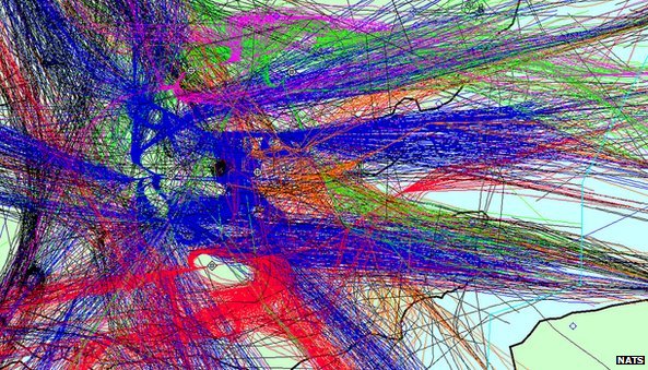
(thought you lived in england for some reason. Can't find an American equivalent, but you get the idea.)
Is there a map like that of air traffic over Boiling Springs? I didn't see any other trails close to this one, it is hard for me to accept they would make a near perfect 90 degree angle by two separate planes. The corner on the trail is round looking like an object turned. The inside of the trail has distinct sharp turn. It is because of the multiple possibilities that I am not convinced this was two planes. There is also a possibility that the plane or whatever it was, wouldn't show up on flight radars.
WeedWhacker
Senior Member
Is there a map like that of air traffic over Boiling Springs?
Here is a link showing the actual layout of major Jet Airway Routes for your area:
http://skyvector.com/?ll=35.92242034575402,-82.07061767450222&chart=304&zoom=4
You can orient using the Spartanburg VOR, about 3/4s down the page, centered. (This NavAid is located a few miles East and North of the GSP Airport).
Marine0811
Active Member
Indeed, as Rico has already pointed out, there are lot of commercial air traffic going in your area. Boiling Springs, SC is at the crossing of two busy routes, one goes N - S, the other NE - SW. On the map, the angle between the two directions is about 60°, but from selected positions on the ground it can appear close to 90°.
Where was the initial crossing point for this two trails? The photographic evidence suggests it was at at least 20 km southeast of Boiling Springs. 1). In both photos there are beams of sun glare that indicate the position of the Sun: above the left upper corner of the earlier photo (20141028_121743) and above the upper right corner of the later one (20141028_122352). With the time near the noon, the Sun is in the south at its highest elevation about 45°. The crossing point (or the corner) is much lower than that, perhaps only 30°, meaning the 'horizontal' trail is at the distance about twice the altitude value away from the camera. 2). In 6 minutes between the two photos the Sun moved only a little, so it were the trails that moved to the left (east) relative the camera. As the trails are already several minutes old, the crossing/corner ought to be formed further west.
Playing back FR24 on October 28 at around 12 noon EDT (16:00 UTC), I've identified two possible candidate flights: DAL1200 (ATL->BOS) and FFR(FFT)1121 (RSW->CLE). I have downloaded KML files with their flightpaths from Flightaware and displayed them at Google Earth:
View attachment 9937
FFT1121 (red) crossed the path of DL2100 (green) at essentially the same altitude at 16:00 UTC, about 18 minutes before the first photo. To model view of the trail in this photo I moved the camera viewpoint under the read path some 18 km east of Boiling spring:
View attachment 9938
The resulted angle between the trails and Sun position fit quite well. In the next step I moved the camera position further west by 6 km (that is, instead moving contrails to the west with estimated speed of 1km/min, I have moved the viewpoint in the opposite direction:
View attachment 9939
Again, the contrail angle and Sun position fit reasonably well.
So this analysis fully supports the two trails explanation. In addition, I'd like to point out that there were no planes making turns in that area at the time.
That is extremely close, but I am not convinced.
Indeed, as Rico has already pointed out, there are lot of commercial air traffic going in your area. Boiling Springs, SC is at the crossing of two busy routes, one goes N - S, the other NE - SW. On the map, the angle between the two directions is about 60°, but from selected positions on the ground it can appear close to 90°.
Where was the initial crossing point for this two trails? The photographic evidence suggests it was at at least 20 km southeast of Boiling Springs. 1). In both photos there are beams of sun glare that indicate the position of the Sun: above the left upper corner of the earlier photo (20141028_121743) and above the upper right corner of the later one (20141028_122352). With the time near the noon, the Sun is in the south at its highest elevation about 45°. The crossing point (or the corner) is much lower than that, perhaps only 30°, meaning the 'horizontal' trail is at the distance about twice the altitude value away from the camera. 2). In 6 minutes between the two photos the Sun moved only a little, so it were the trails that moved to the left (east) relative the camera. As the trails are already several minutes old, the crossing/corner ought to be formed further west.
Playing back FR24 on October 28 at around 12 noon EDT (16:00 UTC), I've identified two possible candidate flights: DAL1200 (ATL->BOS) and FFR(FFT)1121 (RSW->CLE). I have downloaded KML files with their flightpaths from Flightaware and displayed them at Google Earth:
View attachment 9937
FFT1121 (red) crossed the path of DL2100 (green) at essentially the same altitude at 16:00 UTC, about 18 minutes before the first photo. To model view of the trail in this photo I moved the camera viewpoint under the read path some 18 km east of Boiling spring:
View attachment 9938
The resulted angle between the trails and Sun position fit quite well. In the next step I moved the camera position further west by 6 km (that is, instead moving contrails to the west with estimated speed of 1km/min, I have moved the viewpoint in the opposite direction:
View attachment 9939
Again, the contrail angle and Sun position fit reasonably well.
So this analysis fully supports the two trails explanation. In addition, I'd like to point out that there were no planes making turns in that area at the time.
I think the red path is lined up, but not the green one. What were the differences in altitude? In the video, it appears that the corner of the trail disappears around the same time. If this trail were two planes crossing, I would expect to see more dispersion and more differences. This trail is nearly equal in width on both lines. What kind of planes were the one's flying?
Trailspotter
Senior Member.
I didn't see any other trails close to this one, it is hard for me to accept they would make a near perfect 90 degree angle by two separate planes. The corner on the trail is round looking like an object turned. The inside of the trail has distinct sharp turn. It is because of the multiple possibilities that I am not convinced this was two planes. There is also a possibility that the plane or whatever it was, wouldn't show up on flight radars.
The trails did not make a near perfect 90 degree angle. It was just illusion. The trails were carried by wind across the sky so their mutual orientations changed over the time. If you had spotted them a few minutes earlier, when they just formed, you probably would see them shaped like 'V' but with a wide angle. They looked like a 'mirrored L' with a right angle between them only for a short time and then became like '> sign' with an acute angle between them as seen in your movie.
Last edited:
NoParty
Senior Member.
Here is the video I shot of it.
For people who found Andy Warhol's 1964 Empire "...too fast moving..."
deirdre
Closed Account
why? if they are in the same area of the sky, they would react similarly. (ps. what the contrails do AFTER the fact is irrelevant)If this trail were two planes crossing, I would expect to see more dispersion and more differences.
Pete Tar
Senior Member
Sort ofIs there a map like that of air traffic over Boiling Springs?
Attachments
MikeC
Closed Account
Playing back FR24 on October 28 at around 12 noon EDT (16:00 UTC), I've identified two possible candidate flights: DAL1200 (ATL->BOS) and FFR(FFT)1121 (RSW->CLE). I have downloaded KML files with their flightpaths from Flightaware and displayed them at Google Earth:
....etc
Now THAT's what I'm talking about - actual evidence - nicely done!
Similar threads
- Replies
- 8
- Views
- 1K
- Replies
- 12
- Views
- 2K
- Replies
- 3
- Views
- 1K
- Replies
- 18
- Views
- 2K
- Replies
- 10
- Views
- 2K