Unexplained Mysteries on Google Maps [Explained]

Jason

Senior Member
My buddy sent me a link this morning in an email, and there was one that really caught my eye. I'm sure there is a really good explanation for these mistakes, but this one is just hard to explain. There are a few of them involving planes "apparently" parked in a yard. The other ones look superimposed or something like the plane was in the way of the photo from the satellite, and it added the plane into the contour of the land. Guessing? But this one is just hard to explain. First off the shadows seem to line up perfectly, as you would expect from the surrounding foilage and homes. Not to mention the plane actually looks like its under the trees, as it appears the trees are hanging over one of the wings, and the fuselage. So how does a mistake like this happen because I know there isn't a plane parked behind someones house, unless its John Travolta.LOL..

http://www.dailymail.co.uk/news/art...us-field-lake-blood-strangest-cloud-ever.html


Other plane images that seem easy to explain;


I am sure Mick will explain in better detail, but the Google "Mapping" method is rife with such anomalies.
 
Last edited by a moderator:
its a plane in someones backyard. I googled "plane in backyard" (theres quite a few, sure their wives love that). anyway found the coordinates

plane.JPG
 
Well that's really weird:

I just saw on GeoResonance's site that their declassified Kirlian equipment had
pinpointed MH370 at 25 19 22 8 South, 57 30 54 6 West... (aka "The Bay of Ben's Yard")
 
So how does a mistake like this happen because I know there isn't a plane parked behind someones house,

And how do you know this? There are lots of planes that people have repurposed for housing and decoration.

This particular plane is clearly just there. You can go into Google Earth, and use the time to see the same spot in different satellite images:
 
Here you go:
http://www.lanacion.com.py/articulo/93757-boeing-707-de-ex-lap-estacionado-en-patio-privado.html

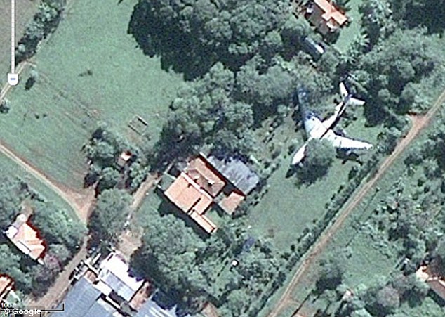
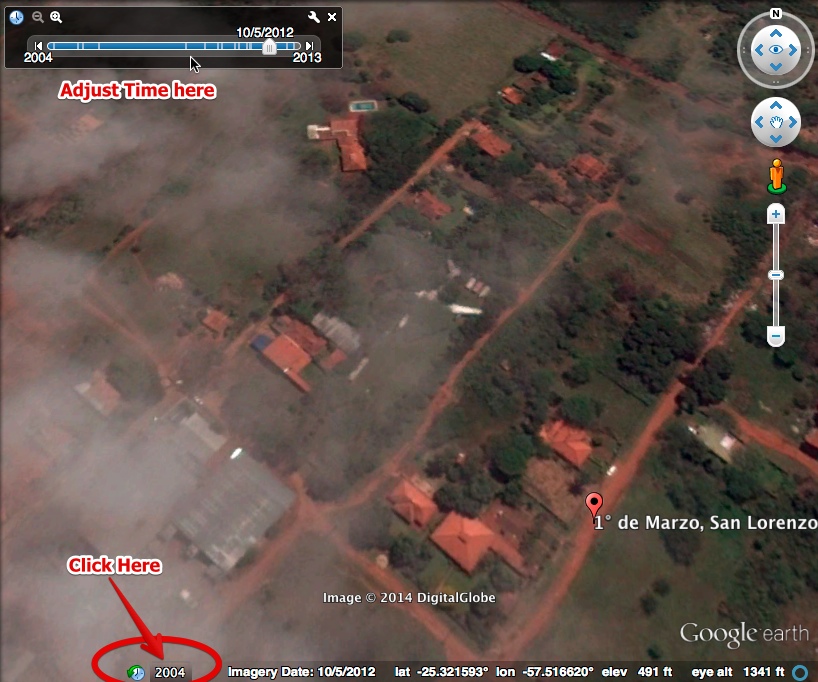
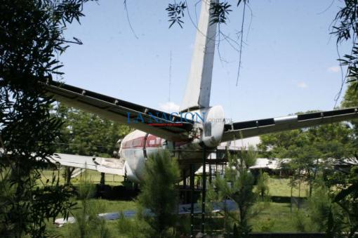
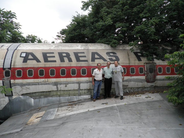
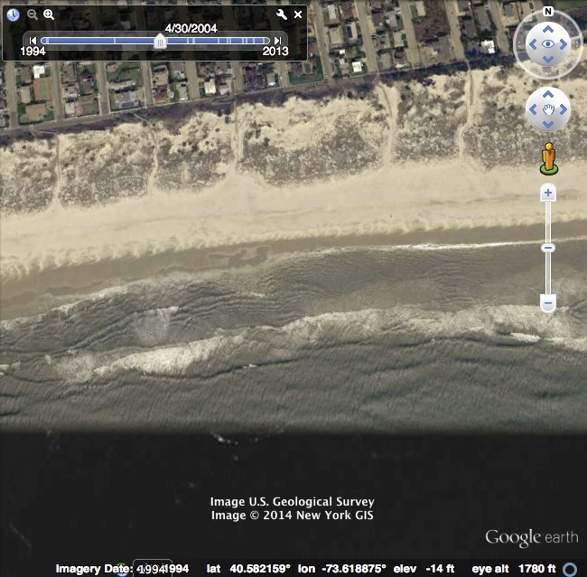
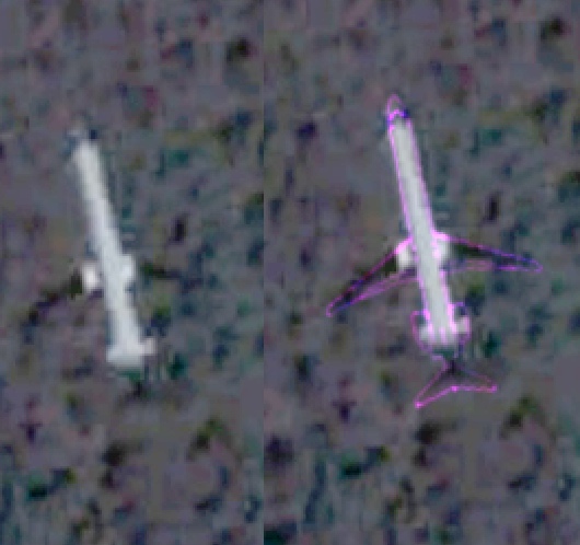
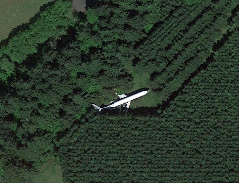
The rear fuselage tail viewed from the side of the backyard, at a glance. On both sides, the machine still holds the insignia of LAP (Paraguayan Airlines), once a symbol of national pride and aviation. Is a Boeing 707 that belonged to the state enterprise and no one knows how it got to this house in the neighborhood Villa Amelia San Lorenzo, a few blocks from the new shopping Pinedo. keepers place-a young couple-he said the owner is overseas and could not take pictures of the huge plane about 44 feet long, installed on your train original landing. The wings (almost 40 meter wingspan) held in place the two jet engines that heaven world ever plowed. Show, from any perspective, is stunning. According to aviation historian Tony Sapienza, the apparatus is in ownership "of one Aranda" and it would be the ZP-CCE, the first 707 of LAP, which was purchased, desguasado and reassembled in the yard where it is today. "Apparently, also bought some pieces of ZP-CCG to literally ride a plane from two parts.

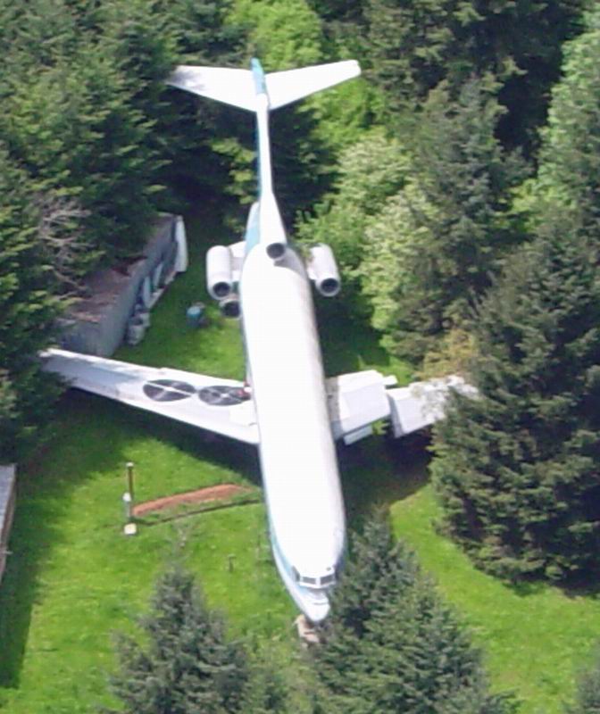
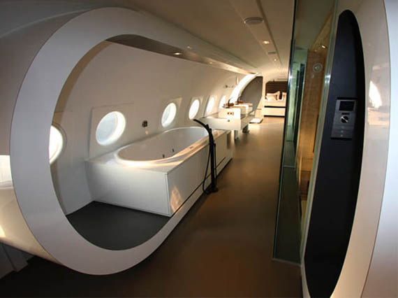
I was told that such Aranda is an eccentric millionaire who has its own military museum in his house and bought the pieces of the 707 to "arm" a bar for the "friends" he wrote in a forum of airline pilots. Parties heightThe data matches the version of one of the residents, who demanded anonymity-on parties that were held previously, inside the device which adds the empty weight 55,000 kilos. "On weekends listening music and many guests arrived to join the private party organized in the plane. A friend went to one of those party and said that the music was awesome inside, but outside barely hear, "the source added. Like a secret, in charge of the residence would not provide the name of the eccentric owner 707. The house sits on 26 February and the Laguna Grande Piribebuy fraction, about 6 blocks from Avenida Mariscal Lopez. A small sign of "Dead End Street" shows the destination have the curious, that never fail. In the past three years, the neighborhood was filled with construction of new residences, some downright elegant.

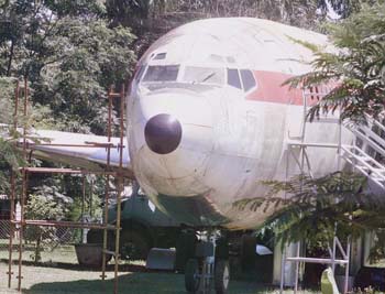
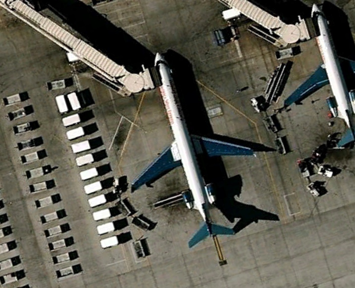
A European and U.S.
"That boeing 707 had capacity for 179 passengers and performed direct flights from Asuncion to Madrid, Frankfurt and Brussels, plus Miami in the United States and Lima, Santiago, Buenos Aires and other South American routes. I was his driver for several years, "said the commander meanwhile Aurelio Neon Aquino, Military Aviation Pilot Colonel (PAM). According to Aquino, who retired with 11,000 hours of flight, the plane had about 15 hours of flight range and was one of the jewels of LAP in full swing, "before privatization, which was negotiated" under the government of Juan Carlos Wasmosy. Sapienza Fracchia investigated the fate of the machine and found that the Boeing 707 was sold for scrap by the firm Lapsa (LAP privatized and converted into SA), between 1995 and 1996. B707 was one the first two jet LAP acquired in 1978 and began flying in early 1979. "It was built in 1965 or so," he said.
Content from External Source


Last edited:
Thanks guys, I guess I shouldn't have immediately thought it was a mistake with google maps...
This might sound like a stupid question, but how did this guy get the plane in his backyard to begin with. F Do they take it apart peice by peice and reassemble it in his backyard, or what?
 
There's a road right along the yard. It was probably brought in on a large truck with the wings detached and then reassembled. It's a pretty big job, but no different than having a large hot tub or custom aquarium trucked in.


As for the rest of the pictures, in order:
Plane in flight between the imaging plane and the ground
Plane in the overlap between two stitched images, wings are possibly lost in the same way the boat in the Loch Ness picture a couple months were
Plane over water, again made transparent by the image processing (almost exactly like the Nessie picture)
 
Plane over water, again made transparent by the image processing (almost exactly like the Nessie picture)

Yes, the key clue here being that it's next to a transition between two areas.


Google Maps images are made from multiple satellite images, and some areas are quite a patchwork. This particular image (on Long Beach, Long Island, New York) is from multiple years, at least five different images are combined in this one particular region.


This one:


Is not actually an overlay, I think. It's just a plane with dark wings and tail. Here's an MD-90 schematic overlaid.


Looked like it was coming from Phoenix, so I had a poke around the airport. These dark winged planes were there until around 2007. I don't recognize the airline. Terminal 4, B gates.


America West Express Canadair CRJ-900, N942LR


Last edited:
Yeah, you're definitely right on the wingless plane, now that I've seen what to look for I can find the wings in the original image as well.
 
This is why we do not leave imagery analysis to amateurs...it takes time to research and verify the subtle differences in imagery to determine what is and what is not. Its an investment that many fail to make and plus we get some outlandish claims/interpretations.
 
Here's a backyard plane in Oregon, similar kind of thing

http://airplanehome.com/

Are all of these backyard plane's decommissioned, and does anyone have an idea of what this would cost in US dollars? I mean it seems like a serious undertaking, especially this last backyard plane. There are no roads leading in or out of this location from the looks of it. Must be nice, if you're in to that sort of thing.
 
If you know the right people, you can get decomissioned aircraft in the condition you see up there in post 7 for basically their scrap value if they're not something collectors are after like military planes. Moving it can potentially cost more than buying it, and then of course the sky's the limit with customizing the interior to what you want.

With no roads, it gets more expensive to move them in, but really, if your landscaping plans involve a large aircraft you've probably got budget to spare. It could have been brought in in smaller parts, or by a more expensive service specializing in moving large things off road (an aircraft museum near me has this problem, and has sometimes used a company that normally moves logs and equipment for the woodcutting industry). That probably trashed their yard, but it looks like they landscaped around it anyway so I assume they planned for that.
 
Last edited:
They move them about the same way as they move houses and historical buildings. Nothing really special except of interesting hydraulics and planning. Just a normal heavy over-sized haul. Plenty of youtube videos of that. Plus that is how Airbus moves parts to the main assembly plant from the smaller plants. A lot of locals not happy about that.
 
Are all of these backyard plane's decommissioned, and does anyone have an idea of what this would cost in US dollars? I mean it seems like a serious undertaking, especially this last backyard plane. There are no roads leading in or out of this location from the looks of it. Must be nice, if you're in to that sort of thing.

$220K. According to this FAQ:
http://airplanehome.com/FAQs.html
 
We use a lot of open sourced imagery (google and others) in our helicopter simulation visual models. Anywhere from 1/4 inch resolution to >13 meters. With the higher resolution, we see "artifacts" that get caught in the image capture. There is a 767 in a ball field just west of Teterboro. Its black and white paint scheme make it look more like Shamu than the U.S. Airways plane it is. Probably caught flying into Newark.
 
Back
Top