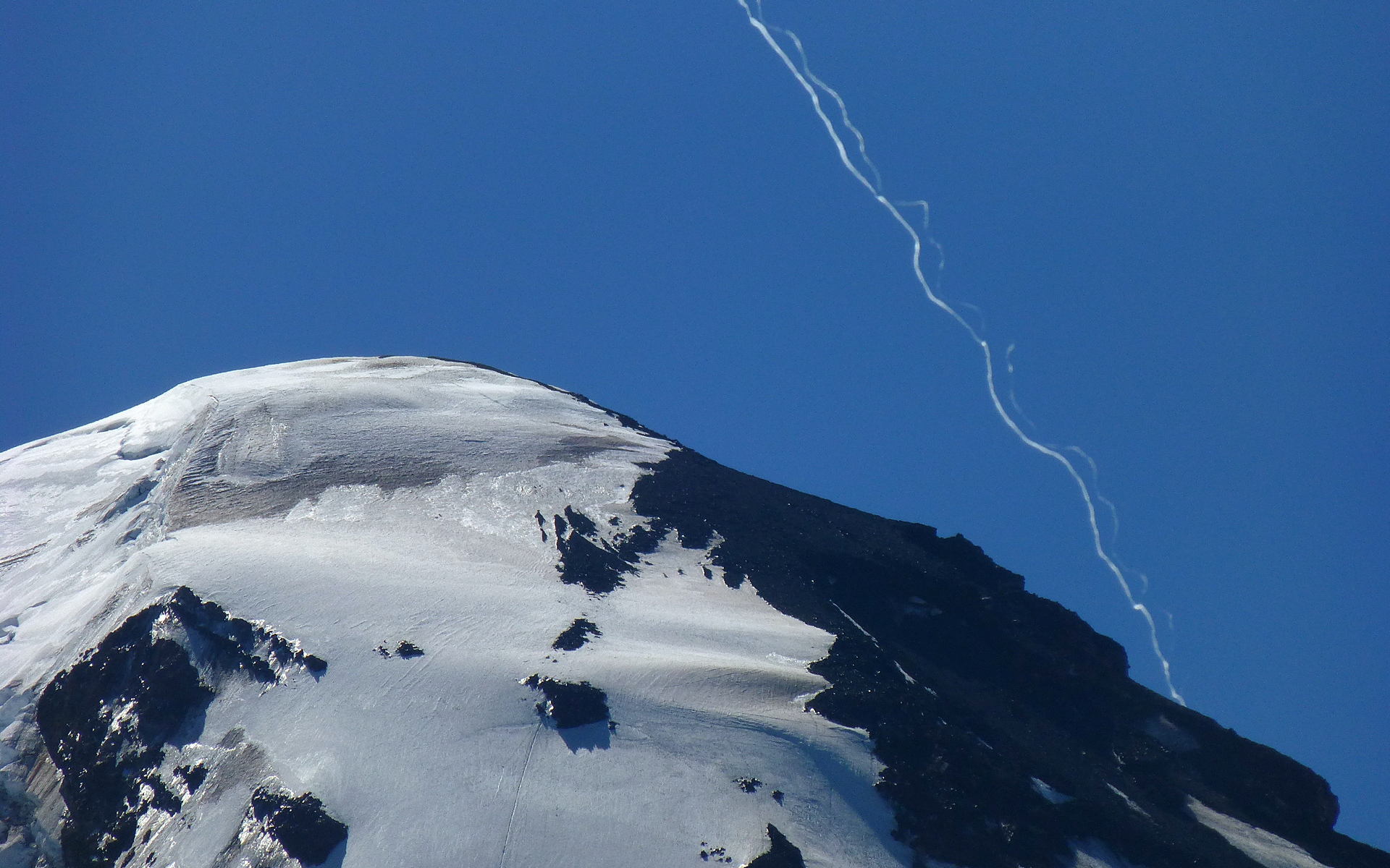
Update: See likely explanation here:
https://www.metabunk.org/threads/si...y-hybrid-contrails-the-rook-instability.4539/
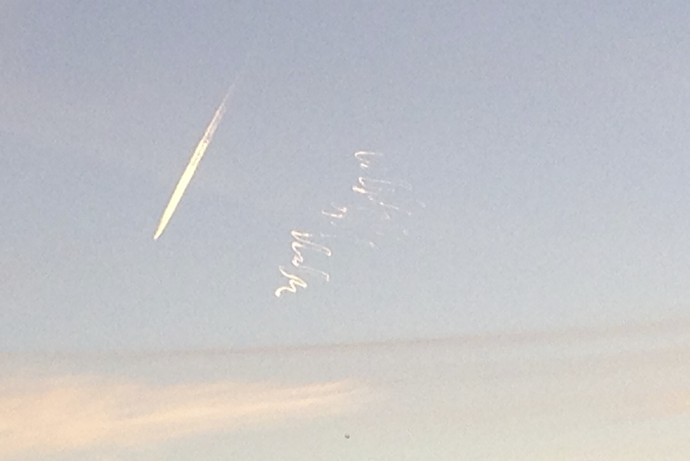
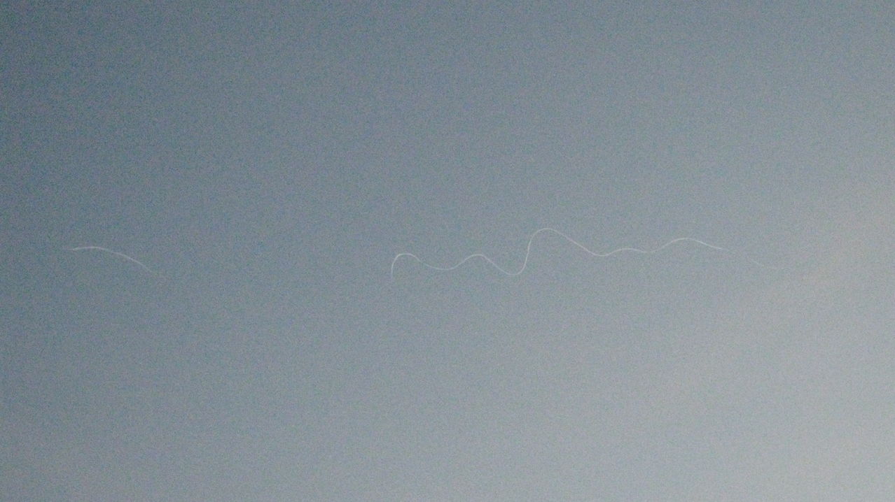
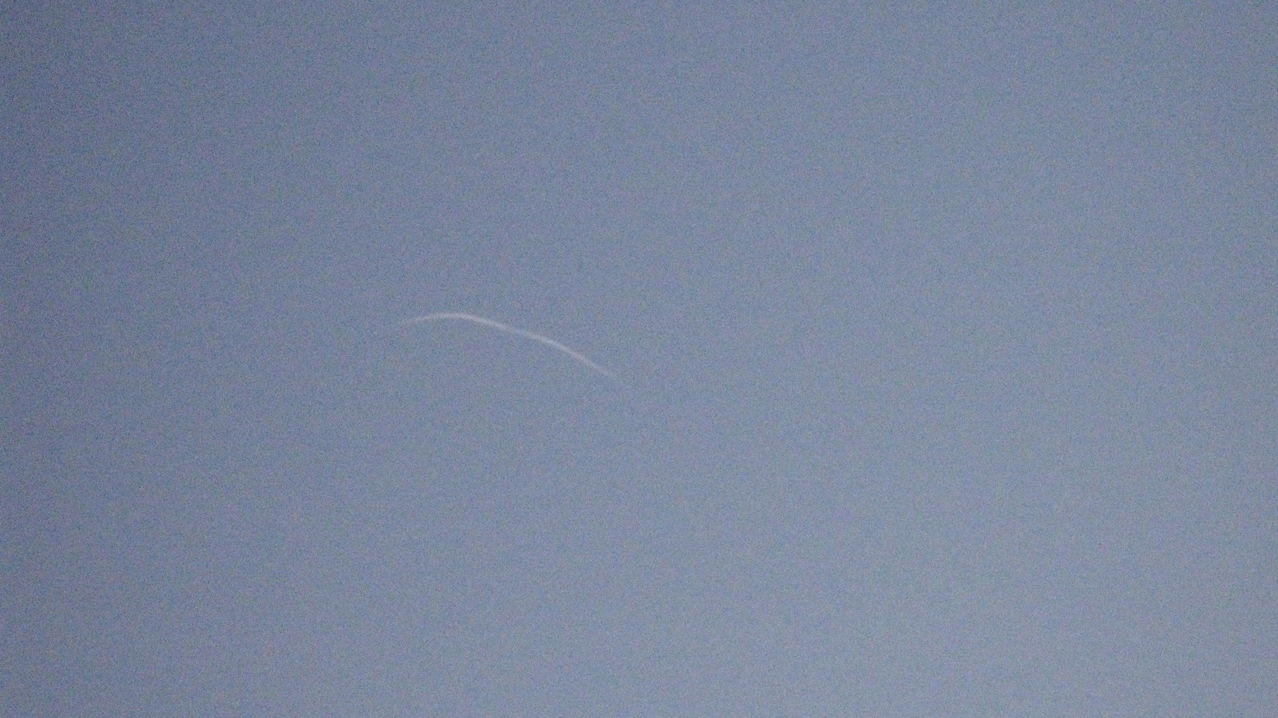
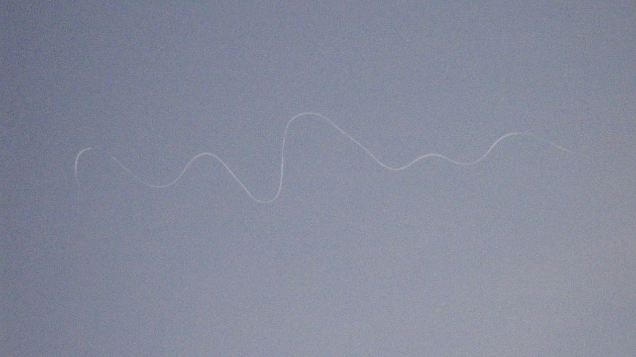
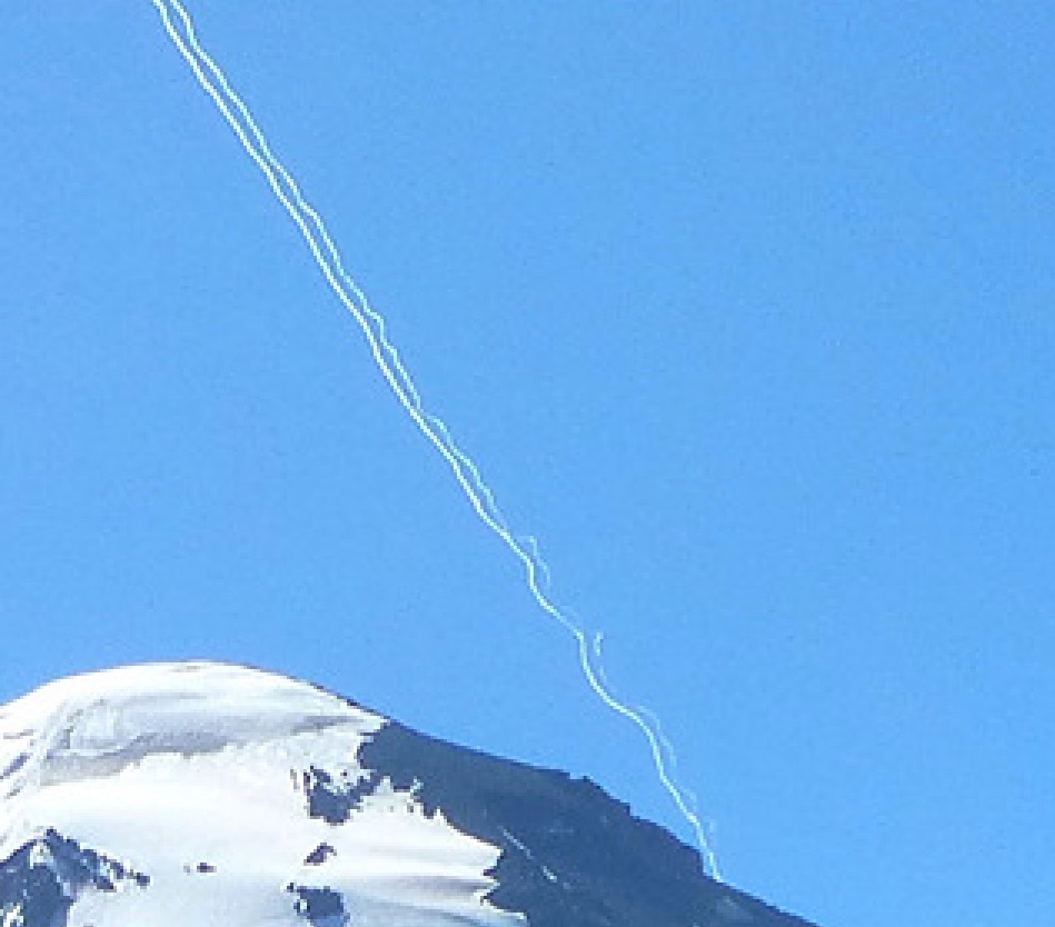
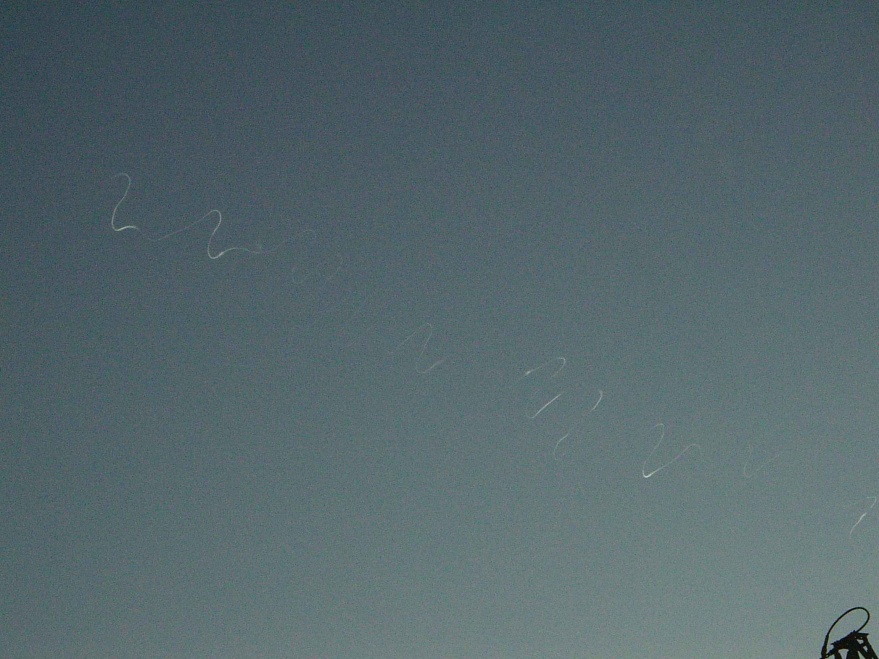
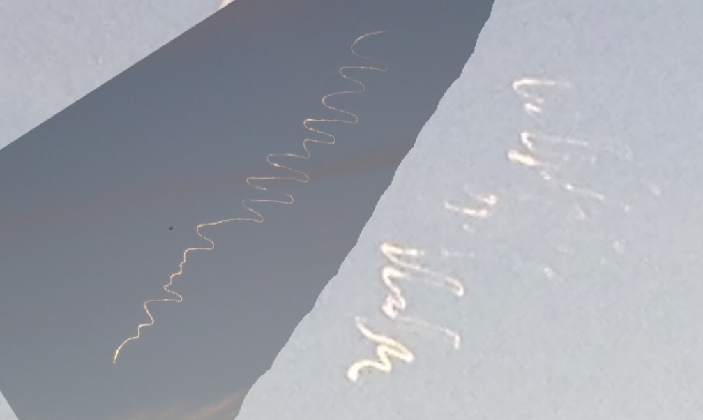
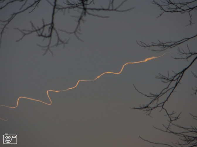
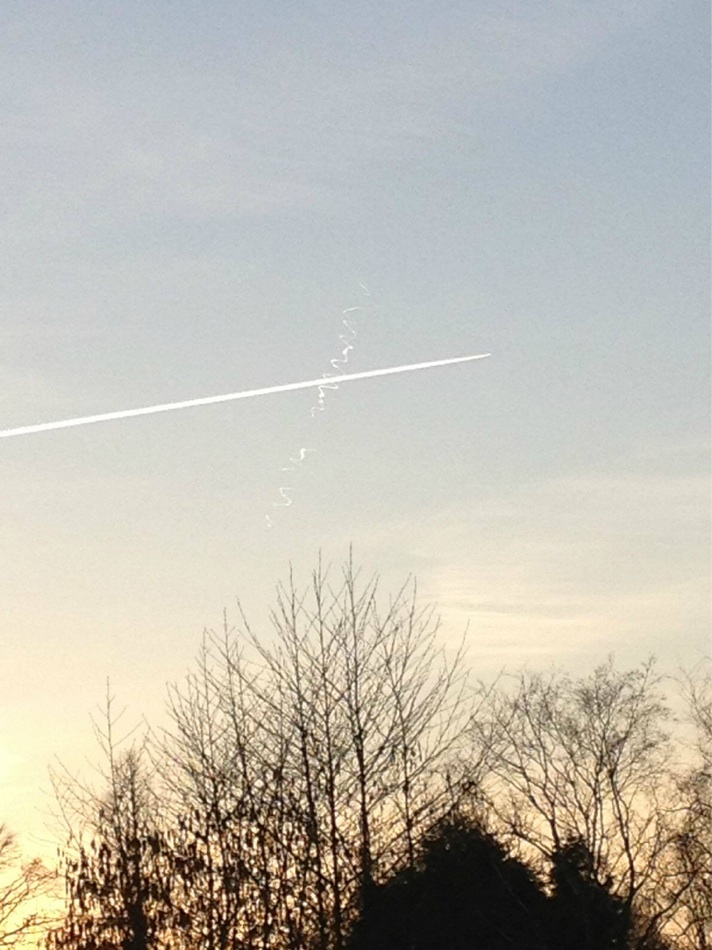
Photo: Christophe EECKHAUT, (c) CAELESTIA/Belgisch UFO-meldpunt
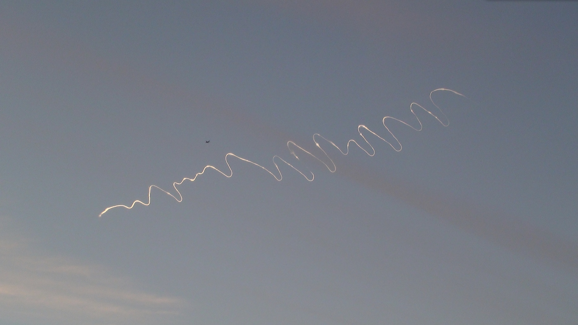
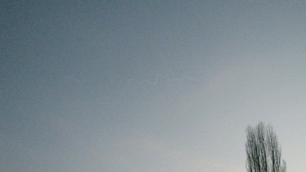
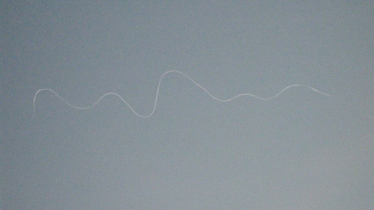
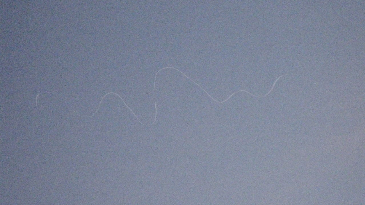
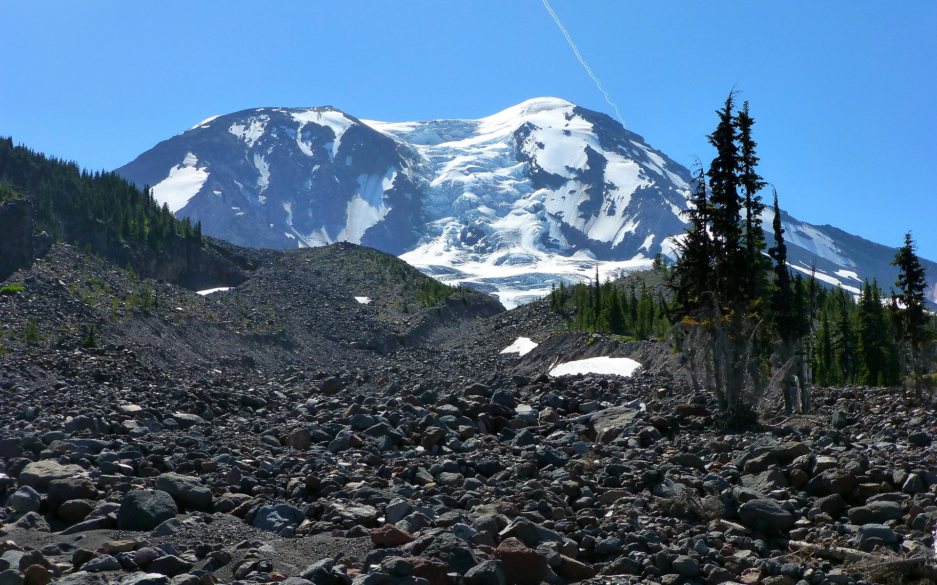
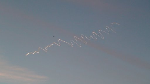
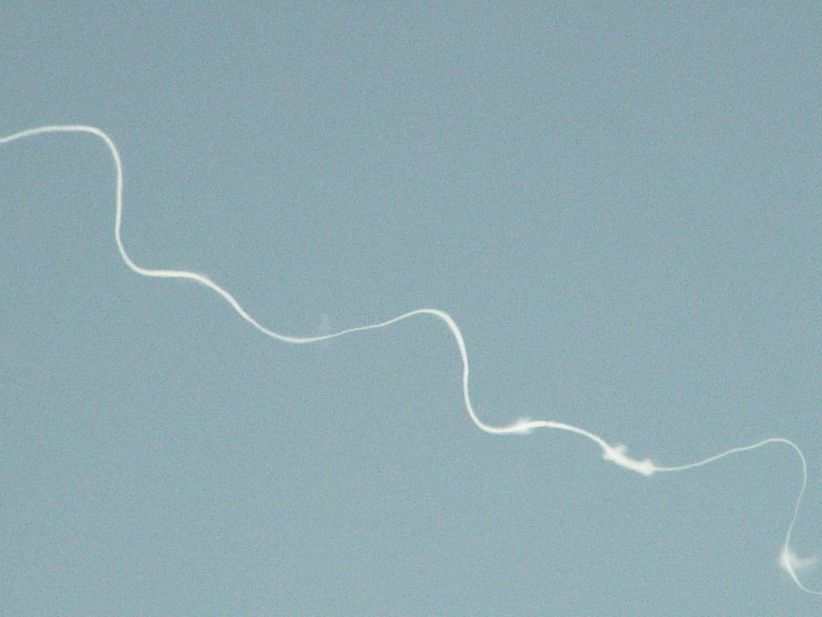
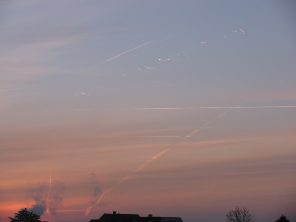
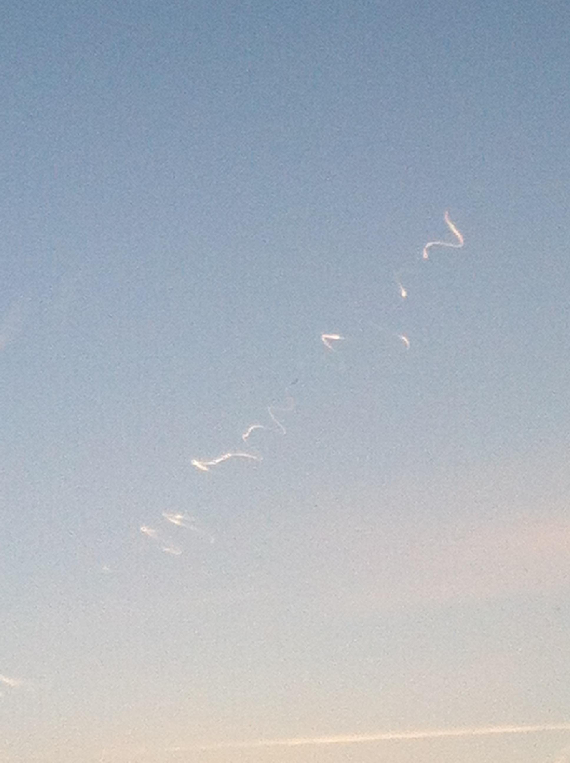
Photo: André DILDICK, (c) CAELESTIA/Belgisch UFO-meldpunt
Via email:
https://www.metabunk.org/threads/si...y-hybrid-contrails-the-rook-instability.4539/
Photo: Christophe EECKHAUT, (c) CAELESTIA/Belgisch UFO-meldpunt
Photo: André DILDICK, (c) CAELESTIA/Belgisch UFO-meldpunt
Via email:
External Quote:
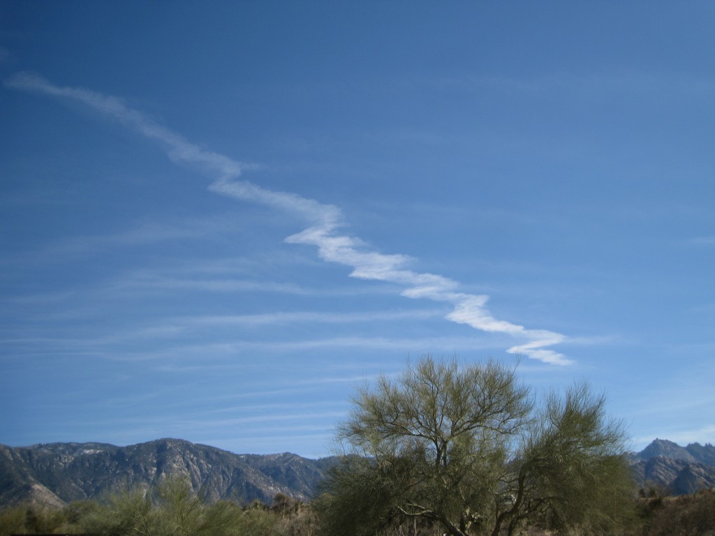
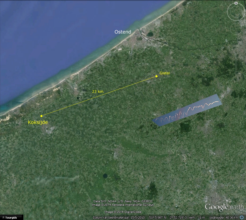
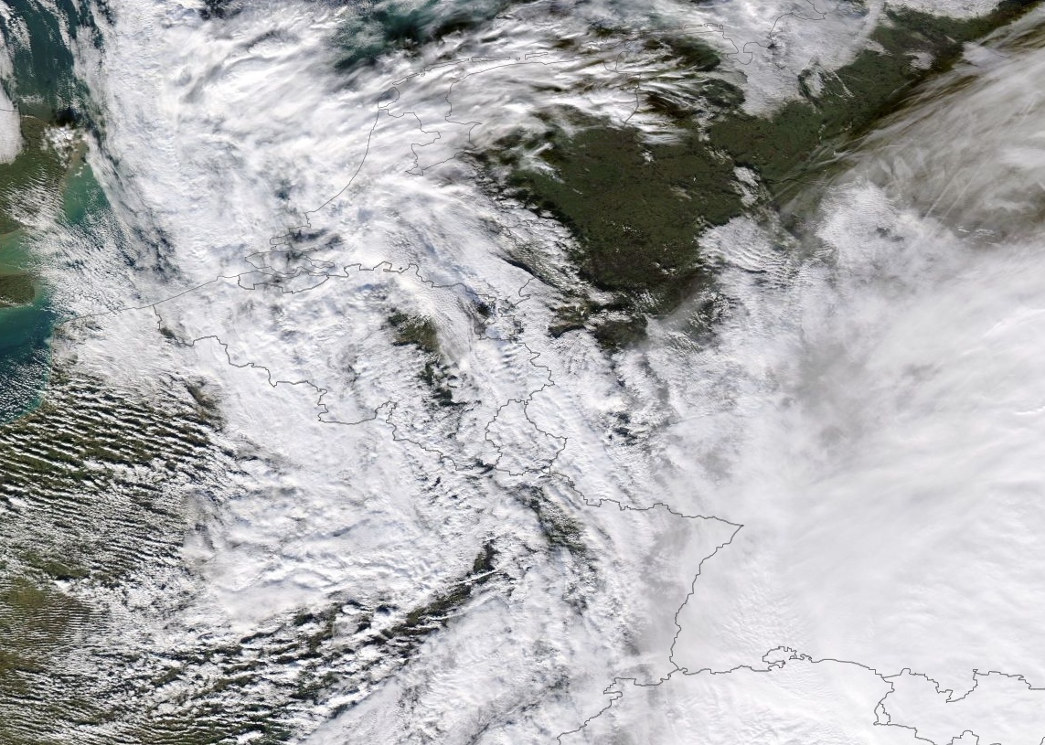
In the course of January and February the Belgisch UFO-meldpunt/Belgian UFO Reporting Centre (please note that this is a group dedicated to explaining mysteries, not promoting them) received two photographs of an unusual "contrail" (see attachments). Both pictures were shot in the morning of January 12, 2014. The first photo was taken by Christophe EECKHAUT with an Apple Iphone 5 while standing at the AF base of Koksijde, not far from the Belgian coast (see map). Time was 08:46:18 CET according to the photo's EXIF data. The photographer reports that he saw an airplane with a short contrail fly over the base when a second trail formed to the right of the plane. What surprised Mr. EECKHAUT and the five colleagues that were with him, was that this trail was not straight but appeared to be zigzagging ("It remained at the same level as the plane but rocked from one side to another. Suddenly the deformed trail stopped and nothing more was visible"). Both airplane and trail were moving East. The sighting lasted about 15 minutes.
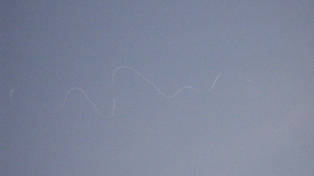
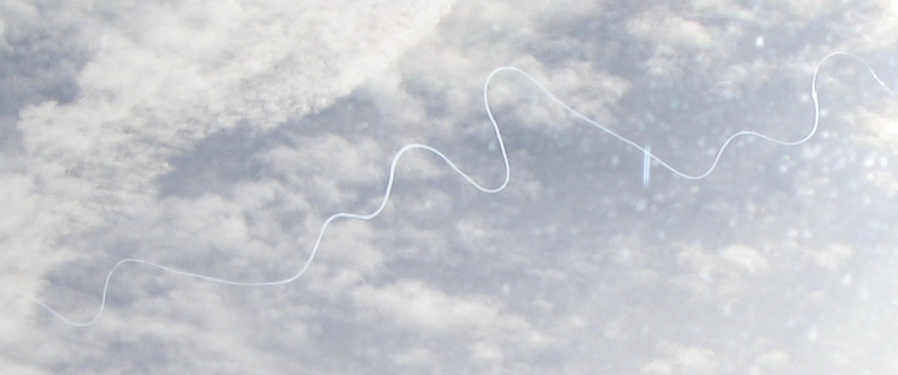
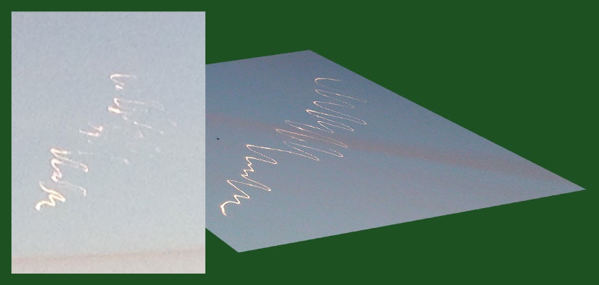
The second photo was taken 7 minutes later (at 08:53:24 to be precise) by André DILDICK from the community of Gistel, 23 km ENE of Koksijde. Mr. DILDICK observed the trail as it moved from the S to the SE. Here too, the duration was estimated at circa 15 minutes. Captured with a Sony HDR-SR11E, this picture is of much better quality. A quick examination of the trail's wave pattern reveals that it's identical in both shots.
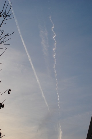
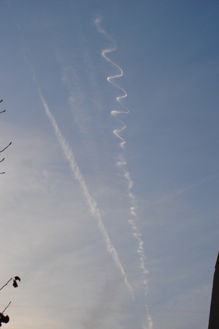
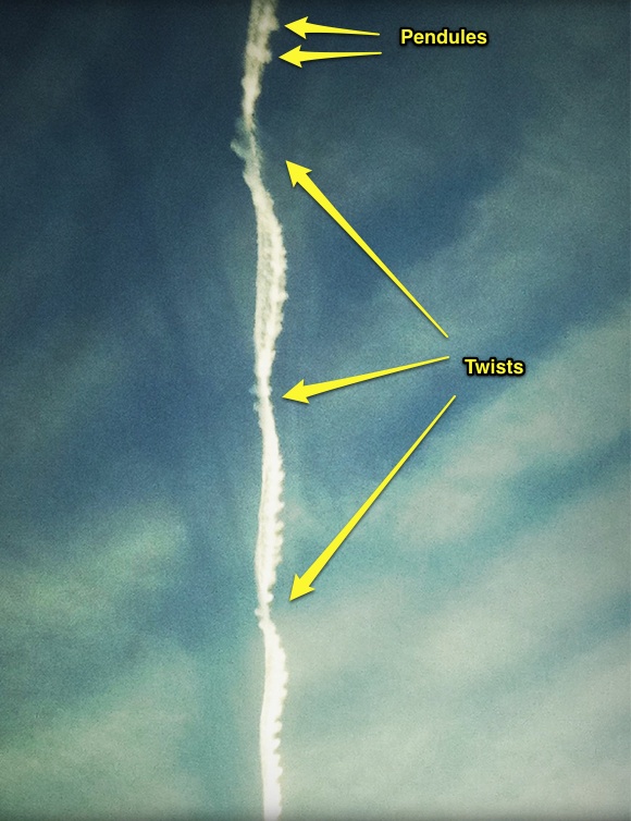
We wonder how this solitary trail may have formed. A "hybrid contrail" is not a good option, I think. If that were the case, we should be looking at two distinct trails with the typical chromosome pattern. Sky writing seems unlikely too because of the smooth and capricious aspect of the trail. Moreover, similar (illegible) trails were photographed over Malderen, Belgium on March 3, 2002 (personal files, photo on request), and over The Netherlands on February 18, 2013 (see https://www.nufoto.nl/fotos/329227/condenssporen-boven-den-haag.html, and http://www.ufomeldpunt.nl/melding/2201-sporen-in-de-lucht), and again on March 4, 2013 (http://www.ufomeldpunt.nl/melding/2313-vliegtuigspoor-met-daarachter-witte-lijnen-letters). Oddly, I found no examples from places outside the Low Countries.
As a regular visitor to your excellent sites, I was wondering if you have any idea how these unusual trails may have formed?
External Quote:
It should also be emphasized that both photographers indicated that they heard no sound. That would not only rule out a helicopter ejecting smoke or flares, but also a jet and a small plane.
So if I'm not mistaken we envisaged five possibilities already:
- normal contrail (to be ruled out because too smooth and wavery and only one trail instead of two);
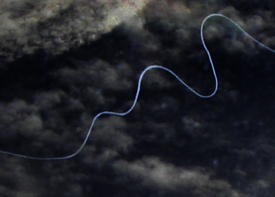
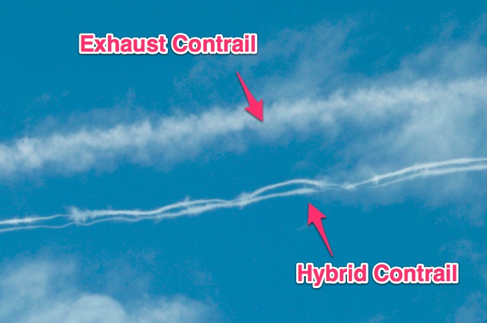
- hybrid contrail (not entirely impossible since the photo taken at Koksijde AFB shows an airliner with a short contrail flying parallel to the unidentified trail, whilst the photo from Gistel shows what looks like a smaller airplane with no contrail just "above" the trail, but here too only one trail);
- sky writing (too smooth in appearance and there's no readable message);
- pyrotechnic flare deployed by a military plane or helicopter (such flares are usuallly short-lived and leave a smoke trail, not a vortex-like trail like the one in the pictures);
- relatively small, malfunctioning rocket (best option perhaps)
Could it be a fluid that was dumped by a plane? If so, it must be something quite exceptional considering that such trails are extremely rare.
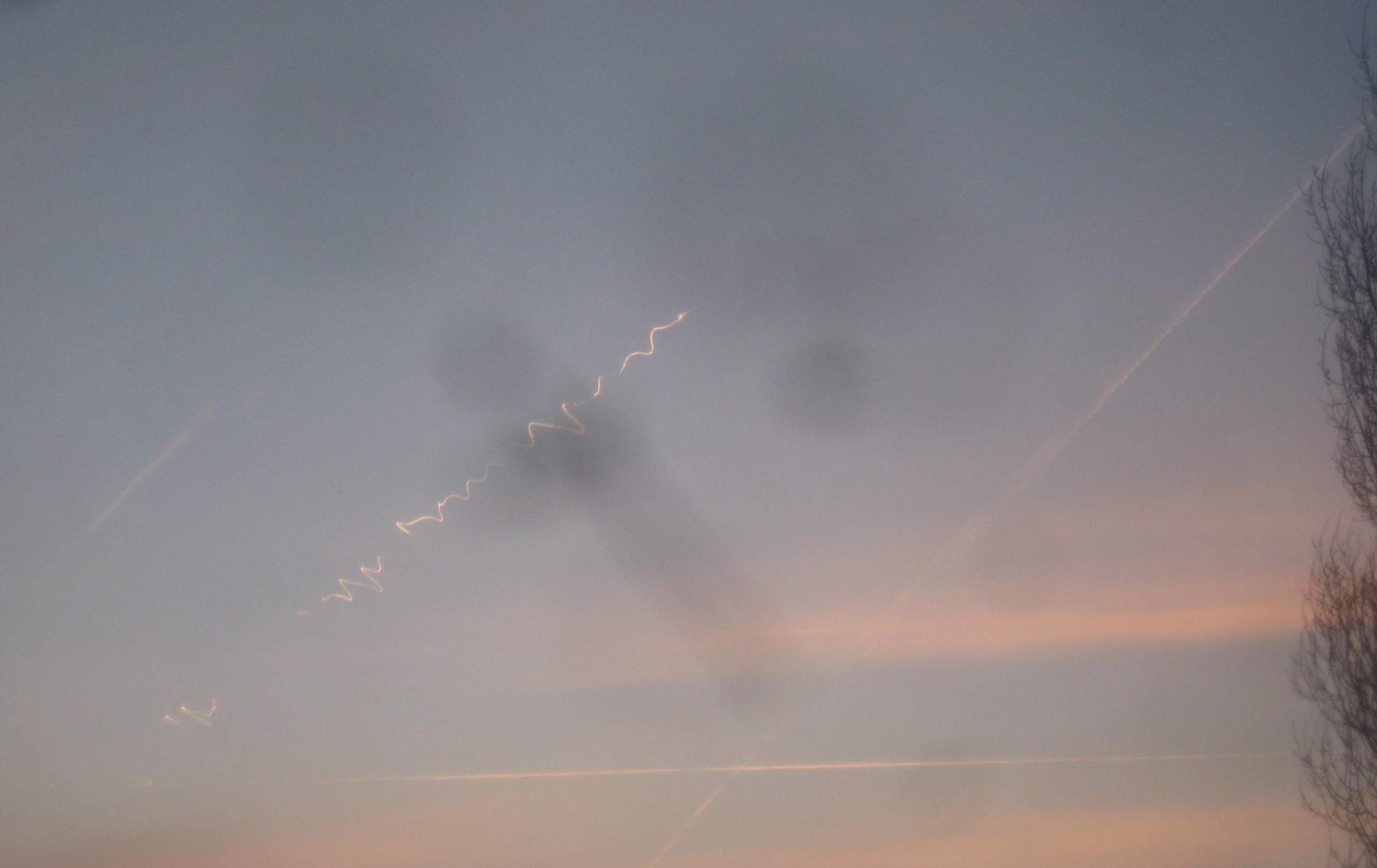
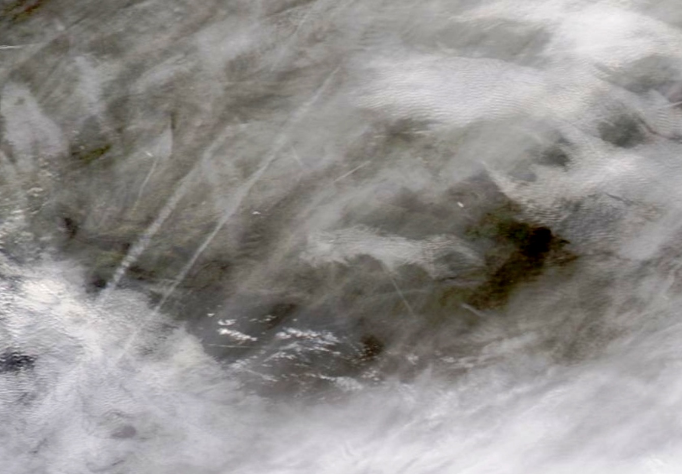
Note also that on the photo taken from Koksijde there's an unusual object in the bottom centre of the picture. According to the photographer this object also appears in a second picture he took of the phenomenon. As a matter of fact, it now turns out that this AFB employee took not one but three photos. I haven't received the other two yet, but I will forward them to you as soon as I get them myself.
For what it's worth, these are the ground weather data from the meteorological station at Bruges, Sint-Andries (15.3 km ENE of Gistel) between 8:50 p.m. and 8:53 p.m. CET:
Temp.: -0.9°C
Dewpoint: -2.2°C
Pressure: 1023.6hPa
Wind direction: SSE
Wind speed: 1.3 km/h
Humidity: 91%
Balloon soundings are not available, alas.
Wim VAN UTRECHT
www.caelestia.be
Attachments


Last edited:
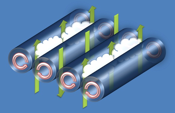
 It illustrates reflective highs and why they're seemingly at random points
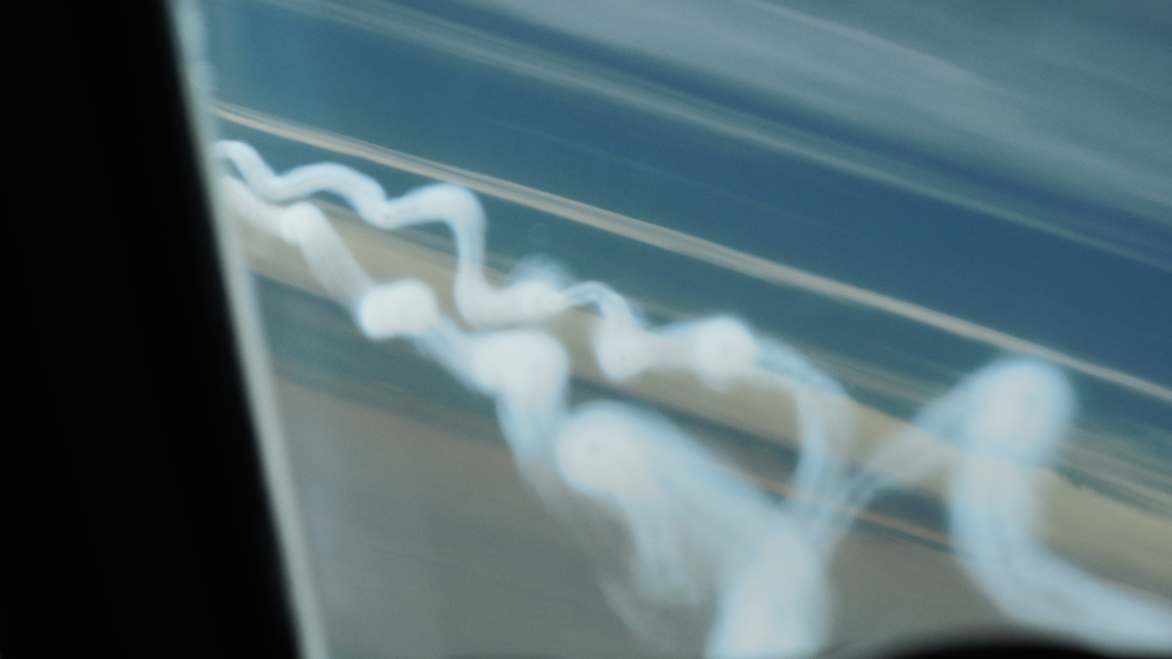
")