I edited it to inline the second image, sorry if that conflicted with an edit you made.Sorry my text seems to have disappeared.
Do you happen to have any other photos of the trail, even if they look pretty similar, it might help see how it evolves.

I edited it to inline the second image, sorry if that conflicted with an edit you made.Sorry my text seems to have disappeared.
I have an image of one of these from 2006 which I observed about an hour after the Transit of Mercury - images here http://www.johnmurrell.org.uk/Transit of Mercury Turbulence V2/index.html near the bottom of the page. The other images show a 'clear air' version of something similar crossing the Sun about an hour earlier. You can see the refraction of the sunlight and the distortion caused by the 'turbulance'. There is an animated gif linked to this page or else just step through the individual images.
John Murrell
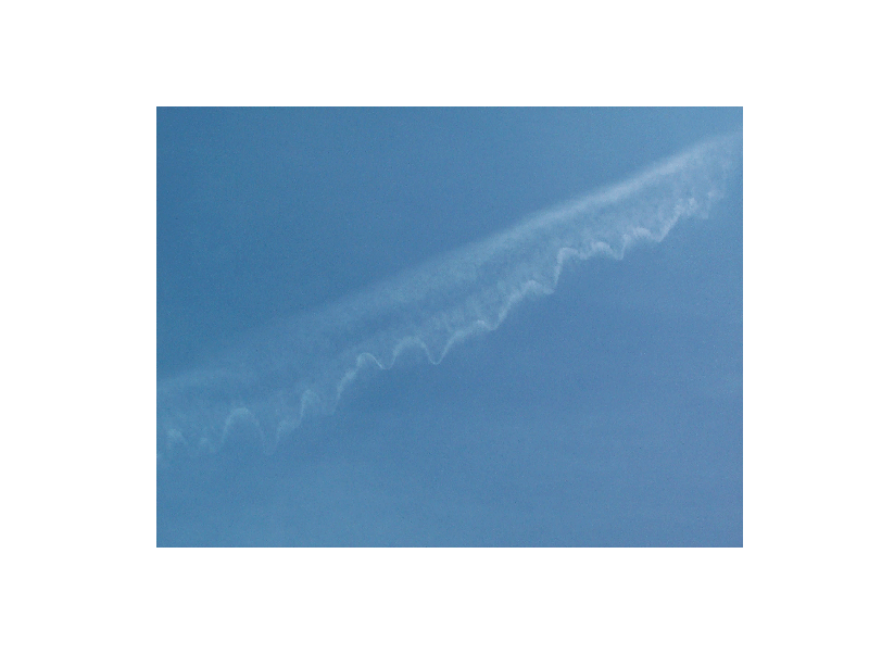
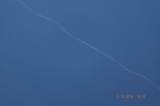
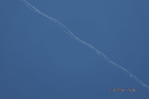
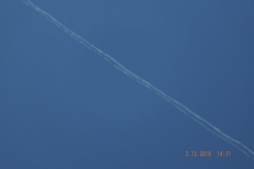
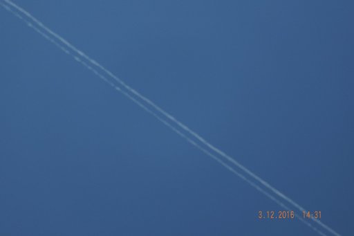
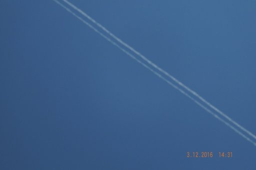
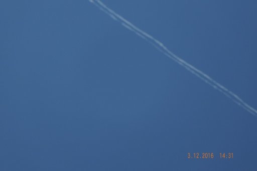
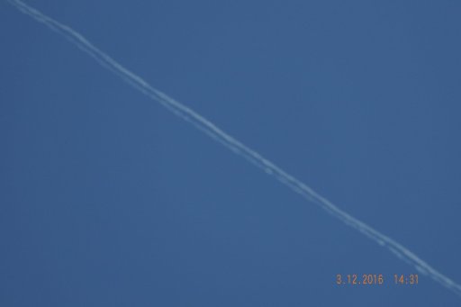
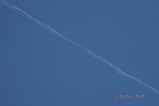
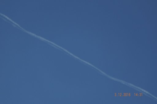
The photo was taken on Sunday 12th at approx 10:20 BST and facing South. The photo was taken from 51.5782°N, 1.1343°W I stopped the FR24 plot over the location.
How do I post the EXIF data? The time/date on the picture will be incorrect as I saw the trail, rushed inside to get the camera and then put the batteries in. I didn't set the time/date.
.............
Focal Length
21.6 mm
.............
No sorry that is the only picture.I edited it to inline the second image, sorry if that conflicted with an edit you made.
Do you happen to have any other photos of the trail, even if they look pretty similar, it might help see how it evolves.
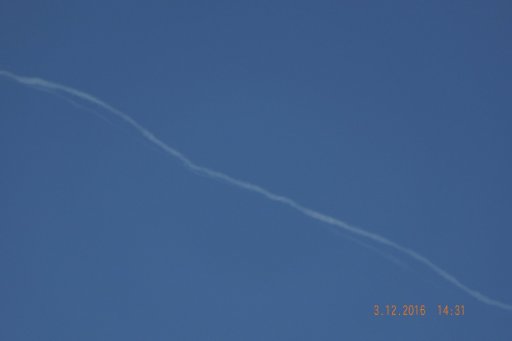
It was definitely KLM751 as that was the direction the trail went, West to East. The trail was almost overhead but definitely to the South of my location.Thank you for the info. I'd like to check a few details that could help to verify your identification of the plane.
Time: was it BST or GMT? The FR24 playback figure suggests 10:17 UTC (i.e., GMT), which is 11:17 BST
Trail: was it to south of you or right above you? KLM751 B777 passed slightly to the North of your coordinates, whereas AFR66 A380 passed to the South of you at about the same time.
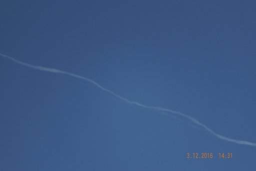
I was interested in the Focal length, as it gives the Field (angle) of view of the photo. It would help in the estimation of geometrical parameters of the sinusoidal trail. As I can see from your camera specs, you have selected a focal distance in the middle of the camera zoom range. Is it correct?
 It is aired from 10:00 to 11:15 BST
Thank you again. This is an interesting and very rare phenomenon that is not fully understood. There are a few dozens of recorded cases compiled in another thread:It was definitely KLM751 as that was the direction the trail went, West to East. The trail was almost overhead but definitely to the South of my location.
Timing may be off. It may have been closer to 11:00 BST. I took the photo and went back in the house to show my wife who was listening to the Archers (if you are not in the UK that is a Radio 4 soap). She told me off for disturbing her
The telephoto would have been set about 100mm.
If I'd known how much interest you guys have shown in this, I would have taken more notice - sorry.
It was definitely KLM751 as that was the direction the trail went, West to East. The trail was almost overhead but definitely to the South of my location.
Timing may be off. It may have been closer to 11:00 BST. I took the photo and went back in the house to show my wife who was listening to the Archers (if you are not in the UK that is a Radio 4 soap). She told me off for disturbing her
The telephoto would have been set about 100mm.

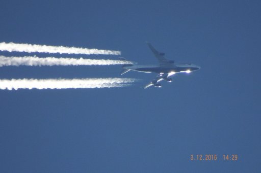
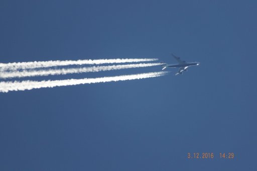
Could you change permission to view this album, it is not accessible to public. The sample image seems to be a typical illustration of the Crow instability in a pair of trailing vortices with entrained contrails. Commonly, the vortices will cancel each other, but in extremely rare cases, one vortex may outlive the other and produce a solitary thin contrail.I have found another sequence of 4 images showing a twisted con trail from 2008 - in this case only one of the two trails is twisted.
Copies of the images are at https://plus.google.com/photos/114549598170254438527/albums/6138655261859848513 which should have the EXIF data still attached.
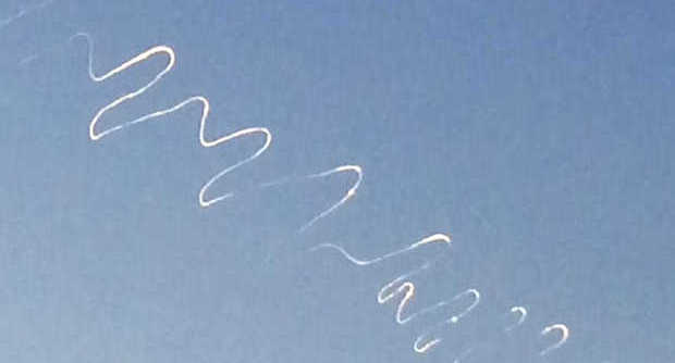
Small sample below
View attachment 12337
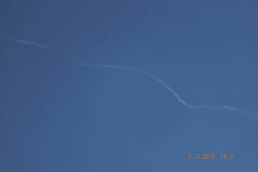
The change was quite rapid as can be seen from the exif times. Times should be in UTC.
John
Thanks. Regrettably, this is just a typical example of the Crow instability.Album images now shared !
Timing may be off. It may have been closer to 11:00 BST. I took the photo and went back in the house to show my wife who was listening to the Archers (if you are not in the UK that is a Radio 4 soap). She told me off for disturbing her
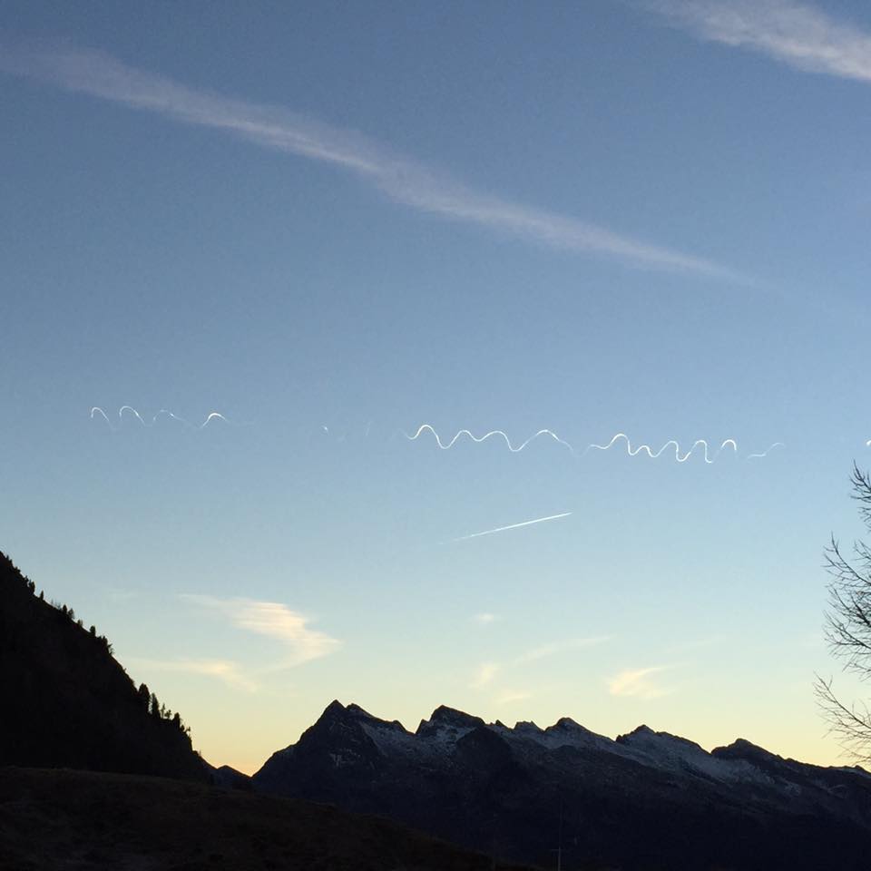
There is a follow-up thread with more examples of these trails:Saw this phenomenon on the 25th of December (15 UTC) here in Austria/Styria and found this forum by researching it - unfortunately I only have photos at this stage:
View attachment 16831 View attachment 16832
It is not about A380 as such, as the first records of sinusoidal thin trails predate it. It is about wake vortices that are stronger behind heavier planes. They last longer and therefore are more likely to be decoupled in the presence of aligned atmospheric vorticity (see post #30 in the previous page). If this theory is correct, we can expect more observations of this phenomenon since the introduction of A380.it does seem that there is something about the A380 that creates these patterns
I do not think so. This is how an ordinary two-strand hybrid trail usually looks at this range of viewing angles. I always keep eye on the hybrid trails, hoping to see a "squiggly" solitary trail, but alas…It looked like this 747 trail was trying to develop into a "squiggly" one this morning but it didn't persist long enough. Hard to see on a phone photo (contrast enhanced)
View attachment 17557

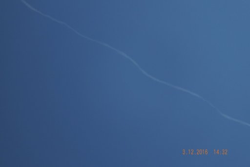
You could be right. It was quite distant (28 miles when I took that photo) so I couldn't really see it in detail. But I haven't noticed one go into quite such an obvious sine wave shape before.I do not think so. This is how an ordinary two-strand hybrid trail usually looks at this range of viewing angles. I always keep eye on the hybrid trails, hoping to see a "squiggly" solitary trail, but alas…
Yes, @TEEJ has already posted the link in the sister thread:More squiggly trails over Germany a few days ago: http://www.nordbayern.de/region/nue...ensstreifen-am-himmel-uber-nurnberg-1.5148303
The time of the photo from Exif (Date Time Digitized: 21 Apr 2016 13:42:37 CEST) corroborates the identification of the flight as Qantas A380 QFA9. See the post from the sister thread:
Probably it was a right one, as the contrail came from a heavy plane (Boeing 747). Actually, it looks similar to the 747 trail I reported in the sister thread:Possibly the wrong sort of squiggle, but it was trying. One has more..View attachment 23212 View attachment 23213

Quite a few, showing the four trails evolving into one. . However.. it evaporated without making a big squiggle. Good evidence for something that did not really happen, but might have! I went back up the trail towards the plane, and then back down to the end, in sequence (by file name).Probably it was a right one, as the contrail came from a heavy plane (Boeing 747). Actually, it looks similar to the 747 trail I reported in the sister thread:
https://www.metabunk.org/sinusoidal...rails-the-rook-instability.t4539/#post-178568
Have you taken more photos of it?
Which direction were you facing here? It would help with identifying the flight.Observed this trail above Ghent, Belgium, 27th of March 2017, 8:15 AM
View attachment 26058