It had to be going significantly faster for a majority of the flight, or range could not have been reduced so dramatically. I understand airline pilots are on this thread: I invite them to estimate average speed increase over the entire flight's duration required to knock 800 knots of range off of what was originally estimated to be a 3,500 knot flight (23% reduction in range).
Minor point for clarity: "knot" is a unit of speed (nautical miles per hour), not distance. A nautical mile is abbreviated "nmi".
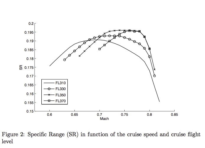
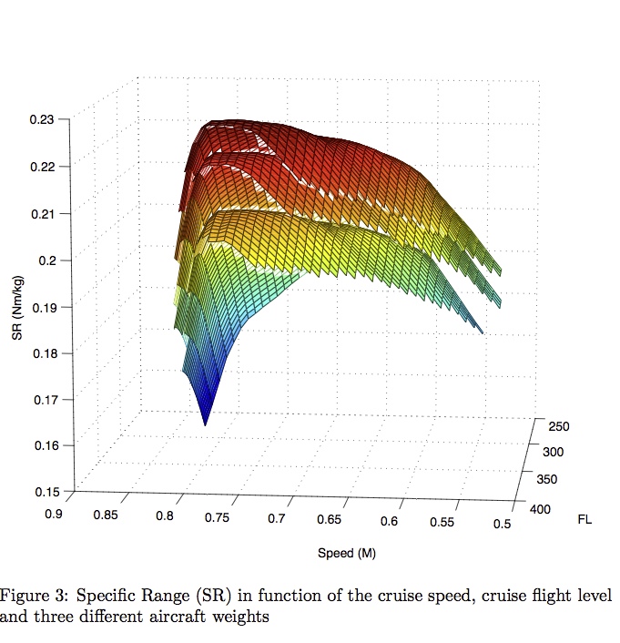
Fuel consumption rate at full thrust is more than double fuel consumption at cruise. It's not like you can just give 10% more thrust and go 10% faster.
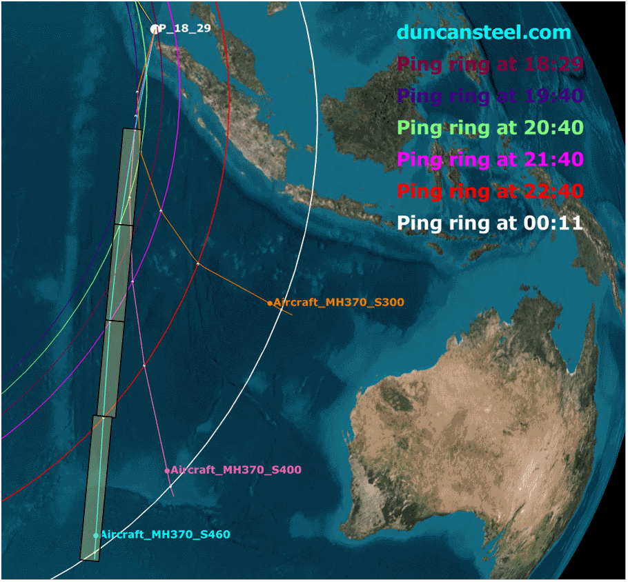
Basically they calculated the maximum range of the plane based on the observed speed for the known segments, the wind speeds, and everything else they knew about the plane, and then found the intersection of that range and the last ping. But it's all just probabilistic - they have identified a likely crash site, but have not proven it to be the crash site - they have to make some reasonable guesses.
Your analysis is very simplistic. Your "assumed speed" is a specious assumption.