Very interesting patterns here:
http://earthobservatory.nasa.gov/IOTD/view.php?id=78154
That's Terra, the Aqua image is later:
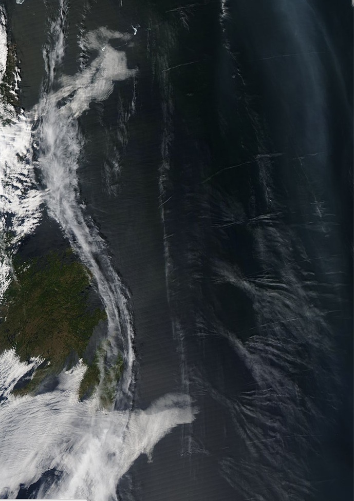
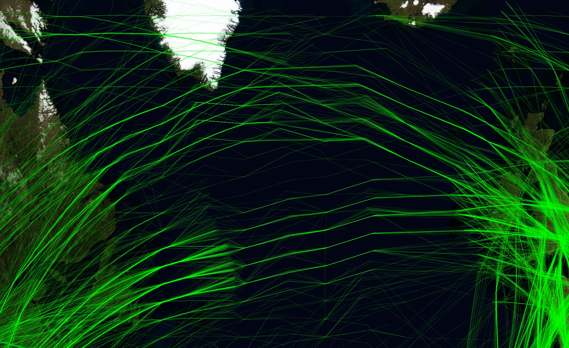
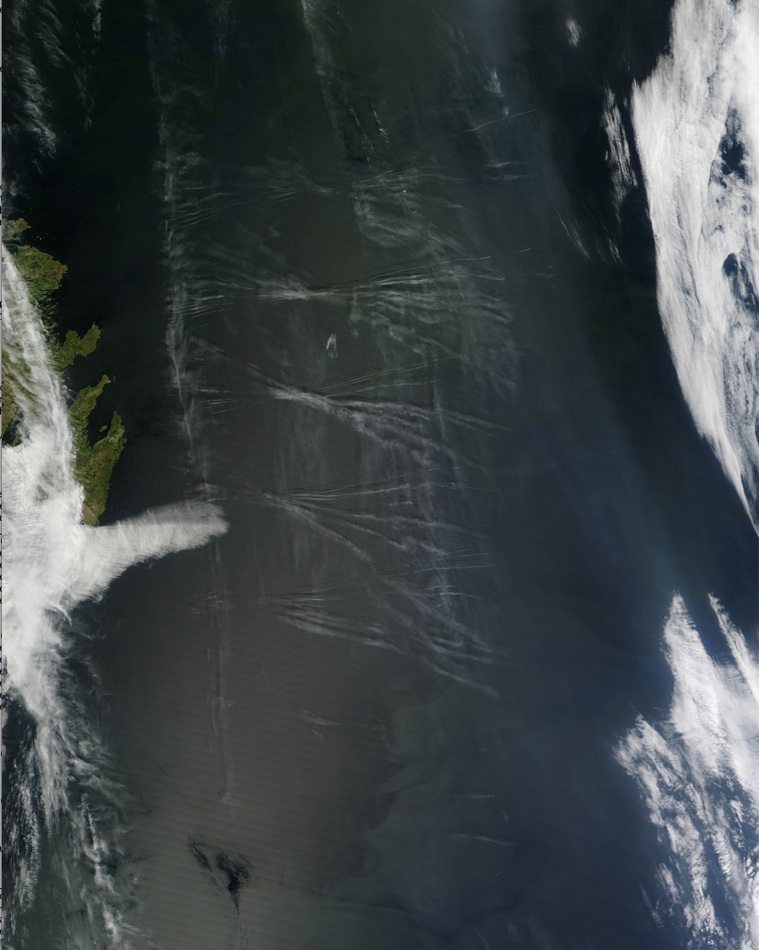
The contrail segments are 200 miles long, and the centers ar about 70 mile apart.
It's not obvious how this pattern could have occurred.
Originals:
http://lance-modis.eosdis.nasa.gov/imagery/subsets/?project=&subset=Newfoundland&date=05/26/2012
http://earthobservatory.nasa.gov/IOTD/view.php?id=78154
That's Terra, the Aqua image is later:
The contrail segments are 200 miles long, and the centers ar about 70 mile apart.
It's not obvious how this pattern could have occurred.
Originals:
http://lance-modis.eosdis.nasa.gov/imagery/subsets/?project=&subset=Newfoundland&date=05/26/2012
Last edited: