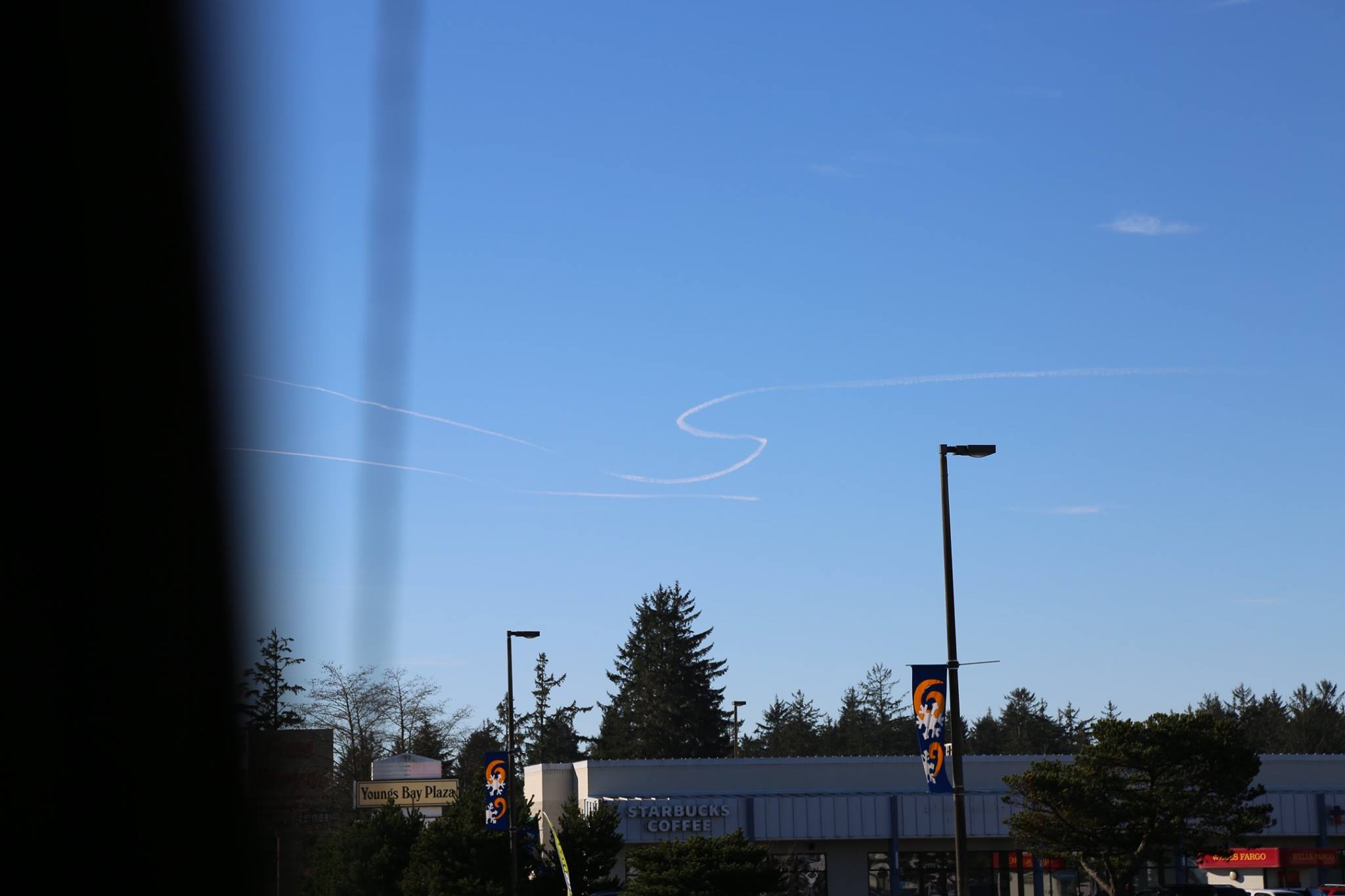
Taken a 2:26PM PST (22:26 UTC) yesterday, Jan 13th, from the 101 in Warrenton, OR, by Matt Crowley. Looking roughly Southwest. Here: https://www.google.com/maps/@46.161...ata=!3m4!1e1!3m2!1srg7SSnYz8sT-tZdOQXCBWA!2e0
A plausible candidate is this Gulfstream, flying a rather odd pattern, taking off from Seattle Boeing Field, flying around a bit and then returning. It's at 38,000 feet, which is quite reasonable for contrails.
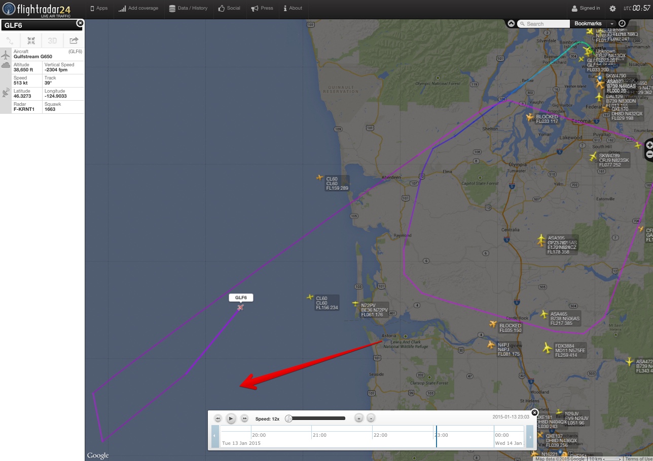
While the track does not seem to have any S-shapes in it, it is very low resolution, with points about 10 miles apart, so it's plausible that this was a training flight, and the pilot did an S-turn in-between points.
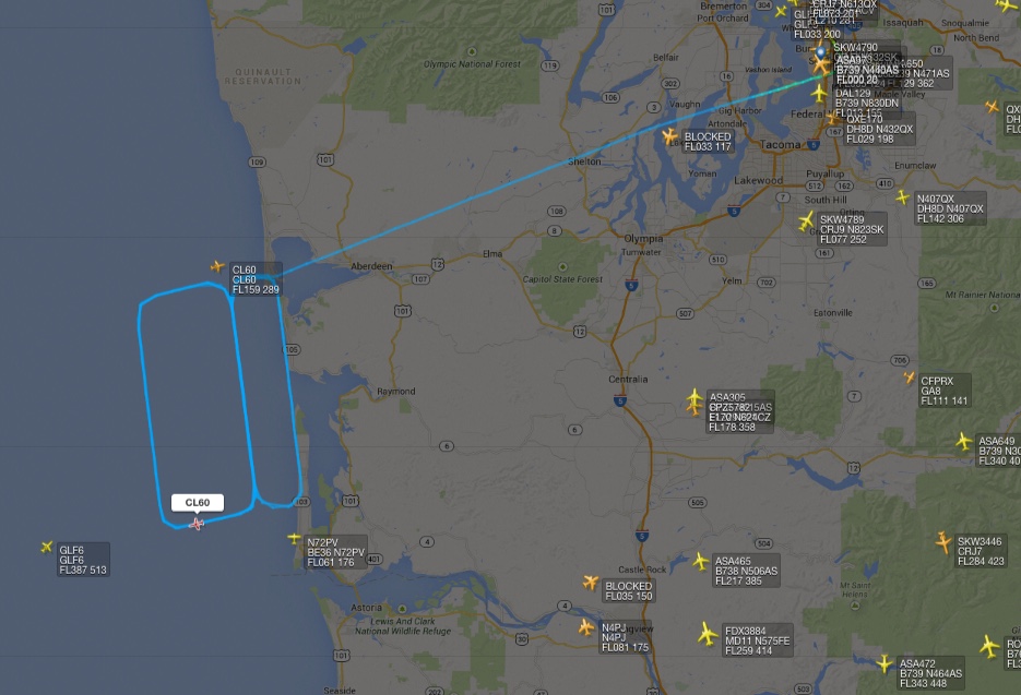
While looking at this, I found another interesting flight from the same field, BOE4BA, a CL600S Challenger, flying an interesting pattern. However this seems too far North.
Attachments
Last edited: