Mick West's latest activity
-
 Mick West reacted to maxim.zavads's post in the thread Moving lights in Siwa sky (Egypt), for more than a year, almost everyday with
 Like.
Ok finally I managed to put it all together in this Sitrec demo . Unfortunately it is a poor quality video from my Samsung A35 camera, and i still didn't get hands on the good footage. Anyway, looks like a match with starlink flares...
Like.
Ok finally I managed to put it all together in this Sitrec demo . Unfortunately it is a poor quality video from my Samsung A35 camera, and i still didn't get hands on the good footage. Anyway, looks like a match with starlink flares... -
Mick West reacted to Giddierone's post in the thread DOW-UAP-PR090, 24 August 2020, Centcom, released 22 May 2026 with Like.
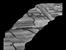
Things that say Egypt to me are: - Canals, of three different sizes - white patches in the fields (grain?) . - efficient looking rectangular grids like this with shrubbery... Then odd triangles like this with parallelogram-shaped fields next...
-
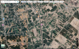
Mick West replied to the thread DOW-UAP-PR090, 24 August 2020, Centcom, released 22 May 2026.But also like Iraq in the Euphrates valley. Or even Iran. Pretty large search area. https://www.google.com/maps/@32.2932123,44.3654123,3114m/data=!3m1!1e3?entry=ttu&g_ep=EgoyMDI2MDYwMS4wIKXMDSoASAFQAw%3D%3D
-
-
Mick West replied to the thread DOW-UAP-PR067 Multiple Spherical UAP USO near Sub.I think the directives to report are specific to the AF or Navy (or other agencies), and don't mean the observer will report directly to AARO. The Navy in particular established new guidelines in 2019...
-
Mick West replied to the thread DOW-UAP-PR067 Multiple Spherical UAP USO near Sub.I think some of them are even more mundane than that. There's been a new directive to report UAP. So people have been reporting them, even when they don't think there's anything special. I think Tim Phillips said that some pilots had reported...
-
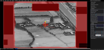
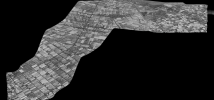
Mick West replied to the thread DOW-UAP-PR090, 24 August 2020, Centcom, released 22 May 2026.Somewhat new, it's just a bit flaky. You have to mask out the boxes and the border, then it analyzes it and tries to make a panorama based on motion analysis. e.g https://www.metabunk.org/sitrec/?custom=1/PR090 Pano/20260605_083827.js
-
-
Mick West replied to the thread DOW-UAP-PR090, 24 August 2020, Centcom, released 22 May 2026.Merged the Geolocation post here. And this was a good candidate for Sitrec's Panorama extraction
-
-
Mick West replied to the thread "UFO" filmed - Brazilian Farmer documents strange encounter on video through Instagram "live" stories..I'm bemused as to why this is getting so much attention. It's clearly just some lights on the hillside miles away.
-
Mick West replied to the thread Philippine Volcano UFO.Post your Sitrec link. Try enabling atmospheric refraction in the view menu
-
Mick West replied to the thread DoW R2 - PR071 - (Lake Huron F16 vs UAP).As best as I can recall, when he talked about such cases they were based on eyewitness reports.
-
Mick West replied to the thread SHF.sitrec.org - Starlink Horizon Flares Predictor web app..Fixed
-
Mick West replied to the thread SHF.sitrec.org - Starlink Horizon Flares Predictor web app..Fixed
-
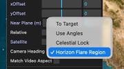
Mick West replied to the thread SHF.sitrec.org - Starlink Horizon Flares Predictor web app..Speaking of that, I added a "Horizon Flare Region" to the Camera Heading menu. This just looks 10° above the horizon at the point above the sun
-
-
Mick West reacted to flarkey's post in the thread SHF.sitrec.org - Starlink Horizon Flares Predictor web app. with
 Useful.
Would it be possible to link the shf.sitrec.org app to a geoloacted live view of the sky...? The live view functionality is already in the sitrec code, but it is kinda hidden or buried under the advanced controls. This, along with the AR mode...
Useful.
Would it be possible to link the shf.sitrec.org app to a geoloacted live view of the sky...? The live view functionality is already in the sitrec code, but it is kinda hidden or buried under the advanced controls. This, along with the AR mode... -
Mick West reacted to purpleivan's post in the thread SHF.sitrec.org - Starlink Horizon Flares Predictor web app. with Like.
Confirmed the fix here. Cheers.