Sitrec2
Sitrec (Situation recreation) is a web application that allows for the real-time interactive 3D recreation of various situations. It was created initially to analyze the US Navy UAP/UFO video (Gimbal, GoFast, and FLIR1/Nimitz), but has expanded to include several other situations (referred to as "sitches"). It's written mostly by Mick West, with a lot of input from the members of Metabunk.
Here's a link to Sitrec on Metabunk.
My goal here is to create a tool to effectively analyze UAP/UFO cases, and to share that analysis in a way that people can understand it. Hence, I focused on making Sitrec run in real-time (30 fps or faster), and be interactive both in viewing, and in exploring the various parameters of a sitch.
User Documentation
Technical Documentation (for coders and webmasters)
Legacy documentation
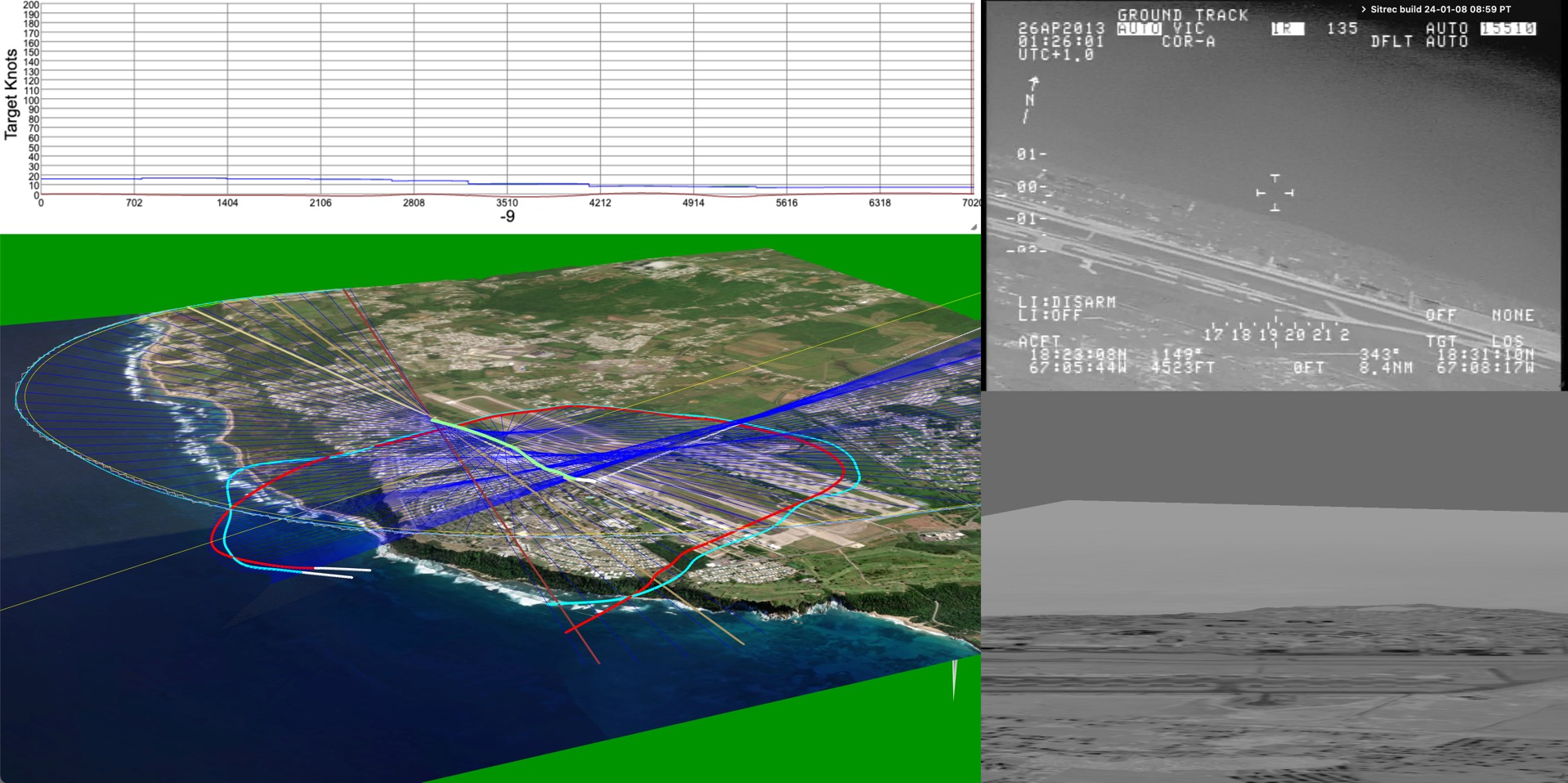
The most common use case is to display three views:
- A video of a UAP situation
- A 3D recreation of that video
- A view of the 3D world from another perspective (with movable camera)
- Plus various graphs and stats.
Here's the famous Aguadilla video
Sitrec uses or ingests a variety of data sources
- ADS-B files in KML format from ADSB Exchange, FlightAware, Planefinder, and others
- TLE files in Two or Three Line Element format (for satellites, mostly Starlink)
- Star catalogs (BSC, etc.)
- Video (mp4, mov, H.264, H.265 )
- DJI Drone tracks from Airdata as .csv
- GLB (Binary GLTF 3D models)
- Generic custom data in .csv
- PBA (Pico Balloon Archive) .txt files
- MISB style 3d Track data in KLV or CSV format
- Image files (jpg, png, etc) as single frame videos or ground overlays
- Image Overlays in KMZ format
Some types of situations covered:
- UAP Videos
- Taken from a plane where a target object's azimuth and elevation are known ("angles only")
- Taken from a plane of another plane
- Taken from a plane looking in a particular direction
- From a fixed position
- Viewing the sky (with accurate planets and satellites)
City Location and population data from: https://simplemaps.com/data/us-cities