When I click the link to verify that information this is all i see
Abstract
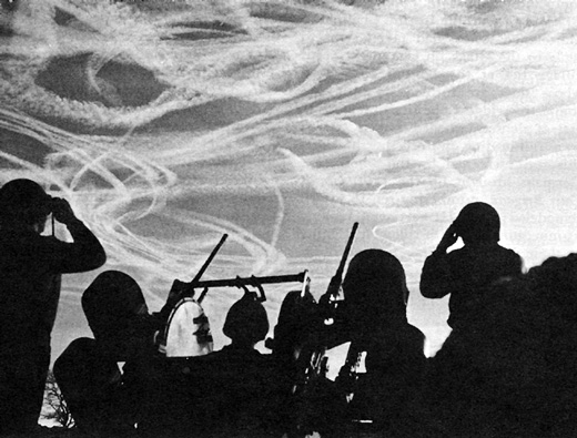
Direct infrared and solar radiometric observations were made to analyse the effects on the environment of any alterations in the radiation budget in regions of heavy jet traffic. The observations, made from the NASA Convair 990 jet laboratory, were coupled with Mie scattering and absorption theory calculations to analyze any inadvertent alterations in the natural atmospheric thermal radiation budget. It was found that a 500 m thick contrail sheet increases the infrared emission below the sheet by 21% but decreases the solar power below the sheet by 15%. The infrared increase cannot make up for the solar depiction, resulting in a net available incoming power depletion at the base of the sheet of 12%. Such a change at altitude results in a 7% reduction in the net total available thermal power at the earth's surface, which, in turn, results in a 5.3C decrease in the surface temperature, if we assume contrail persistence. The actual temperature decrease is ∼0.15C with 5% contrail persistence.
Received: March 6, 1970
was there a seperate link I need to click once im on the page you linked me to?