UFO over Bristol Channel captured by Police helicopter

their twitter feed suggests a sky lantern, others suggest weather balloon. although pilots claim it was flying into the wind and they had camera set black to hot..
skylantern.JPG

Source: https://twitter.com/NPAS_StAthan/status/779325831101423617


I can't figure out the location there: there are two sets of co-ordinates at the bottom of the video. One is in South Wales, the other in Somerset. Neither is over Bristol.

These are the approximate locations of the two sets of co-ordinates at the start of the video, along with local air traffic at the time. There is a plane very close to one of the locations, in Wales.

upload_2017-1-27_10-27-49.png

It was at high altitude, 36,000ft:

upload_2017-1-27_10-29-36.png

Unlikely to be relevant as they say the object was at low altitude.


To me the "doughnut" shape looks more like a camera artifact due to poor focus, rather than the actual shape of the object, so the lantern explanation may not stand up.
 
Last edited:
Neither is over Bristol.
i'm horrible with time zones and utc.. did you read the twitter feed? ex:

upload_2017-1-27_10-43-22.png


add: and whats with the "N" in the bottom right, does that mean they were facing south? and if so then how could they be 'as we were coming back into land'...
 
Last edited:
i'm horrible with time zones and utc.. did you read the twitter feed? ex:

upload_2017-1-27_10-43-22.png


add: and whats with the "N" in the bottom right, does that mean they were facing south? and if so then how could they be 'as we were coming back into land'...
I read that it was off by an hour (not corrected for summer time), but September 16 was a Friday. So maybe the clock was off by a day as well?


If it was the 17th then this flight seems to have been diverted into the area at the same time:

upload_2017-1-27_16-57-31.png

Dubai to LHR shouldn't take it anywhere near that area. Strange...

Edit, on further inspection, the Dubai reference is incorrect. BA9171 is a code used for repositioning flights to Cardiff for maintenance. So this plane was flying at low altitude across the Bristol Channel at exactly that time, if the video was taken on Saturday 17th.
 
Last edited:
So, the time appears to match that BA 777 approaching Cardiff airport. But they say there was no air traffic on radar?
 
So, the time appears to match that BA 777 approaching Cardiff airport. But they say there was no air traffic on radar?
I guess they asked ATC for the wrong date. It appears that the firework video was taken during the same flight, just a few minutes before they filmed "UFO". And the fireworks in Cardiff were on 17 September after 9 PM BST. In ~10 min interval between the videos they flew about 12 km (7.5 miles) from the western outskirts of Cardiff to the Cardiff airport at the coast near Barry.

BA9171 would have been at about right azimuth relative the helicopter heading. Perhaps, the sky have been (partly) overcast at the time, otherwise they probably would be able to see the landing lights of the aircraft. I wonder, if clouds are more transparent to IR.

If we are to continue the discussion of the NPAS video, it should be split in a separate thread. Done.
 
Last edited:
According to the Daily Telegraph when they reported it, they said "It was on Saturday Night" which would be the 17th.
(Although to be fair all reporting seems shoddy these days. The Telegraph also said Saturday night (sept 24th) cos they reported it on the 27th. They said 24th despite showing pictures of tweets about this from earlier dates.
And the Bristol Post first said Bristol Channel and THEN said Bristol)
 
Couldn't they have uploaded footage from the camera, rather than filming a screen with a mobile phone? (33 seconds into video)
 
I have been looking into this "UFO" case again over the weekend and now think that it wasn't BA9171 or another aircraft descending to Cardiff Airport or St Athan airlield nearby. Moreover, I think that the object wasn't flying, but it probably was a ground based heat source somewhere at the top of the Quantock Hills in Somerset (e.g., Wills Neck).

I started with the analysis of the Cardiff firework video (#6), which I almost certainly was taken by the same camera on the same helicopter flight just six minutes earlier. After all, NPAS St Athan operates only one helicopter, EC135 G-NWOI.

Unlike the "UFO" video, the firework video was taken directly from the camera feed. Below is a frame from this video:
Screen Shot 2017-01-28 at 22.58.46.png
The bottom line displays the helicopter's coordinates, the azimuth and elevation of the camera (relative the helicopter's frame?) and the date and time. The date is wrong by one day, as the fireworks were on September 17 after 9 pm BST (UTC+1), but the time (Z means UTC) is about right.
The line above it displays the target's coordinates, its altitude (above ground?) and the distance to it.
The scale on the left side of the display window shows the camera elevation, that at the bottom shows the azimuth.
The scale on the top is a compass, which is doubled by the arrow at the bottom right corner.
I have not found the meanings of the remaining indicators.

I have added this frame to Google Earth by fitting the distinct building, including tower blocks in the middle and the Celsa Steel Works in the upper right corner (note the hot pipework above the roof):
Cardiff fireworks.jpg
The camera was placed at the helicopter's location at the time. There were four parameters to adjust the fit, which resulted in the following values:

camera
  • altitude: 450.00 m
  • heading: 92.25°
  • tilt: 86.00°
horizontal FOV: 4.25°

Untitled placemark (yellow pin) corresponds to the target coordinates and coincide well with the camera cross-hair (the tip of the pin is obscured by the 3D buildings. The distance to this placemark coincides well with the displayed value of 6429 meters. Note that the target coordinates change a bit during this short video.

The camera heading coincides with the compass reading, suggesting the compass was working correctly during this flight.
The elevation of video frame fit (tilt - 90° = -4°) is within one degree with the camera elevation reading of -4.9°, but this is probably coincidental.

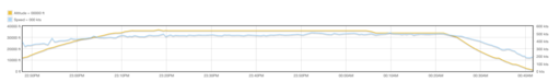
The "UFO" video begins about 6 minutes after the fireworks video ends. In between the helicopter moved by about 6 miles, travelling with an average speed of 60 mph or one third of the cruise speed of this helicopter type. The "UFO" video is taken from the monitor by a phone camera and comprises two segments separated with a 3-minute gap. The image is distorted with the top part of the camera display being cut off.

The target coordinates remain unchanged during the entire video, suggesting that camera does not track the object but has frozen the location of the last meaningful target (probably something other than the object). The elevation and azimuth readings change greatly, which probably reflects the rotation of the helicopter itself.

In contract, the compass direction, where it can be seen, remains largely unchanged around 163°. The compass direction, demonstrated above to be correct, differs greatly from the direction of landing approach to the Cardiff airport (the helicopter was flying over the airport at the time). This direction also differs by about 15° from the direction to the "frozen" target location and points to the Quantock Hills beyond the Somerset coast of the Bristol Channel. Their highest summit Wills Neck is only 1261 ft (384 m) high (that is lower that the deduced helicopter's altitude), but would appear above the horizon for the said altitude. It seems possible that, in the conditions of poor visibility, a heat source near the summit could be mistaken for a flying object by a FLIR camera operator.
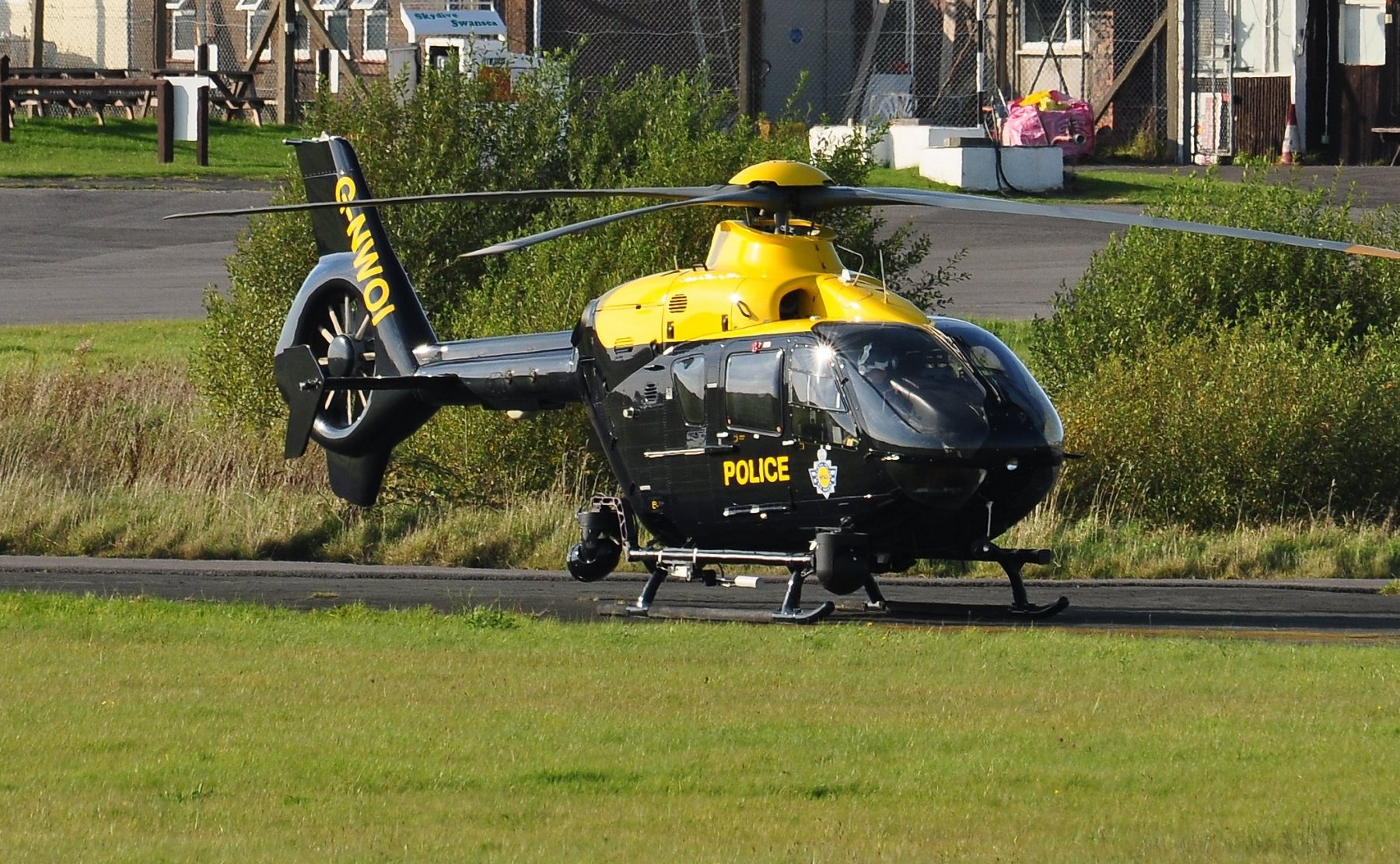
 
Last edited:
I have added this frame to Google Earth by fitting the distinct building, including tower blocks in the middle and the Celsa Steel Works in the upper right corner (note the hot pipework above the roof):

The camera was placed at the helicopter's location at the time. There were four parameters to adjust the fit, which resulted in the following values:

camera
  • altitude: 450.00 m
  • heading: 92.25°
  • tilt: 86.00°
horizontal FOV: 4.25°

There are other guide marks within the frame that allow to deduce its FOV for different zoom values using the resulting HFOV of the above fitting.

At low values, the angular diameter of the central area outlined by the the cross-hair capping bars and the conners is about 1°:
zoom 1.png

at medium zoom values, the diagonal between the corner marks remains 1°, but the new capping bars are 10 arcminutes from the centre:
zoom 2.png

At high zoom values, the corner marks go out of the frame, but the 10' bars remain:
zoom 3.png

This allows the measurements of the object's angular diameter, which (by the order of magnitude) is about 10-3 rad (0.057°). For example, this is how a sphere with the diameter of 1 metre will look from the distance of 1 km.
 
Nice work, Trailspotter. Have you contacted/tweeted South Wales Police? I think you have nailed it and especially when it is reported as an "invisible object"

The invisible object, which could not be seen with the normal eye, was captured by thermal cameras.
Content from External Source
As already highlighted by the "Chilean UFO" incident aircrew can be deceived. During a training or test flight it should be easy for them to replicate the footage if the heat source is a constant in the area?
 
Nice work, Trailspotter. Have you contacted/tweeted South Wales Police?
Actually, my investigation is not finished yet. I have found a new candidate flight that seems to fit the first segment of the video, the duration of which is just 7 seconds from 20:21:33 to 20:21:40. In this segment, the compass shows the object at about 135°, the heading that crosses the landing approach to the Cardiff Airport. But the plane is not a big 777 that was further to the north at the time, but a smaller ATR72, a twin engine turboprop. This was one off flight by Aer Lingus Regional EI-FNA (callsign RE440P) that landed at 20:23 UTC. The KML file with converted PF track is attached:
Screen Shot 2017-02-01 at 21.51.26.png

The EI-FNA track and speed at the time appear to match those derived from the video (will write a more detailed post later). This finding suggests an intriguing possibility - the doughnut shape is created by the propeller tips or their vortices. Note that one of the two "hot" engines could be obscured at the viewing angle:
Screen Shot 2017-01-30 at 09.54.23.png
It remains to be demonstrated, whether a thermal signature of the hot aircraft engine attached to a propeller resembles a doughnut or not.


The first segment is followed by a 3-minute gap in the video, during which the plane landed. If the crew were tracking the object, they undoubtedly would eventually see the landing aircraft or, at least, its lights. Could it be that this gap was left deliberately?

The second segment is more than one minute long, from 20:24:11 to 20:25:13. It also shows a similar doughnut-shaped object, that could be a light single-engine propeller aircraft, flying above the Bristol Channel parallel to the runway while waiting for BA9171 777 to land (at 20:30 UTC). There are a number of such aircraft based in the airport and MOD St Athan nearby. According to the South Wales Aviation Group log, several of them were active on the day. Regrettably, their flying times were not specified.

From my personal observations of small planes belonging to a local aero club and flying around the airport on a good day, most of them do not show on FR24 or other flight trackers.
 

Attachments

  • RE440P_PF_Metabunk.KML
    7.8 KB · Views: 856
Last edited:
At high zoom values, the corner marks go out of the frame, but the 10' bars remain:


This allows the measurements of the object's angular diameter, which (by the order of magnitude) is about 10-3 rad (0.057°). For example, this is how a sphere with the diameter of 1 metre will look from the distance of 1 km.

Those 10' bars remain the same from 0:46 to 01:04, however there are significant changes in the object:
20170202-071819-dhi24.jpg

20170202-071850-a6obg.jpg

20170202-071933-qej84.jpg


20170202-072000-0wvwv.jpg

If these are all at the same zoom setting, then that strongly suggests the circular shape is a focus artifact, and that the closest actual shape is at 0:57 (and less zoomed in at 0:30)

20170202-072149-96mt2.jpg
I saw this. To me it looks like they were going into digital zoom, because the background became more and more pixilated.
Also, in all other "doughnuts" the dark inner spot is off centre of the ring. I do not see how this could be explained by a focus artefact.
 
Another thing, I noticed in the Chilean case that the "true" shape of the hotspots was revealed when the camera switched zoom levels and had to adjust the exposure. There are a few frames of light grey screen fading to darker with the dark spot fading in. With the Chilean case this gave the nice shot of the engines (actual size inset here)


There's a similar fade at 01:10 (20:25:13), where we see:
20170202-082554-gquz7.jpg

Also at 00:05 (20:21:37)
20170202-084812-b3d7j.jpg

Unfortunately not very good images, however there is the suggestion of two engines there.
 
Unfortunately not very good images, however there is the suggestion of two engines there.
Well, they filmed from the monitor to a mobile phone, which probably have different frame rates. Also, if you download the youtube video, it probably was a screen capture of the twitter feed. There could be plenty of additional artefacts here.
 
I downloaded the twitter video, which is the best quality available, but still just phone video off the screen.

I don't want to rule anything out, but a single propellor just seems incredibly unlikely to me - you'd expect a much hotter spot on the exhaust somewhere, and fairly significant heat sources from the windows. But we get nothing, just the blob, or the ring - although that does have an offset inner blob, which you could conceivably fit over the exhaust of a Cessna 172
20170202-100138-rfmfe.jpg

But this inner blob is cooler than the ring, and vanishes when zoomed in (or lost focus)
20170202-100310-vgkea.jpg
 
In the firework video taken at a moderate zoom, there are no ring effects from the rockets some 3 miles (5 km) away, whereas a more distant 5-metre wide pipe on the roof of the steel works 5 miles (8 km) away is also well resolved. The "UFO" video apparently was taken mostly at a higher zoom, apart of the very last frame showing the helicopter's foot 2 inches (50 mm) in diameter some 3 metres from the camera. I haven't found the camera specs, perhaps, there are focus issues at the high optical going to digital zoom.

The propeller hypothesis is verifiable, we just need a thermal video of the propeller aircraft with a running engine.
So is the focus artefact hypothesis, if we can find more high zoom videos by this camera type.

Here is a photo of the helicopter in question:
G-NWOI by Roger Winser, on Flickr
 
Last edited:
The camera appears to be a FLIR Star Safire, maybe model II or III, similar to the one used to view Dzhokhar Tsarnaev in the boat (Star Safire III).

20170202-161103-f0xnl.jpg

It looks like in the phone screen videoing they chopped off some minor info at the top of the screen.
20170202-150113-c0n00.jpg
 
Last edited:
Similar, but head-on. Hot exhaust, slightly warm blades. Not warmer at the tip.
20170202-150913-a2mpn.jpg

Well, it probably depends on the flight duration, as the aircraft skin gets colder, whilst the propeller tips get hotter with time:
watch?v=aQbjTAmNS0o.png
source

However, having watched quite a few FLIR videos in the past few days (while staying home with a bad cold:(), I agree that is less likely to be a propeller. At the estimated range of distances for a light plane, the camera would almost certainly resolve the entire craft.

Now I'm entertaining a different hypothesis - the object was one or more aircraft flying over the English Channel 80-125 miles away in the approximate direction Bournemouth to Guernsey:
Screen Shot 2017-02-05 at 17.40.51.png
By the times and compass directions, the likely candidates are flights TAP367 for the short first segment of the "UFO" video and FR5953 for the long second segment.

Also, there appears to be varied amount of digital zoom used in many frames, that I did not take into account in my post above (#14).
 
In the Flight Log, the date is Sep 17th. The helicopter took off at 21:00 and landed at 22:15. It is specified in this log that time is expressed in Local Time (BST UTC+1). This confirms your findings, the time displayed in the video is Zulu Time (UTC), like displayed in the video with the letter "z". This document also confirms that the date displayed in the video is off by one day.

Capture d’écran 2017-06-09 à 20.24.56.png

Like you guys, when I started investigating this case, I ran into the same time and date issues but a short article and a YT user confirmed that the firework happened on the 17th, no later than 21h30 local time (09:30 pm BST UTC+1):

Capture d’écran 2016-09-30 à 17.11.18.png

Source:
Source: https://www.youtube.com/watch?v=zhZgPq9bnVg


Now, was the clock off by a few minutes or even more? Since the date is wrong, could time be wrong as well? I might be too skeptical but I consider to be just cautious. This could explain why nobody found a solid match so far. I say, we should rely on what we know for sure, that is, the helicopter took off at 21:00 local time and landed at 22h15 local time on Sep 17th because they filmed the firework.

Maybe if we widen our search when it comes to time, we'll be able to catch this "sucker".

Good hunting (if you agree of course)
 
Last edited:
Hi Trailspotter,

Nice investigations so far. I would like to point out that weather data has to be taken into account when looking for potential candidates.

You said:

Now I'm entertaining a different hypothesis - the object was one or more aircraft flying over the English Channel 80-125 miles away in the approximate direction Bournemouth to Guernsey:
Content from External Source
The aircraft you mentioned was flying at an altitude of 24,925 ft ASL. I don't think that any aircraft flying over the clouds or in the clouds can be detected with the FLIR MWIR system. Why? Simply because in other IR videos , clouds are known to obstruct heat signatures and make the signal weaker or simply disappear. It is easy to notice it in the Mexican AF video:


Source: https://www.youtube.com/watch?v=35jolCqH9_I


In our specific case (date, time and location), clouds can be seen in the video but I extracted METAR data from Weather Underground in Cardiff-Wales Airport (ICAO:EGFF). As you can see, the sky was Overcast/8 oktas ("Couvert" in french). METAR data stipulates "OVC 039" @ 09:20 pm BST and 09:50 pm BST, this translates to Overcast with a cloud ceiling expressed in feet located at an altitude of 3,900 ft:

Metar Cardiff.png

I also extracted METAR data from RNAS Yeovilton (ICAO:EGDY):

Capture d’écran 2017-06-10 à 09.54.06.png

As you can see, the sky was Overcast/8 oktas as well at 09:00 pm BST and 09:50 pm BST and the METAR data tells us that the cloud ceiling was located at an altitude of 3,600 ft at 09:50 pm BST:

Capture d’écran 2017-06-10 à 10.02.37.png

In our quest for finding candidates, I think that it is reasonable to only focus on potential candidates flying at an altitude lower than 4,000 ft. This is important imo and will help us narrow our search.
 
Last edited:
Hi Trailspotter and everyone,

I noticed that you also worked on the firework event, I did the same thing as well in order to approximately test how accurate the camera Line Of Sight (LOS) can be.

The first thing I did was to use the geographical coordinates in order to position the helicopter on the map and also to pinpoint where the laser (rangefinder) hits the ground. The first set of coordinates represents the location where the laser hits the ground, below this set of coordinates, the other set of coordinates shows the position of the helicopter:

Capture d’écran 2016-10-03 à 10.27.42.png

1, 2 and 3 represent 3 buildings I used as visual referentials. The compass on the top of the screen indicates the azimuth of the camera related to true North, in this case, I used a scale to get an accurate reading of 92,6°. The "Az" displayed at the bottom of the screen indicates the camera pan in relation to the front of the helicopter. In this case, we can see that the camera was pointed to the starboard side of the helicopter (33,6°) since the small white cursor is located to the right of "0" (12 O'clock):

Capture d’écran 2016-10-03 à 11.27.21.png

Here are the 3 buildings I used as referentials:

Capture d’écran 2016-10-03 à 11.23.08.png

I can position the helicopter with the LOS of the camera, I can also figure out the approximate heading of the helicopter since I know both the azimuth of the camera related to true North and the azimuth related to the front of the helicopter (its 12 O'clock): 92,6 - 33,6 = 59. Please note that in this image below, the LOS does not stop where the laser hits the ground:

Capture d’écran 2016-10-03 à 11.03.40.png

Now, here is a close up of the LOS, 1, 2 and 3 represent the buildings I used as visual referentials and 4 is where the laser hits the ground. As you can see, the LOS is not off by much. I could have "cheated" and only used the geographical coordinates of both the helicopter and where the laser hits the ground in order to be more accurate but there's no point in doing that since the rangefinder was not "on" when they filmed the "ufo". In other words, at no point in time the target was illuminated:

Capture d’écran 2016-10-03 à 11.21.04.png

This shows that the simple method I used is accurate enough to proceed with the analysis of the "incident". As I will show you in the near future, I made 16 Lines Of Sight (LOS) at 16 different times within a 4' period (time). I will show you how this helped me to refute/invalidate two hypothesis (lighter than air and/or a motionless object) and how this might help us find a potential candidate or candidates with planefinder.
 
Last edited:
Hi everyone,

The full 8-min HD St Athan "UFO" video (2016):

Source: https://www.youtube.com/watch?v=mDFOINEChYE

Thank you for the link to the full video. Although the chopper's coordinates have been redacted from it, the extras at the end point to a new strong candidate flight - Flybe 4312, which landed at Exeter at about the same time. Like the 'Chilean UFO', the plane was at a long distance from the chopper, about 45 miles.

The Planefinder track stops near the English Channel coast at 20:20 UTC, but the missing final part, including the turn and landing approach from the East, would have taken at least 9 more minutes (as supported by more recent BE4312 tracks available from FlightAware):
BE4312 track.png

I will post the key points of my analysis leading to this candidate later today. Meanwhile, I wonder if any member has access to the complete BE4312 track for 17-Sep-2016, e.g., from FlightAware or FR24. It will help to validate or reject this candidate flight.
 
Embraer 195s did not come with ADSB transponders from the factory.
I have seen a Honeywell Brochure from 2016 saying a retrofit is available but I don't know if Flybe have upgraded. The last I heard was that none of Flybe's fleet had ADS-B and were only available on M-LAT so would generally not show up on FR24 and the like below about 5,000ft. (This is why certain well known British "chemtrailists" had accused FLybe of spraying and turning off transponders)
 
The 'extra' part at the end of the full video contains terrain images, which could be matched to Google Earth, in particular, the frame at 20:27:58Z with a rather characteristic ground relief pattern:
Bristol Channel UFO ground match.jpg
For this image fit I used the same parameters as deduced from the fireworks video above (#13):
the horizontal FOV is 4.25° and the camera altitude is 450 m. The line of sight passes throw the NPAS home base at St Athan, near which the helicopter probably was at the time. Although its coordinates were redacted, the last known position at 20:25:17Z was south of the airport and the helicopter traveled due West afterwards. In 2.5 minutes, it could readily fly ~3.5 miles between the last known position and the base.

To analyse the track of "UFO", I stitched together four frames: 20:27:58, 20:28:19, 20:28:32 and 20:28:57, and marked the "UFO: positions at these times with blue dots:
Bristol Channel UFO.jpg
The object moved steadily above the skyline in western direction with an angular speed of about 4.3° per minute. Angular speed here is the ratio of the object's linear speed perpendicular to the line of sight to the average distance between the object and the camera. That is, the faster the object moves, the farther it must be from the camera. For a car speed of 60 mph, the object would be 13 miles away, on the opposite coast of the Bristol Channel, for a faster plane it would much farther inland.

I also noted that the extended line of sight passes near the Exeter airport some 45 miles away from St Athan. The object speed at this distance would be about 210 mph, or just about right for a landing jet. The Planefinder playback revealed such a jet, landing at Exeter at the time - Embraer 195 of the FlyBe flight 4312 (see my previous post). I've tested this hypothesis by downloading a recent BE4312 track from FlightAware and displaying it in Google Earth from the same viewpoint:
GE_fit_with_BE4312_track.jpg
The darker grey segment of the track, which comes rather close to the object position, represents a one-minute interval.

Further refinement would require the exact helicopter's coordinates, as well as the full BE4312 track.
 
Last edited:
Hi Trailspotter,

I am now investigating this potential candidate as well but too bad we cannot read the geographical coordinates, which leads to speculations about the location of the helicopter at various points in time.

So far, I can tell you that I disagree with your angular speed estimate because it does not (and cannot since GPS coordinates are blurred) take into account the fact that the helicopter was probably not motionless. This of course could have an impact on perceived angular motion and speed Vs distance estimates.

Nevertheless, I can confirm as well that if the helicopter (towards the end of the video @ 20:27:58Z) was flying over St-Athan (see image below) or even slightly further West or East, this potential candidate could be in the approximate right position (172°) for the turret to track it. This is not the case for the whole video, so this candidate could potentially explain what is seen at the end of the video, not what was filmed before:

Capture d’écran 2017-06-15 à 02.32.35.png


I retrieved METAR data for Exeter Airport and the sky was scattered with a ceiling at 3,800 ft at 09h20 pm and 09h50 pm local time. Near Cardiff Airport and the helicopter, the sky was overcast and the ceiling was located at an altitude of 3,900 ft. This is important because it can help us find evidence to either support or discard this hypothesis once we get our hands on the flight track:

Capture d’écran 2017-06-15 à 02.53.08.png
Why? Simply because once we get our hands on it (see image below for another flight track with the same aircraft/company to Exeter), we'll be able to figure out where and for how long the heat signature could be seen without being partially or fully obstructed by clouds. In other words, the heat signature in the video would only be clearly visible when the liner was flying below 3,800 ft. In this example below (same aircraft/company but different date), the heat signature would be visible for approximately 180" (3 min) or less before touchdown if the cloud ceiling was located at 3,800 ft:

Capture d’écran 2017-06-14 à 09.14.45.png


Yesterday, I also contacted NPAS ST-ATHAN because I am not satisfied with the evidence I found so far regarding the EO/IR turret & system used on this helicopter. I identified it as a Star Safire HD 2nd Gen and what we see in the video could come from (awaiting confirmation) an MWIR sensor (3–5 µm) and an HD color low light ccd camera (0,1 Lux) with continuous zoom (labelled HDZ in the video/AVDU Mission Display).

From my research so far, I found out that strobe lights at night can be seen at great distances (> 50 NM) when weather conditions allow it, this will also be something to work on since it does not seem that the low light ccd camera captured anything, which is strange if it is indeed a commercial aircraft. The low light camera was used at various times during the "incident".

I'll hit you up as soon as I get an answer from the NPAS.
 

Attachments

  • Capture d’écran 2017-06-14 à 09.14.45.png
    Capture d’écran 2017-06-14 à 09.14.45.png
    40.2 KB · Views: 483
  • Capture d’écran 2017-06-14 à 09.14.45.png
    Capture d’écran 2017-06-14 à 09.14.45.png
    40.2 KB · Views: 439
Last edited:
I am now investigating this potential candidate as well but too bad we cannot read the geographical coordinates, which leads to speculations about the location of the helicopter at various points in time.

So far, I can tell you that I disagree with your angular speed estimate because it does not (and cannot since GPS coordinates are blurred) take into account the fact that the helicopter was probably not motionless. This of course could have an impact on perceived angular motion and speed Vs distance estimates.

I'm fairly confident in my line of sight for 20:27:58Z, as the distances to the discernible ground features on the opposite side of the Bristol Channel vary significantly. For example, the crescent-like shape on the left is much closer to the camera than a broad tilted bar above and to the right of it. These features narrow down the range of suitable lines of sight. You can check this by matching this frame to Google Earth yourself from various locations near the helicopter's last known position from a previous short video.

My angular speed estimate is based on the movement of the object relative the backdrop ground features some 20 miles away, which is a much longer distance than helicopter could have travelled in a minute. It is quick and dirty, but probably is in a right ballpark, say ±50%.

Nevertheless, I can confirm as well that if the helicopter (towards the end of the video @ 20:27:58Z) was flying over St-Athan (see image below) or even slightly further West or East, this potential candidate could be in the approximate right position (172°) for the turret to track it. This is not the case for the whole video, so this candidate could potentially explain what is seen at the end of the video, not what was filmed before.

Well, it is possible that the camera may have lost the original object and picked a new one at the end. However, it is also possible, that the actual BE4312 track of the date was very different from a typical one, as picked by you. For example, here is the track for 06-Jun-2017:
Screen Shot 2017-06-18 at 17.42.57.png
https://uk.flightaware.com/live/flight/BEE4312/history/20170605/2030Z/LEMG/EGTE

It is quite possible, that on the night of the arrival, in conditions of reduced visibility, BE4312 flight made a similar or even bigger loop before aligning for the landing. We need the actual track to see whether it is (in)consistent with the camera directions through the whole video. At least, it would be good to know the actual time of landing to find out how long did it take from the last position in Planefinder.

In other words, the heat signature in the video would only be clearly visible when the liner was flying below 3,800 ft. In this example below (same aircraft/company but different date), the heat signature would be visible for approximately 180" (3 min) or less before touchdown if the cloud ceiling was located at 3,800 ft

For the above track, the heat signature would be visible for much longer, more than the duration of the video:
Screen Shot 2017-06-18 at 17.43.18.png

Thus, as I concluded in my previous post:
Further refinement would require the exact helicopter's coordinates, as well as the full BE4312 track.
 
This case has risen again:

Source: https://www.youtube.com/watch?v=9KAZE1wmV9k

A UFO which appeared to travelling around 106mph and is said to have been only visible on a thermal camera was filmed by a police helicopter in the UK. The eerie footage - which is similar to recent UFOs videos captured by the US military - was released by cops after a Freedom of Information (FOI) request appears to show the object moving over the Bristol Channel. Video shows the object moving against the wind as it appears to travel at high speed and is tracked by the police helicopter's FLIR thermal camera near St Athan in Wales at around 9pm on September 17, 2016. Snippets of the video filmed off a screen were originally shared by the NPAS team at the time. But now the full video of the strange encounter has been revealed following on FOI request by former cop turned UFO investigator Gary Heseltine. And after a protracted battle to get his questions answered, he has called on the UK government to finally come clean on what it knows about UFOs. NPAS South West tweeted at the time the object was not detected by local air traffic control and was described as "hot" as it travelled against the wind - meaning it was unlikely to be a balloon or lantern. It was flying around 1,000 feet and was only visible when the cops noticed it on the thermal camera which they were said to be testing by pointing it at planes heading into Cardiff Airport.
Content from External Source
 
But now the full video of the strange encounter has been revealed following on FOI request by former cop turned UFO investigator Gary Heseltine.

Is there anything in this 'full video' that wasn't in the one released in 2017?

Also, how do they know it was 'flying against the wind'?
 
Thinking about the questions as to whether the time on the helicopter camera was off by 60 minutes exactly, or by some other number, it seems like it might be possible to match up the two firework display videos.

At first glance, I think around 0.46 on the spectator video might be about where the helicopter video begins.

Probably too late now, but if they could be matched up and the spectator still had time info for their vid (or there was another way to find out when it started/finished) you'd be able to get an accurate time for looking at flights, etc.
 
Back
Top