Using a very long water level to measure Earth's curvature

danno

New Member
heres an idea: let's take 53 -100ft garden hoses and hook em together. find 2 miles of relatively flat ground(the flatter the easier) from a center post, run the garden hose 1 mile in 1 direction. drive another post. attach sections of clear tubing to both ends of the hose. fill the hose with water until water line is visible in both clear tubing sections and hold them still against the posts until water settles to a stop. mark the water level mark on both posts. then take the hose and drag it in the opposite direction of the center post to a third post, 1 mile from the center, 2miles from the far post, but in line with the other two. repeat first step of filling with water and making marks. (after 2nd marks are made adjust both 2nd marks equally to match elevation of first marks.)(eg. if on middle post 2nd mark is 10" lower than first mark, raise both 2nd marks 10" to match first marks elevation) now we have 3 marks, all level to the middle post mark... shoot a laser from 1 end mark to the far end mark and then see where it intersects on the middle post relative to the mark thats been made. ( if it drops low of the mark... its round! if it is right on the mark...its flat! and if its high of the mark... its concave!) that's it! it's that simple! ( a high powered spotting scope with horizontal line could be used instead of laser also. or even a really fancy transit with 2mile range) and if you're wondering what good filling a miles worth of garden hose would do... its called a water level (water will always sit level to itself. yes even inside of a hose* so long as no section of the hose is higher than the ends) its how they leveled mobile homes for years and still do. SO... there ya have it! you know youre right! you know they're wrong! stop arguing nonsense and someone put their money where their mouth is please!
 
Someone actually did this a year or so ago, but, as I recall, it was kind of a video of the setup, and not very clear on the results, like it was an initial test. I forgot about it, and can't find the video, but it's probably out there somewhere.
 
Wouldn't work with a laser. Lasers diverge. You get a cone of light, not a pencil thin line that goes on forever. Lasers are basically spotlights.
 
Camera end
Metabunk 2018-05-13 21-13-18.jpg

Middle station at 500m
Metabunk 2018-05-13 21-14-44.jpg

End station at 1000m
Metabunk 2018-05-13 21-16-11.jpg

The black and white targets are visually aligned in a straight line. The water levels at each end match the targets, the water level in the middle is higher.
Metabunk 2018-05-13 21-17-35.jpg
 
The video does show the concept that water doesn't really bend. Each column of water points to the center of the Earth.

If you had a spherical magnet and sprinkled iron fillings on the entire surface, the iron fillings aren't bending.
 
The video does show the concept that water doesn't really bend. Each column of water points to the center of the Earth.
I don't think it shows either of those things. The direction of the columns of water is constrained by the tube — it could actually point at 45° and still get the same results. And how could a liquid bend?

The experiment shows that the level line of the water is not a straight line. Now this is because the value of gravity is about the same, but in a slightly different direction, at each location. But the experiment does not exactly show that. It's consistent with that. It does disprove the notion that the water heights in water level define a plane. They define a curved surface.
 
The video could be used to introduce the idea that water doesn't really bend as if it were a single, solid piece of plastic. Water is a liquid. Each water molecule in the ocean is seeking its local level.

Better?

I've been reading the comments. I saw the objection, as I thought I would, that this means nothing because the ground isn't really level. It's as if the water level in a section of vertical tubing would be a foot higher if you put a foot tall box under that section.
 
Last edited:
The video could be used to introduce the idea that water doesn't really bend as if it were a single, solid piece of plastic. Water is a liquid. Each water molecule in the ocean is seeking its local level.

Better?
I'm not sure you are introducing an idea that anyone needs. Nobody thinks water bends like a single piece of plastic. It's a liquid.
 
The video could be used to introduce the idea that water doesn't really bend as if it were a single, solid piece of plastic. Water is a liquid. Each water molecule in the ocean is seeking its local level.

Better?

I've been reading the comments. I saw the objection, as I thought I would, that this means nothing because the ground isn't really level. It's as if the water level in a section of vertical tubing would be a foot higher if you put a foot tall box under that section.
It would make no difference if a 20-foot deep trench were dug out for 50 yards around the center station, the water level of the center station would remain exactly where it is, about an inch higher than the first and last station, because it's following the geoid!

These 3 columns of water are showing where the geoid is. That's all there is to it. Maybe they're AT the geoid, or maybe they're above or 
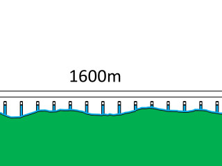
below it, but in any case, they are following the shape of the geoid. They are all 3 equipotential water surfaces with approximately the same ambient air pressure, humidity and temperature, because they are fairly close to each other; and the fact that they're connected by the hose means they have the same water pressure. If there were 100 more columns connected in between them, they would gradually rise up to a maximum and then fall back down at the far end, much like these 3 do, and perhaps exactly like these 3 do (the one at 500 m being the highest). But it's possible you'd find the true high point to be a few inches or a few feet closer to the beginning or the end. Having the middle station at 500 meters is probably just fine.

I should point out that it's possible, if there were an anomaly here, that all 3 glasses could show the same water level or very nearly the same, like 1/4" different or 3/8" or whatever. That would be because of a gravitational irregularity underground that's causing the geiod to have a flat spot, or at least, some anomaly that makes it appear, by these 3 locations, to be a flat spot here. The geoid is not a nice, smooth sphere, but an irregular, lumpy oblate spheroid. Some such anomaly might be going on at lake Balaton, for example, or at the Hawking's "Genius" video lake (the location of which curiously was never identified). In such a case, an open body of water above such anomaly would appear to have a flatish area on the water surface, or perhaps a HUMP. But normally, over a 1000 m distance like this we should expect to find the center glass column water surface an inch or so higher than the other two. No surprise here, because it conforms to the expected curvature of the earth.

It seems to me there is no cause to find some way of explaining this by saying "water doesn't bend." That is one of the false canards of flat-earthers and it has no value or relevance. It's simply bogus. It serves no purpose to pay obeisance to their nonsense. Just like it does nobody any good to say, "the horizon rises to the eye level of the observer," because it doesn't. The horizon stays right where it is. Period. The truth is what one should stick to, and in this case the truth is, under one atmosphere of ambient pressure (more or less) AND a not-unpleasant temperature, water conforms to the shape of its container, and in this case, its container is the hose, the 3 column glasses and the OPEN CHANNEL surface that is defined by proximity to the geoid. Simple!

Open Channel is a standard engineering term. A fluid mechanics engineer would say these 3 column surfaces have "the same head." Head means the potential distance above (or below) the geoid, or relative to some other elevation of water. Open Channel even applies to moving water, such as in an aqueduct, but it also applies to a lake without any appreciable movement, and that is what we have here. We have basically a lake with stagnant water, emerging in three places and connected by a static subsurface continuum of garden hose. It is a quasi-closed system: closed all over except at the 3 open surfaces where the column glasses are.
 
Last edited:
Camera end
Metabunk 2018-05-13 21-13-18.jpg

Middle station at 500m
Metabunk 2018-05-13 21-14-44.jpg

End station at 1000m
Metabunk 2018-05-13 21-16-11.jpg

The black and white targets are visually aligned in a straight line. The water levels at each end match the targets, the water level in the middle is higher.
Metabunk 2018-05-13 21-17-35.jpg
See the fancy yellow case open on the ground? That's what houses the theodolite for traveling.
See the fancy yellow self-leveling theodolite perched atop the camera end framework?
It probably has a 32-power telescopic lens with coated high resolution optics.
You're looking at a $3,000 instrument.
Then there are the black-and-white field targets and their supports, plus 1,000 ft. of garden hose.
They've got a capital layout of $5,000 here.
Plus, all put together it makes an objective, empirical test for Earth's curvature.
Over a short 1,000 meter distance (1 km) curvature is clearly measurable.

0.02 m per km = 0.002% crown in 1 km

They deserve our commendation,,,,,,,,,,,,,,, maybe a merit badge! (How about an award ceremony?)
 
Last edited:
In this image:

...one might be inclined to think that the apparent out-of-level appearance of the black/white rectangle target would make it difficult for the observer to sight the level line from the instrument. (Thus making it really hard to know whether the water level is truly 2 cm above the level line of sight as it would seem, OR NOT.) Curiously, the first 3 photos slope to the left (unfortunately) and this one slopes to the right, that is, in the opposite direction. I suspect the cameraman had no idea this was going on.

In the first place, note the likewise out-of-level appearance of the ground in the distance/horizon, above the target, and how it is entirely PARALLEL with the top of the target. All considered, that horizon is perhaps slightly inclined but not by much, perhaps a foot or two, at full field of view (left of frame to right of frame). IOW it is effectively a level horizon for purposes of the target's appearance that might translate to an error of one millimeter at the tape measure, or a negligible effect. That shows how the apparent incline of the foreground target is due to the cameraman's choice of which way to point the camera. He's pointing it DOWNWARD 5 degrees and TO THE RIGHT 10 degrees. Some photographers have a CROOKED EYE and to them, sloping lines look level. I fired a photographer one time for this very reason. This guy (above) was obviously not well-experienced in technical photography as well as surveying techniques! To do a proper technology shot he should squat down to the level of the target and put the centerline of the camera lens exactly in line with the instrument-to-target line of sight. That would make the background hidden behind the target.
.
So it would take two photos, then, to cover all the information. Okay, so then TAKE TWO PHOTOS!
IOW one photo is missing! (The one I described.)

Secondly, in my own experience with surveying, when such large targets are used for long distance sightings, it is the point defined by the intersection of the horizontal black line with the perpendicular line of the two black rectangles: the line of the right side of the top rectangle being the same (vertical) line as the left side of the bottom rectangle. There is no dot on the target, and there is no arrow pointing to the point, but the whole focus of this target is the one point where that thick black line intersects the thin vertical black line. If they had wanted to make it obvious, they could have set a short spirit level on those two pegs that stick out of the target on the left and right side (but that would have obstructed the overall image of the target, which is the objective of this photo). The two pegs that stick out go all the way through the target, protruding on the back side as well, where they are being used to set on top of the black/gold/diagonal panel, the top edge of which is established by the theodolite as a level line of sight between the first and third stations. It would have helped if the authors had been able to show a photo of what the viewfinder of the theodolite had for this sighting. But that would require a specific attachment or adapter for the camera, which they might not have had.

In summary, the crooked appearance of this photo is a result of the position in which the camera was held, and has nothing necessarily to do with the accuracy of the theodolite work in determining the relative elevation of the water level at the middle station. A second photo could have been taken directly in line with the theodolite's line of sight and oriented level from frame left to frame right, supporting the accuracy of the water level. Additionally, a third photo showing a spirit level resting on the horizontal black line that runs through the target would verify that the target is in fact level, but that would require its own photo, thus it would be a third photo. As it is, a viewer is left to trust the diligence of the authors (something flat-earthers are extremely remiss at doing!).
 
Last edited:
sly sparkane started an indiegogo campaign to perform a similar experiment, albeit with a P900 instead of a professional theodolite


Ultimately there is but one test left. This test is the displaying of what is commonly referred to as “Bending Water”. This is the fact that Water will always settle to a level. In the Case of the Globe, As Gravity pulls towards the center of the Earth, this produces a cross-section of water that ‘bends’ around that center.

Per the geometric principal known as the Pythagorean theorem and the stated radius of the Earth, the drop of the Earth’s surface as it increases in distance from the observer should occur at 8 inches per mile squared. I have designed a test which will display this principal not just by mathematics but with physical demonstration.

I just need your help to fund it. And Hopefully put to rest at least the arguments of Gravity (which Flat Earthers say does not exist) as well as displaying the actual “Bending Water” which Flat Earthers laugh at. This is a Flat Earth claim killer.
Content from External Source
 
Last edited by a moderator:
sly sparkane started an indiegogo campaign to perform a similar experiment, albeit with a P900 instead of a professional theodolite

Using a theodolite is not really needed. The key is observing a significant curve in the heights of the tubes between the first and the last one.

Unfortunately, I don't think 1.6km (1 mile) is long enough. You get an 8" drop, but only a 2" difference in the middle. Refraction effects could be a big problem.

Should still be interesting.
 
he wants to put markers on the tubes and align the markers using the P900 so that they are in a straight line of sight and then at each individual tube measure the distance between the marker and the water level. I assume the farther the tubes will be from the ground the less refraction distortion there will be. Also he plans to do it above ground rather than above a lake or sea, so that might mitigate the refraction too
 
Back
Top