Leifer
Senior Member.
First time I've tried this....
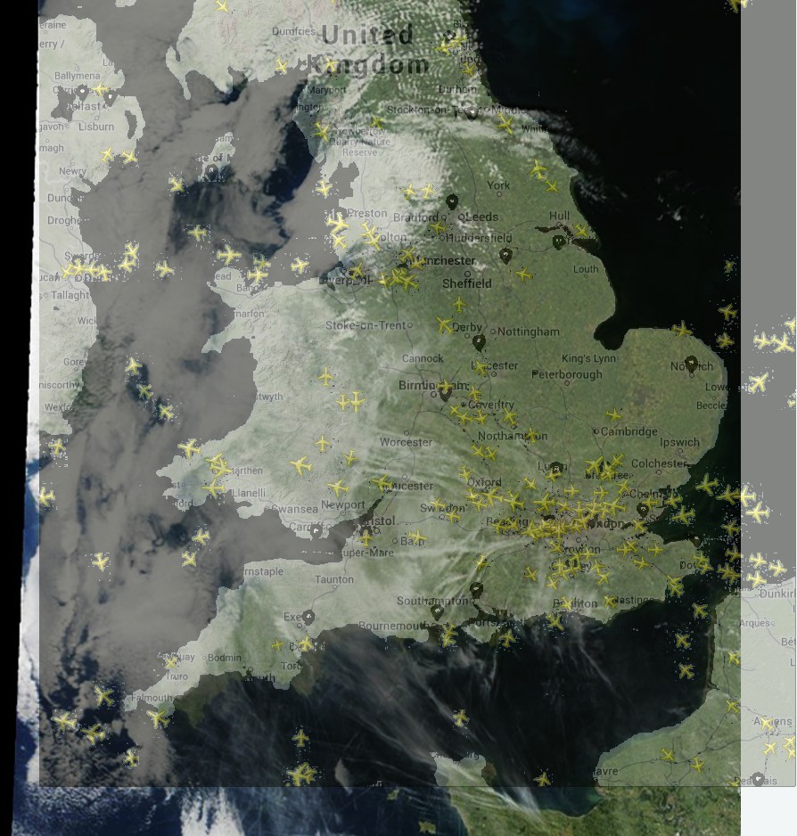
Overlaying a current satellite image, with a current FlightRadar24 image.
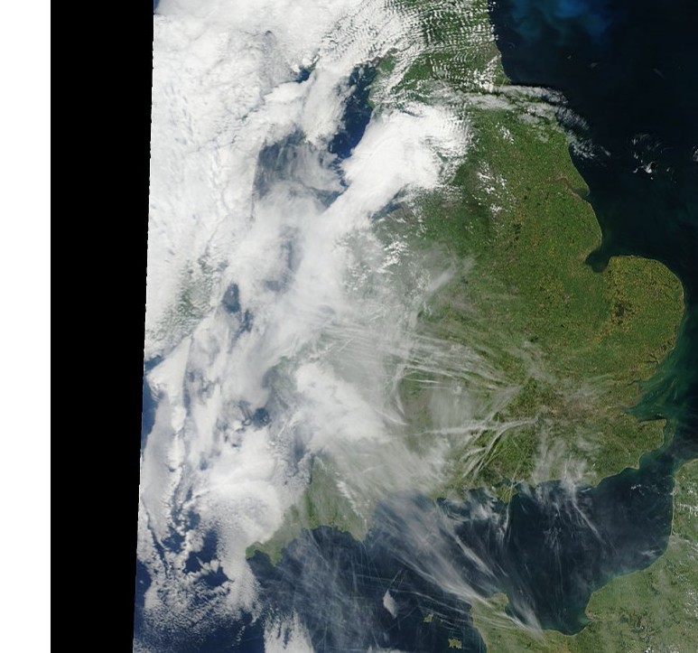
Today 7/15/13, there were MANY clear contrails over England, as seen below in today's MODIS satellite image.
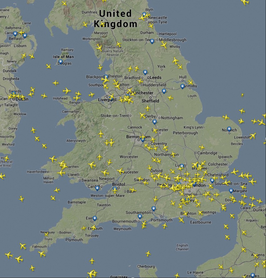
Then I took a snapshot of the current air traffic......and then combined them into one image.
They are not aligned perfectly in "time", but close enough because the flight paths among commercial airliners is generally the same day-to-day, all day long.
Both images were sourced fairly close in time, on the same day.
There is only one satellite image from MODIS each day....every day.
As I learn more about these sites (tracking/satellite) and how to align them in "time", I am confident I should be able to demonstrate this even better. Perhaps
This could help counter the claim that it's "mysterious unmarked military planes" leaving the trails.
I hope be able to capture a plane pretty near it's very own trail, when combining the two images (overlay).......if I know the upload time of the MODIS image, and factor the delay time of the tracking software.
Advice or tips, appreciated")
Quite an impressive view of trails.....
Next is the FlightRadar24 image from today.....
Here are the two images overlayed.....
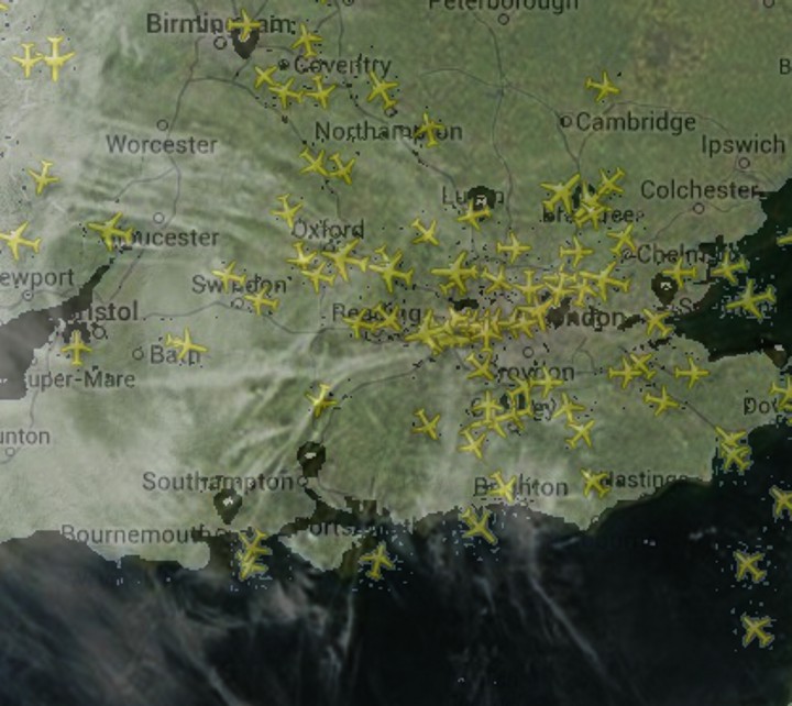
Detail of the London area....
http://www.flightradar24.com/
http://earthdata.nasa.gov/data/near-real-time-data/rapid-response/modis-subsets
Overlaying a current satellite image, with a current FlightRadar24 image.
Today 7/15/13, there were MANY clear contrails over England, as seen below in today's MODIS satellite image.
Then I took a snapshot of the current air traffic......and then combined them into one image.
They are not aligned perfectly in "time", but close enough because the flight paths among commercial airliners is generally the same day-to-day, all day long.
Both images were sourced fairly close in time, on the same day.
There is only one satellite image from MODIS each day....every day.
As I learn more about these sites (tracking/satellite) and how to align them in "time", I am confident I should be able to demonstrate this even better. Perhaps
This could help counter the claim that it's "mysterious unmarked military planes" leaving the trails.
I hope be able to capture a plane pretty near it's very own trail, when combining the two images (overlay).......if I know the upload time of the MODIS image, and factor the delay time of the tracking software.
Advice or tips, appreciated
Quite an impressive view of trails.....
Next is the FlightRadar24 image from today.....
Here are the two images overlayed.....
Detail of the London area....
http://www.flightradar24.com/
http://earthdata.nasa.gov/data/near-real-time-data/rapid-response/modis-subsets
Last edited by a moderator: