
Posted on Facebook:

This is a real cloud seeding report, from:
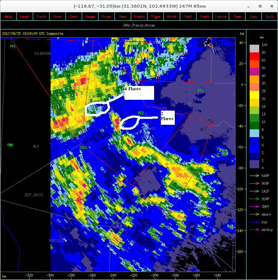
http://wtwma.com/Daily Operations/TPWMA/08242017T.pdf

However it describes cloud seeding on August 24, in Reeves County, over 500 miles from Houston. And as you can tell from the brown nature of the ground, it has a very different climate to Houston.
And on that day Harvey was 800 miles away.

Just because one region 500 miles away is getting a lot of rain, it does not mean that they don't want more in Reeves county. They are untouched by the Hurricane, and they were on that day, and still are now.

The West Texas Weather Modification Association lists its activities here:
http://wtwma.com/operations_page.htm
With a like to current activities:
http://wtwma.com/Daily Operations/TPWMA/
Which has:
In context:


This is a real cloud seeding report, from:
http://wtwma.com/Daily Operations/TPWMA/08242017T.pdf
However it describes cloud seeding on August 24, in Reeves County, over 500 miles from Houston. And as you can tell from the brown nature of the ground, it has a very different climate to Houston.
And on that day Harvey was 800 miles away.
Just because one region 500 miles away is getting a lot of rain, it does not mean that they don't want more in Reeves county. They are untouched by the Hurricane, and they were on that day, and still are now.
The West Texas Weather Modification Association lists its activities here:
http://wtwma.com/operations_page.htm
With a like to current activities:
http://wtwma.com/Daily Operations/TPWMA/
Which has:
In context:
Attachments
Last edited: