Altitude and contrail persistence

Trailblazer

Moderator
Staff member
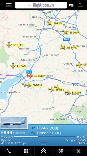
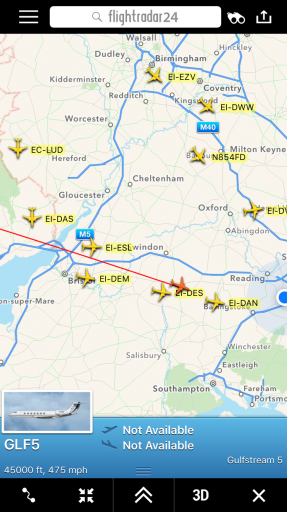
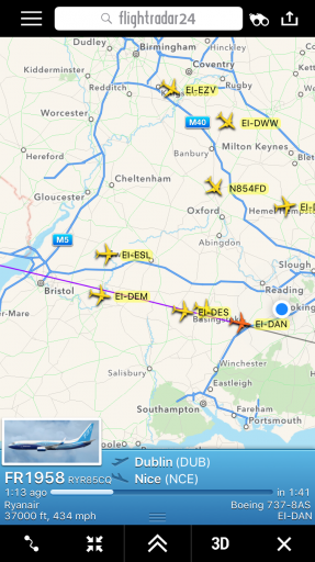
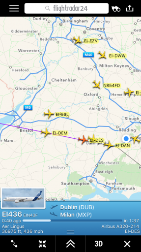
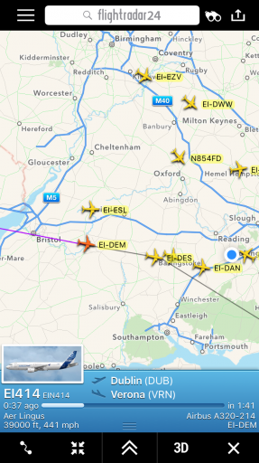
Looking out of my window around sunset this evening I noticed a succession of planes lining up from the west, all with short contrails except one which was leaving a lengthy persistent trail. I thought it would make quite a good illustration of how "adjacent" flights can be at very different altitudes, so I looked up the flights on FR24 and annotated the photo here:

trails copy.jpg

The only persistent trail is from the very high altitude private Gulfstream. The trails at 39,000ft and 41,000ft are slightly longer than the ones at 37,000ft, once you take into account the fact that they are much more distant.

That's not to say that higher flights will always have more persistent trails, of course. It depends on the atmospheric profile at the time,. Sometimes I've seen planes at 29,000 feet leaving persistent trails while those at 34,000 feet were hardly leaving any.
 
Last edited:
Here are the FR24 screenshots.

IMG_5408.PNG IMG_5409.PNG IMG_5412.PNG IMG_5413.PNG IMG_5414.PNG

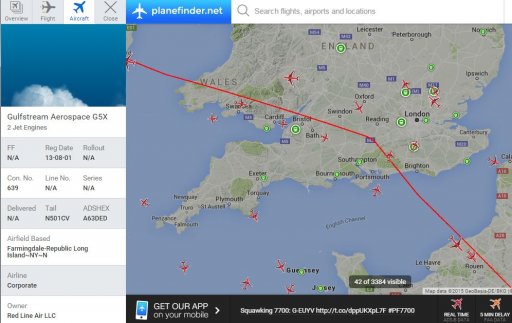
And confirmation of the Gulfstream registration from Planefinder.net, which tends to have more information for private aircraft than FR24 does.

n501.JPG
 
Last edited:
And here is a photo taken approximately 10 minutes after the one above, showing the trail persistence (it appears to have barely moved in 10 minutes, I think because the upper-level wind is almost parallel to the trail).

P1190036.jpg
 
Maybe you could find the sounding data from the closest weather station?
This is the data from Herstmonceux (about 60 miles southeast) for 00Z today, which is about 18 hours before the photo was taken.

86ab113be03f6221ccf5bc040c86d993.gif


FL450 is equivalent to 150 millibars. This sounding would suggest the highest humidity (in the region above 300mb) is at around the 190 millibar level.

Here is the text output:

upload_2015-9-30_21-26-59.png

Tonight's 00Z sounding may be more representative. I think radiosonde humidity readings are pretty suspect up at that altitude though.
 
From Camborne and Nottingham, 12Z data are available. Camborne shows only 2% RH at 13666 m, but Nottingham shows 51 and 53% at that altitude and only 22-23% at around 11200 m.
 
Tonight's 00Z sounding may be more representative. I think radiosonde humidity readings are pretty suspect up at that altitude though.

That's in the ball park region, if not the diamond, for the RH for contrail persistence.

That's easily a "success" in my book.
 
That's in the ball park region, if not the diamond, for the RH for contrail persistence.

That's easily a "success" in my book.
But it's not the right altitude, we should look at 45,000 feet i.e. cca 13,600 m where the sounding only shows 17% RH.
 
The Oct 1 00Z Herstmonceux sounding still only shows 17% RH at 13,700 m, no luck here.
 
Spotted something similar this morning

WP_20151002_07_29_27_Pro.jpg

An Air Canada 787 leaving a persistent trail at 39000ft

can.JPG

And a Thomson Airways 757 climbing through ~35000ft heading for 37000ft leaving a short trailtom.JPG
 
Last edited:
Back
Top