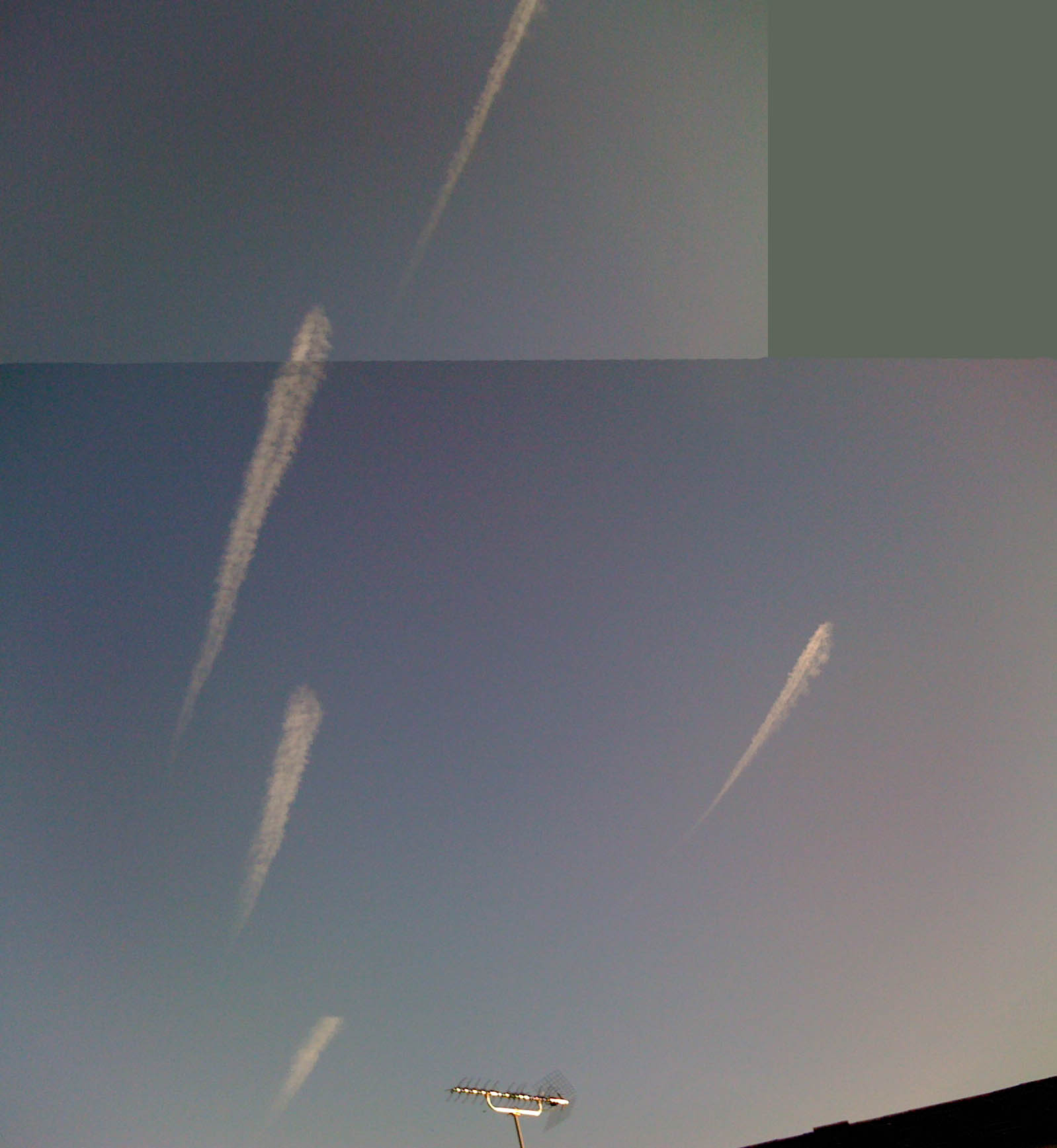
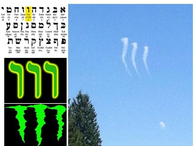
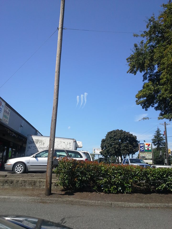
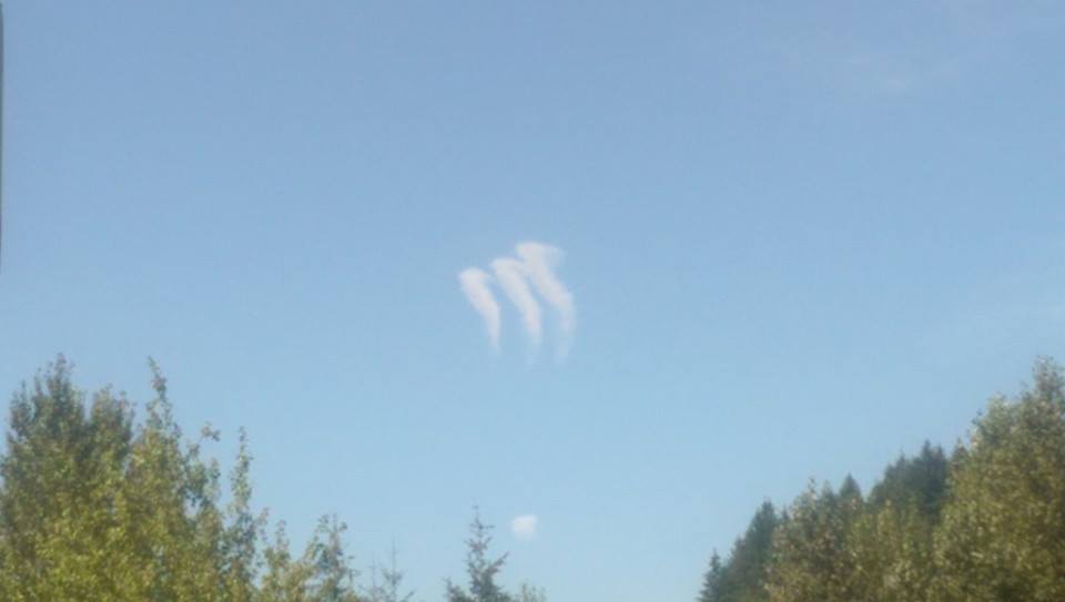
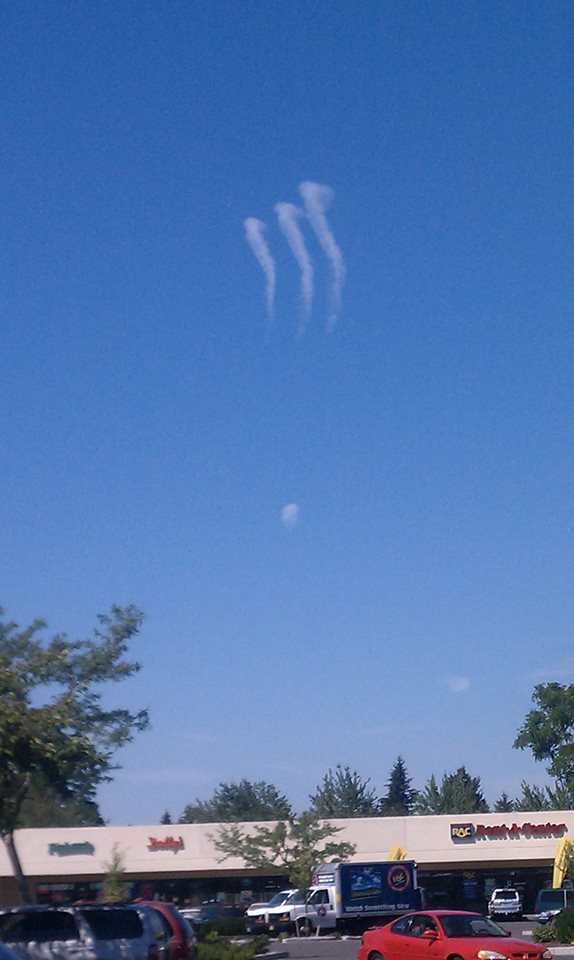
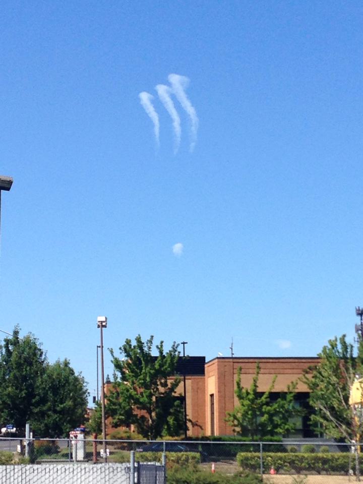
I have found two photographs which are relevant to the case despite they do not depict these particular contrails.
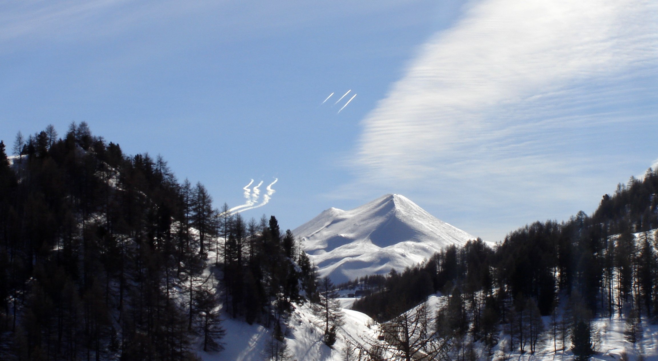
The first is from Portland, depicting the Steel Bridge with some short tapered contrails above:
 https://www.flickr.com/photos/126136136@N03/14796616232/sizes/o/
Alas, it is an instagram without exif data or time stamp. The arrangement of contrails is clearly different from OP and probably represents those from sequential descent of commercial planes. The location of the image is readily identifiable, adding it to GE shows the heading to these contrails is about 21° from the North.
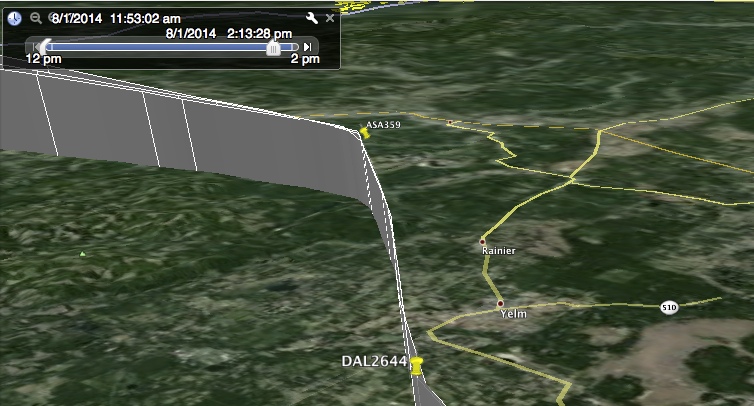
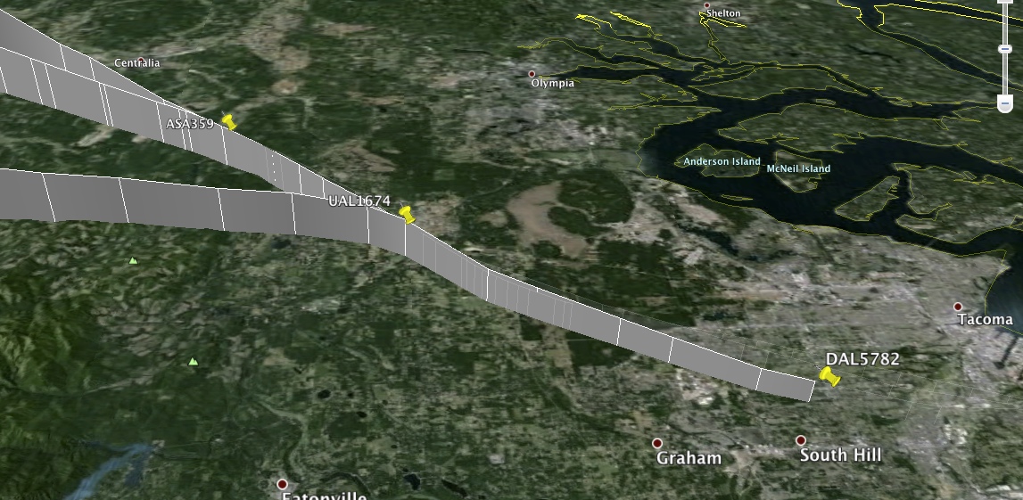
This heading crosses the viewing line(s) from the OP pictures north of Battle Ground (WA):

The second picture is cropped from the
Aqua satellite image of this area taken 7-31-2014 at 21:39 UTC.

It shows a short (only about 3 miles long) young contrail in this area and a couple of older short probable contrails further north. From the
FR24 playback, the most likely candidate for the young contrail is ASA611 that descended through the spot at 21:31 UTC. It was at 31,000 ft at the time that suggests the probable altitude of shallow wet layer. The next flight SWA362 descended through the spot at 21:39, so its contrail would not have time to spread out to be seen by the satellite.
Putting the satellite and FR24 data on Google Earth shows that the image of the young contrail is about 13 km to the East of the plane route. The most of this distance (about 9 km) can be attributed to a non-orthogonal projection of the contrail to the ground (the satellite was to the West from the area at estimated altitude of 40-50°), the rest (4-5 km) to the contrail displacement by westerly wind. The pictures in #4 show that there was a westerly component of the wind.

The section of actual route shown in cyan, the contrail projection in magenta and its estimated location in blue.
I've raised these segments to altitude of 9 km on Google Earth and looked at them from the known locations.


There is a good agreement with the contrails from the bridge picture, but the three OP contrails appear higher and therefore closer to the camera. Only the shortest, fourth contrail looks a bit lower and further than the modelled one, but given a large margin of error in these fitting, it probably is in the same general area. Its non-descript shape suggests that the short contrails from commercial planes were formed too far to produce such a spectacular pattern in the area where the OP contrails have been observed.
I uploaded a kmz file (
Short contrails OR|WA.kmz) with all these pictures and fittings.


")