Photos of Planes and Contrails (That you took yourself)

Noticed these 2 contrails yesterday here in "flyover" country...the older one really spreading laterally with the prevailing upper winds. The younger one happened to be a NASA flight from Palmdale, CA to Hamburg, Germany.

Novcontrails.jpg Novcontrails2.jpg FLTRDR24.png
 

Attachments

  • Novcontrails.jpg
    Novcontrails.jpg
    143.8 KB · Views: 469
Another "corkscrew shaped" contrail. Presumably an illusion due to the pendules being blown one way and then the other, rather than the whole trail actually being twisted.

IMG_7955.JPG

Nine minutes later:

upload_2017-11-27_12-35-20.png
 
Last edited:
A lot going on in this sky- multiple contrails criss-crossing but what really caught my eye was the Kelvin wave cloud...was so much cooler looking 5 minutes before I got my "camera"...(and in person- sorry for the crappy pic quality)

Wavecloud.jpg

WCL.jpg
 
A nice long fall streak over Bakersfield, California. 3:40 pm, January 1. This was a 3 frame shot using the panorama setting. DSCF1050b.jpg
 
A nice long fall streak over Bakersfield, California. 3:40 pm, January 1. This was a 3 frame shot using the panorama setting. DSCF1050b.jpg

A possible candidate. After having watched the direction of it's drift and time it took to deteriorate. AS3497 flying from Burbank to San Jose reached it's cruising altitude about the time it was alongside the I-5 sign just south of Wheeler Ridge, it maintained an altitude of 26,000 ft., it began it's descent just a minute or 2 after I stopped the playback to take the screen capture, just south of Blackwell's corner.

Untitled.jpg
 
A nice long fall streak over Bakersfield, California. 3:40 pm, January 1. This was a 3 frame shot using the panorama setting. DSCF1050b.jpg

I contacted Meteorologis Miles Muzio of KBAK Channel 29 TV here in Bakersfield, ran my photo and the plane track by him. He provided me with a satellite loop of the fallstreak. The full loop can be viewed here: http://rammb-slider.cira.colostate.edu/?sat=goes-16&sec=full_disk&x=4190&y=4076&z=5&im=12&ts=1&st=20180101230038&et=20180102000038&speed=130&motion=loop&map=1&lat=0&p[0]=16&opacity[0]=1&hidden[0]=0&pause=20180102214539&slider=-1&hide_controls=0&mouse_draw=0&s=rammb-slider

zoomin.jpg
 
Last edited:
I contacted Meteorologis Miles Muzio of KBAK Channel 29 TV here in Bakersfield, ran my photo and the plane track by him. He provided me with a satellite loop of the fallstreak. The full loop can be viewed here: http://rammb-slider.cira.colostate.edu/?sat=goes-16&sec=full_disk&x=4190&y=4076&z=5&im=12&ts=1&st=20180101230038&et=20180102000038&speed=130&motion=loop&map=1&lat=0&p[0]=16&opacity[0]=1&hidden[0]=0&pause=20180102214539&slider=-1&hide_controls=0&mouse_draw=0&s=rammb-slider

zoomin.jpg
Am I looking at the right streak? It doesn't seem to match the flight path. Or is it the long trail to the right of the curved streak?
 
Am I looking at the right streak? It doesn't seem to match the flight path. Or is it the long trail to the right of the curved streak?
How long does it take for a fallstreak to take shape? There's a third one that forms between the second and 3rd frame. FR24 showed AS3497 started it's descent at about 23:08 or 23:09. It shouldn't have been in the first frame, now that you mention it.
 
Last edited:
The Sun was about 3 minutes from sunset and I got this photo. In the photo you can clearly see the shadow of the 3 birds and the contrail on the upper cloud layer (I do not remember seeing the shadow maybe because I was looking at another plane which was in the South and I just randomly snapped this picture without properly looking in the viewfinder), guess it should go in debunking of flat Earth.

Recovery 252.jpg
 
this relates to https://www.metabunk.org/posts/216735/

Singapore SQ297 bird back over my head 630 am 11/1/18 on its way to Christchurch New Zealand & this time i was able to show the RH at 250hpa was ideal for exhaust contrails.. Im hoping now to catch & show it above me but on day that does not support contrails.

thumbnail_WP_20180111_001.jpg

sq29711th.PNG


RH25000vic.PNG
 
Last edited:
From 7+ miles away it looked like a near miss. The 2 photos were taken were taken 6 seconds apart. This was taken with a 30X's zoom.

DSCF1144.jpg DSCF1145.jpg

Flight radar only showed one of the planes.
WN329.jpg
 
Flight radar only showed one of the planes.
WN329.jpg
Are you sure you have the right plane there? I don't see that flight on Planefinder, but I do see these two:

upload_2018-1-24_17-8-57.png

That's SU107 and WN5370. The heights seem off for your photo though.

I don't see WN329 going anywhere near Bakersfield at that time.
 
UTC time was about 23:54, my camera reads 23:51 and is off the FR24 clock by 3 minutes. I often see SU 107, he always has a blue belly. Feb. 6, 2017 was the last time I photographed him.

SU107.jpg FR24.jpg

I didn't turn on the FR24 until after I had taken the photo and only saw WN329. I turned on planefinder, by that time they were already 40 miles north, at that time it showed 2 planes, I thought I had them, so I went to playback to get the info at the time of my photo, neither plane showed on playback and when I went back live, only WN329 was showing.
 
Last edited:
From 7+ miles away it looked like a near miss. The 2 photos were taken were taken 6 seconds apart. This was taken with a 30X's zoom.

DSCF1144.jpg DSCF1145.jpg

Flight radar only showed one of the planes.
WN329.jpg
I think that the white plane is a Boeing 777 flying significantly higher than the red B737. Unfortunately, as the Metabunk software resizes big photos, its magnified image is not at the full camera resolution.
Could you please crop the planes from the original photos and repost them.
 
I think that the white plane is a Boeing 777 flying significantly higher than the red B737. Unfortunately, as the Metabunk software resizes big photos, its magnified image is not at the full camera resolution.
Could you please crop the planes from the original photos and repost them.
How's that?

DSCF1144b.jpg DSCF1145b.jpg
 
How's that?

DSCF1144b.jpg DSCF1145b.jpg
Well, two black spots on the bottom now look more like the 737 gear, so I agree with Mick on this. However, compared to the red plane, the white plane seems to be a more recent model with winglets and stretched fuselage, so I think it was higher by one or two thousand feet than the red one.
 
are you sure your date is right? 1/22 this plane was traveling near WN329.. at that exact time.
1-24-2018 6-01-02 PM.png

(of course there is another plane nearby you probably would have seen too. )
 
These are likely candidates, both by types and colours. Just about five minutes later. The red SWA5952 at 34,000 ft; the white UAL1755 is at 40,000 ft:
Screen Shot 2018-01-24 at 23.14.49.png

Check your camera against actual time, not that on FR24 display.
 
These are likely candidates, both by types and colours. Just about five minutes later. The red SWA5952 at 34,000 ft; the white UAL1755 is at 40,000 ft:
Screen Shot 2018-01-24 at 23.14.49.png

Check your camera against actual time, not that on FR24 display.
Way too far west, I'm very familiar with the position of that flight path from my house. The 2 planes flew almost directly overhead. In my FR24 image, you see the little yellow dot under the r and s of Bakersfield.

WN329.jpg

That was the Highway Patrol Helicopter, there was an accident on the freeway, I live 1 block from the freeway and he was circling low directly over my house, that's what drew me outside to see what the commotion was.

DSCF1143.JPG

Taken at 3:51:04 pm PST, I turned and saw the 2 planes approaching. At the moment of typing this my camera says 4:31 pm flight radar shows 00:34.
 
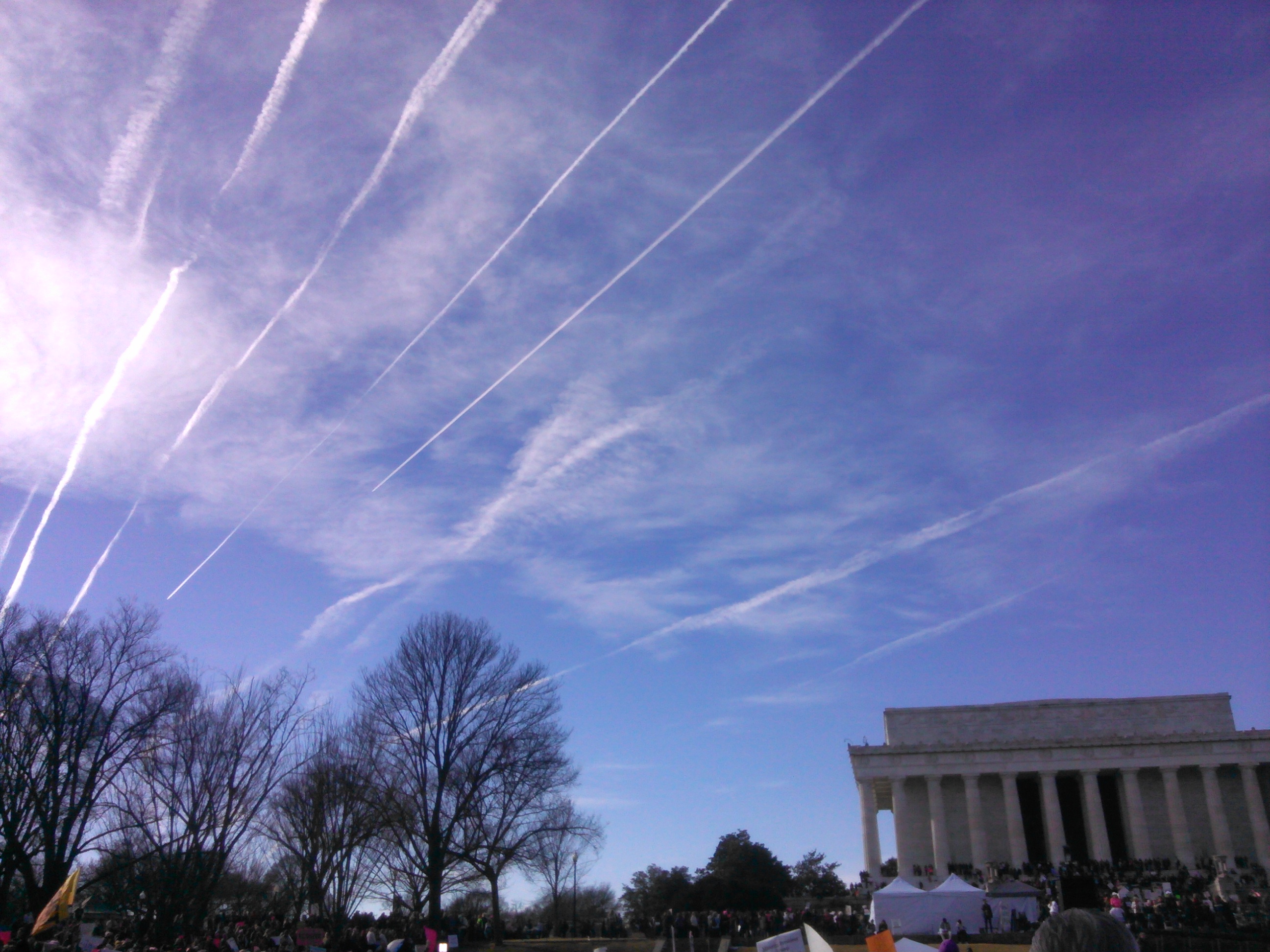
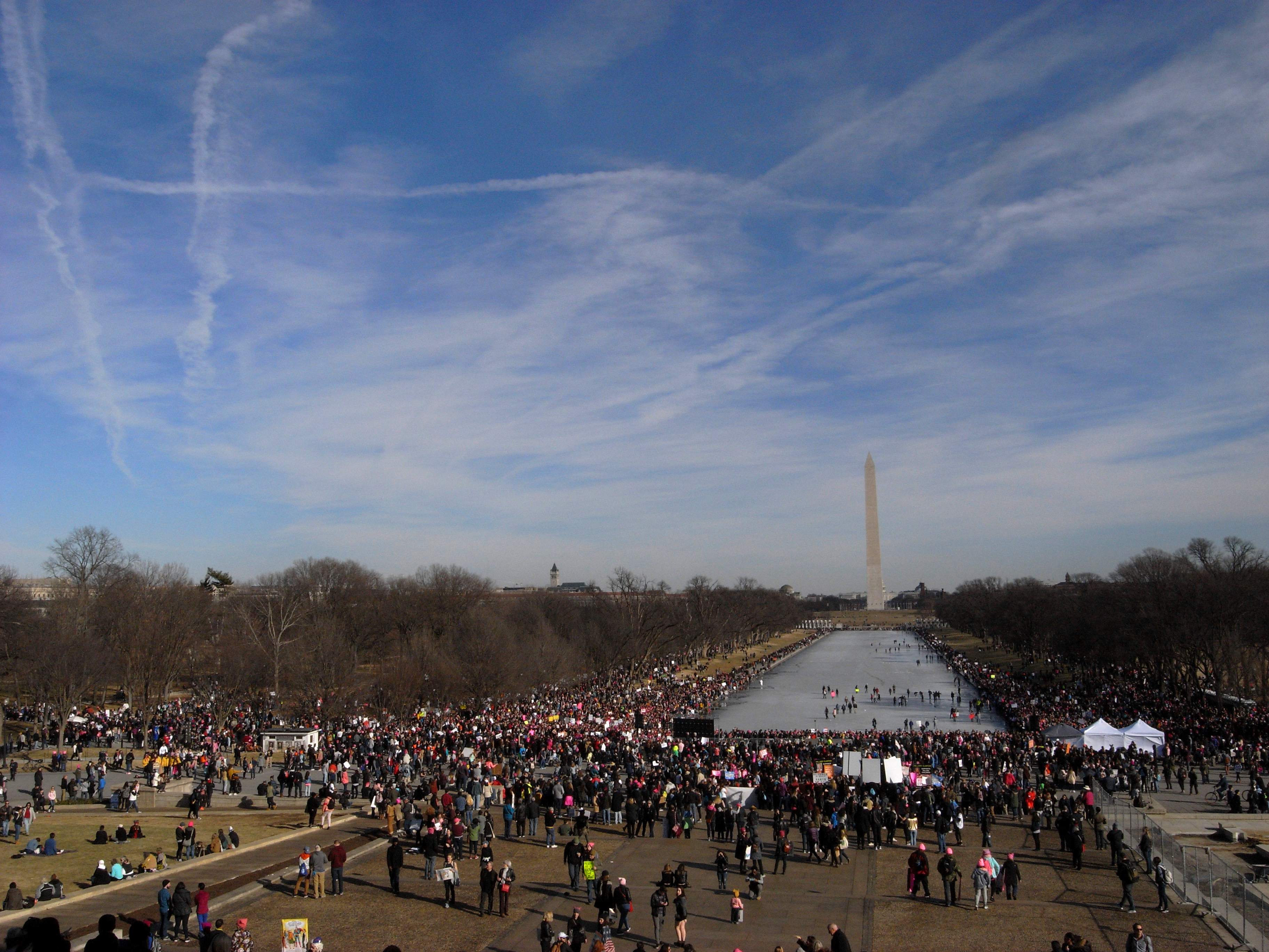
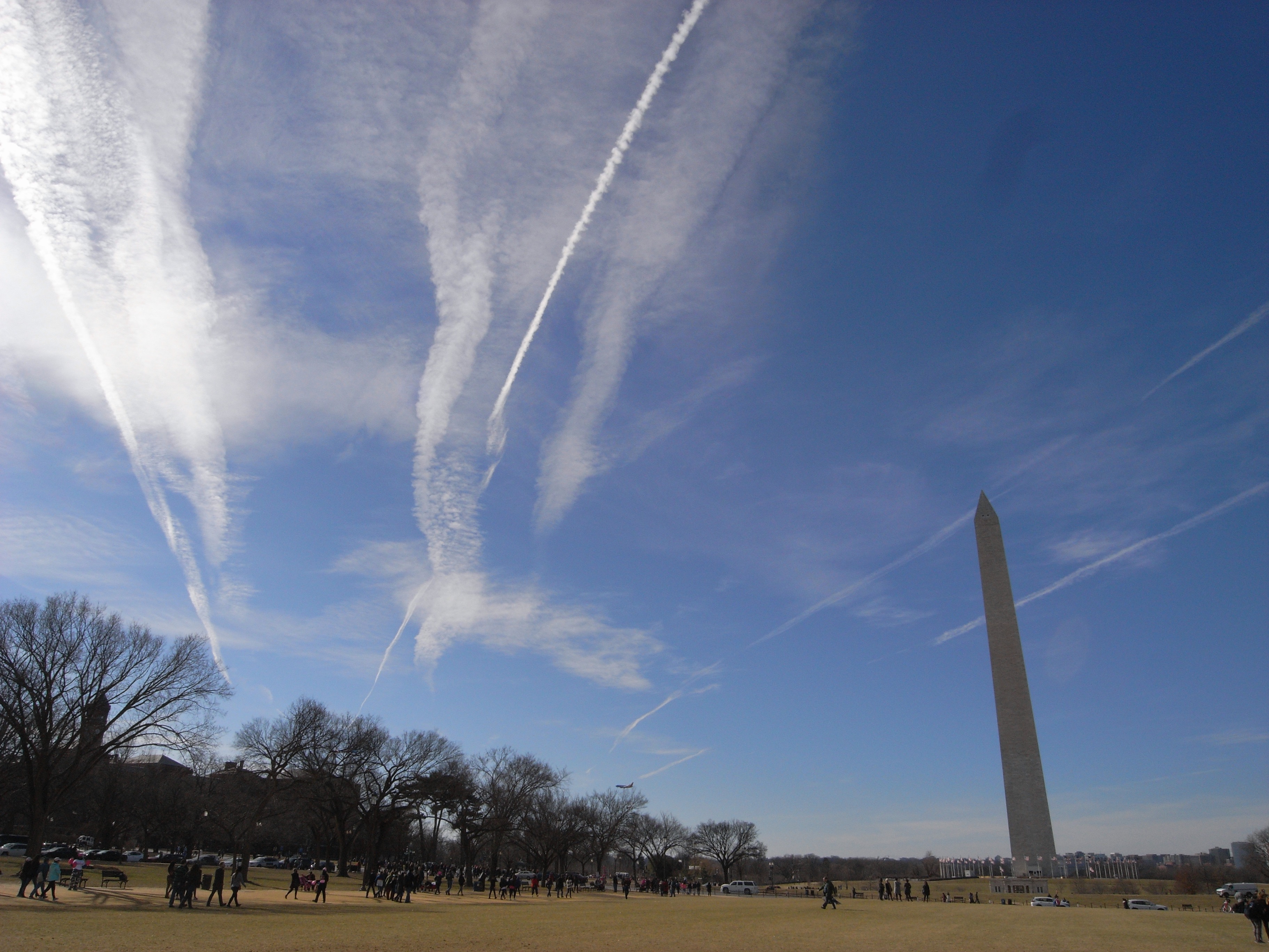
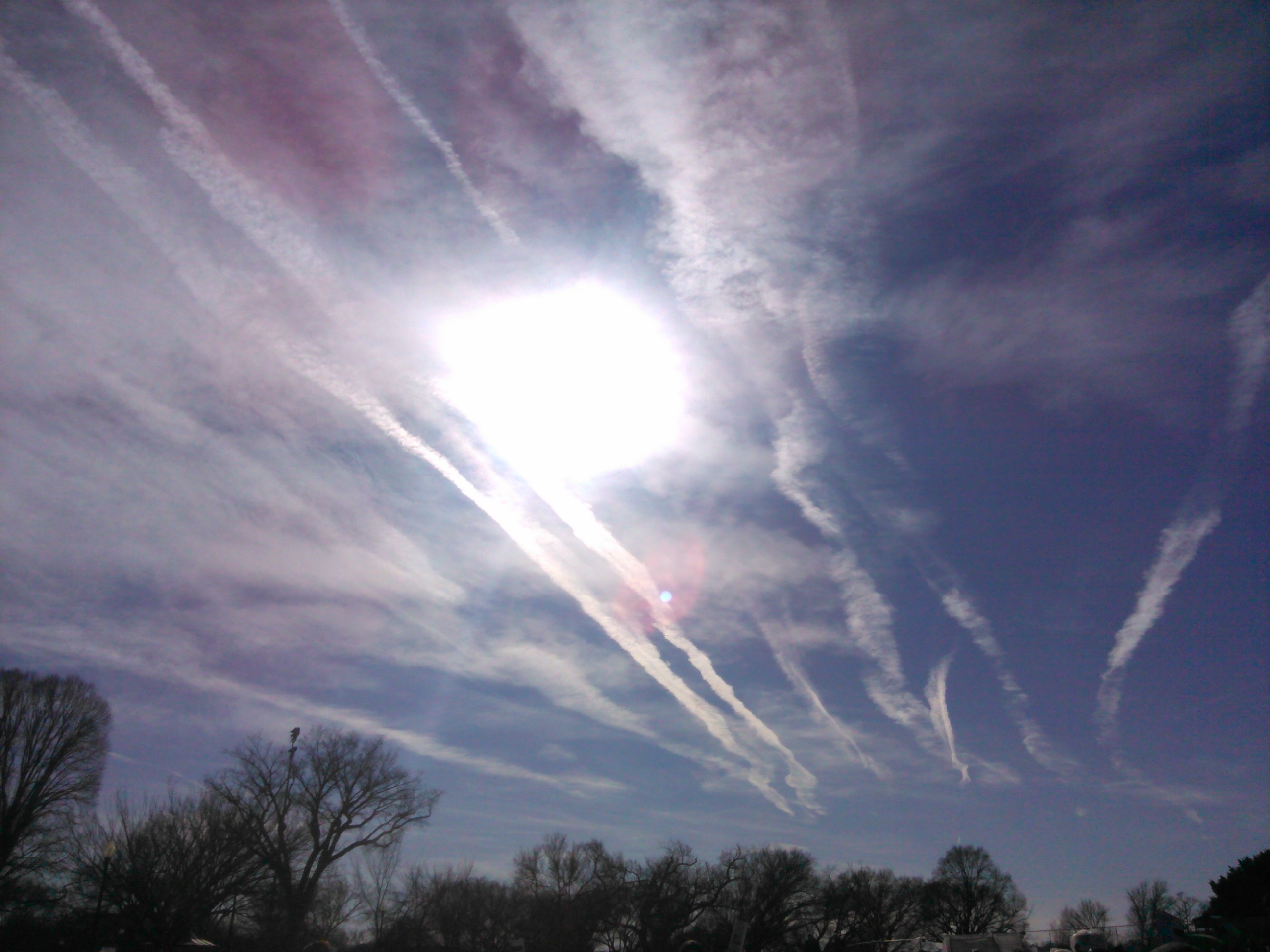
Here are some contrail photos I took in Washington, DC on Jan 20, 2018, from approx 1:30 to 3 pm. Whatever the exact mechanics of contrail preservation are, they were in effect that day along this air corridor...


Here are a battalion of new trails, which thereafter spread out...


Here are some contrail photos I took in Washington, DC on Jan 20, 2018, from approx 1:30 to 3 pm. Whatever the exact mechanics of contrail preservation are, they were in effect that day along this air corridor...

DC was just on the edge of an area of high humidity that afternoon. (This chart is 1pm DC time)

upload_2018-1-26_10-20-5.png

I often find that contrails can be more striking at the edge of a big area of high upper-level humidity rather than when you're smack in the middle of it, as you often get less natural cloud. Also the sudden appearance of trails on one side of the sky but not the other can catch your attention more.
 
Back
Top