Trailspotter
Senior Member.
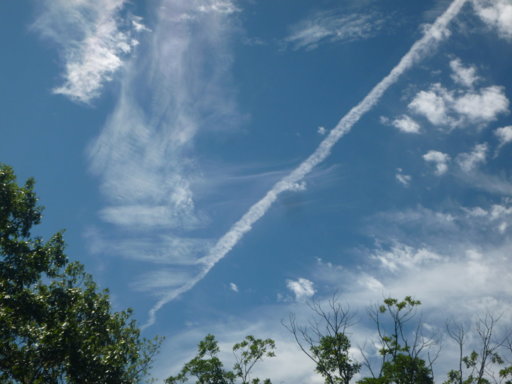
It's called 'distrail'.It disturbed the cirrus, and left a trail of it's own....

It's called 'distrail'.It disturbed the cirrus, and left a trail of it's own....
There was an almost identical photo (bottom left) posted on Chemtrails Global Skywatch yesterday from someone living in Bracknell:


I think this is a distrail ?? on the edge of some clouds. the sun is setting so I think if it was a shadow it is on the wrong spot ?? (the dirt smudges are either my window or something with the camera up against the window)

That's a textbook thunderstorm anvil ... An exhibit for the WMO cloud atlas perhaps.LA to Orlando . Over Arizona


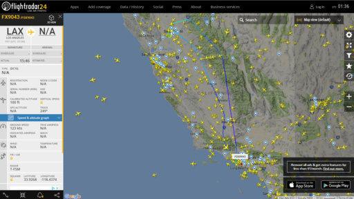
They almost certainly were the same plane, DC10 N307FE. I've seen similar FR24 'glitches' before on passenger flights, where two flights were merged (due to cancelation or other reasons). BTW, planefinder.net playback shows only one flight, FDX9000:Were 9000 and 9043 the same plane with a glitch? I could clearly see 1 before the trail started, I never saw 2 planes, and they were always right on top of each other showing pretty much the same altitude and speed..

There are no reports on any incidents with this plane yesterday (yet), e.g., in http://avherald.com/.
From the recorded track, the plane attempted to land in Sacramento, missed approach and then returned to LAX. Or all this was just a training exercise, including fuel dump.
It could be a minor incident thad did not require emergency landing. I gathered that not all minor incidents are reported promptly, if reported at all. The plane in question had a reported incident earlier this year. Keep checking Aviation Herald for the next few days, or report your observation to them, they may check themselves whether it was an incident or training exercise.I'd also think that if a plane was in distress they'd put the other planes coming into and out of Sacramento into a hold while it was attempting to land. While it did it's 2 circles several other planes did land.
Did the trail spread out like a contrail before it disappeared?It was on for about 2 minutes, then stopped. The trail was visible for just a couple of minutes.
Did the trail spread out like a contrail before it disappeared?


Is that a GPS altitude? The reported altitude (ie flight level) was 40,000ft according to FR24.Quite a high persistent contrail, but some way of the record.
Is that a GPS altitude? The reported altitude (ie flight level) was 40,000ft according to FR24.
The sea-level pressure is only about 1021mb so I wouldn't have thought that would account for such a difference in pressure altitude, although it is quite a warm airmass which would make the levels higher.