National Scout Jamboree 2013

Status
Not open for further replies.
So protecting kids from predators--human is a problem now for you?

It NOT owned by Bechtel, no matter how many times you imply it is. They donated a bunch of money for it, that is all.

I guess you would think the Hunt or Hill family owns the Margaret Hunt Hill bridge in Dallas

http://en.wikipedia.org/wiki/Margaret_Hunt_Hill_Bridge


Or that grade school student Klyde Warren owns a deck park in Dallas. (His dad was a major donor, just like with the bridge and that family.

http://en.wikipedia.org/wiki/Klyde_Warren_Park
 
Well, who could blame you? You got some of the twigs and trees, albeit in a twisted form, but you missed the forest entirely. It was about how the crazy ideas of moonbats are formed in reaction to what on the surface seems like an outlandish idea.

If all you do is focus on the twigs and branches and never examine the roots, you will never see that any issue clearly. After all, they call it the surface for a reason. It means there's something else underneath.

Do you have any evidence? No, then let's move on.
 
In google earth I see a "strip" passing through Glastonbury that is fairly obviously a "3rd photo" - it there's a photo to the left, and a photo to the right, and this strip is about 70 m (0.07km according to the ruler) wide between where those photos do not overlap and it looks a bit different - some of the foliage is a different colour, some of the fields have sheep in this strip but not outside or vice versa.

It is aligned 0.71 degrees according to the ruler - not sure that's what you see or not?

Sorry, it's West Virginia I was refering to, Garden Ground Mountain, location of the site. The reference to south west England and druidism was more a passing thought about alleged alignment between Washington Monument (is it?), the obelisk in New York and Stonehenge or Avebury stone circle, can't recall. Tried getting a variety of Android screenshot apps to work but to no avail. I got the scale wrong, it is perhaps ten or fifteen miles, cuts like stitching through Garden Ground. I mean, aside the peculiar straightness, considering it traverses a rugged terrain, it seems to alternate. One minute there's a road, then no road just woods, then road, then woods, and punctuated by white dots. Zooming in the dots are like extremely irratic paint has been thrown all over the ground in a scribble-loke motion, particularly at the intersection of this line with the fork in the Mill Creek Road, just north east of the designated spot for the site on Google map. Perhaps these are markers for the Google map team, enabling them to see points on roads beneath the alpine canopy. Just looks odd, stitched.

It happens to be in the map grabbed by Van Der Beek in his Youtube video, just below where the site is designated, cutting across. I thought perhaps it was one of these over-lapping irregularities one often sees, as you rightly say, but the line also appears on (what I would call) the Ordnance Survey map, very subtly cutting right across it in a dead straight north-easterly direction, from Hope Mountain to the New River by McKendree Road, where the second map indicates a river crossing but there's no bridge, at least, it is not on Google. The bridge is a mile upstream. It must be a tunnel under the river. So I wonder if this line cutting right across Garden Ground is also underground. I thought perhaps it is an old railway tunnel, delineated on the surface, but I doubt it and it does not correspond with the old railway maps in that respect. Certainly were many coal companies and railways on the mountain a hundred years ago.
923219_564608260251009_1924896671_n-1.jpeg
 
Royal College of Psychiatrists, London, on mass hysteria and sociogenic disorder:

Protean Nature of Mass Sociogenic Illness
From Possessed Nuns to Chemical and Biological Terrorism Fears
http://bjp.rcpsych.org/content/180/4/300.full

Mass sociogenic illness refers to the rapid spread of illness signs and symptoms affecting members of a cohesive group, originating from a nervous system disturbance involving excitation, loss or alteration of function, whereby physical complaints that are exhibited unconsciously have no corresponding organic aetiology. In the standard psychiatric nomenclature, mass sociogenic illness is subsumed under the general heading of ‘ somatoform disorder’, subcategorised as ‘conversion disorder’ or ‘hysterical neurosis, conversion type’ (American Psychiatric Association, 1994).
Content from External Source
 
In google earth I see a "strip" passing through Glastonbury that is fairly obviously a "3rd photo" - it there's a photo to the left, and a photo to the right, and this strip is about 70 m (0.07km according to the ruler) wide between where those photos do not overlap and it looks a bit different - some of the foliage is a different colour, some of the fields have sheep in this strip but not outside or vice versa.

It is aligned 0.71 degrees according to the ruler - not sure that's what you see or not?

Phone's being a pain in the proverbial, unable to upload the detailed map even though it's only 1.6MB. One more try... The line I am referring to isn't an anomaly or error in Google Maps as it appears here, also >>

Nope, won't upload :) I will find it's web location and link to it.
 
So protecting kids from predators--human is a problem now for you?

It NOT owned by Bechtel, no matter how many times you imply it is. They donated a bunch of money for it, that is all.

I guess you would think the Hunt or Hill family owns the Margaret Hunt Hill bridge in Dallas

http://en.wikipedia.org/wiki/Margaret_Hunt_Hill_Bridge


Or that grade school student Klyde Warren owns a deck park in Dallas. (His dad was a major donor, just like with the bridge and that family.

http://en.wikipedia.org/wiki/Klyde_Warren_Park

Yes I'm aware that having one's name tied to something isn't the same as ownership. I never implied Bechtel own the site. I am not altogether sure who does own it. The mountain was formerly shared by army corps and the New River Gorge National River, I think. I presume the land for the camp was the army's. Bechtel's donation secured the land, as to whether that was, for example, a one hundred year lease holding, or outright ownership for the BSA, I do not know, but presume the latter, given the money invested in infrastructure. I don't understand why ownership is important to you. You don't need to own or work for an entity to exert influence, ask any non-executive chair, or trustee, and corporations do not give, necessarilly, out of the goodness of their philanthropic hearts. 50 million dollars exerts considerable weight; to what end, I have no genuine idea.

As for safety, again, it isn't a question of not caring about the safety of scouts, it is a simple pointer, to an obvious culture of fear in the states, and a simple fact, that a wall restricts movement on both sides of it's divide.
 
In google earth I see a "strip" passing through Glastonbury that is fairly obviously a "3rd photo" - it there's a photo to the left, and a photo to the right, and this strip is about 70 m (0.07km according to the ruler) wide between where those photos do not overlap and it looks a bit different - some of the foliage is a different colour, some of the fields have sheep in this strip but not outside or vice versa.

It is aligned 0.71 degrees according to the ruler - not sure that's what you see or not?

Finally, it uploads. As I was saying, the line I was referring is also on 'proper' maps. The line goes from a town called Bradley, then appears approximately two thirds of the way up the map and goes north-easterly to the river's edge, and is then signified as crossing the river at that point (where there is no apparent crossing). Bechtel also bought considerable land for the scouts on the other side of the river despite there being no access across the river on their property, aside boats, I suppose. I looked up the topology for this line (four dashes then a dot, and highlighted) on the National Geographic site but couldn't establish what it means within symbol lists of boundaries, roads, tunnels etc

Just curious, I know, the obvious thing to say is it is a road, and I know in saying that it looks too straight the Romans built very straight roads thousands of years ago, it just struck me as very odd, the way on Google maps it appears, then disappears, then reappears, in a perfect "stitched" line of delineation without purpose, and that this particular map (here) indicates a river crossing that is not on Google (to the mainline rail and a back road on the other side, and where similar lines converge as if to meet this line, but without purpose as there is no crossing). There are also, I believe, some of the very oldest and deepest mine shafts in America along there by Stoney Cliff Bridge (which very much does exist as a crossing, a mile upstream). I live in the Black Country, famed in a by gone era for coke, lime, iron, the cradle of the industrial revolution. The whole of the Black Country resembles a huge piece of swiss cheese, meaning it is riddled with holes and deep excavations from mining, I should imagine that mountain is too. Anyway, that was the anomolous feature of the map. I could, and do, spend far too long engrossed in cartography.


Garden_Ground.jpeg
 
The railway and mining companies that had interests on top of and below the mountain in days gone by (turned 90 degrees for comparison with the map above, illustrating where they would be have been on the mountain that is now the camp site.
2013-07-13 20.22.18.png
 
And the link I posted shows that. It has been too long since I played with top maps, I need to remedy that.
 
What's the question Boodles? The straight lines are power lines.

Good thinking, had escaped me. Certainly looks peculiar on Google's satelite maps, the intermittancy of the lines, I guess some parts of the forest through which it passes need clearance more than others, hence roads to nowhere. As I said, there are freaky looking marks along that line, I thought perhaps the white spots were chalky stone in the summer heat, now I assume it's Google technicians obliterating infrastructural information with tip-ex (or the digital equivalent). Or neither, I do not know. If you search "The Summit: Summit Bechtel Family National Scout Reserve" on Google Map (not Earth) and go up 200 or so metres east from the Google tag, to the intersection of the line with Mill Creek Road you'll see what I mean. Looks like a truck was driving back, fourth and around spilling half a ton of paint.

Wasn't a question as such, just struck me as odd looking. My original passing reference to lines and Glastonbury triggered a flight of fancy regarding alleged alignments between historic monuments on the north east American coast and druidic monuments in England, gleaned from this video below, I think, which unlike many other Youtube uploads with far-fetched notions such as architectural owls in the 'plan view' of Washington DC - seems to have a reasonable basis in sound geometric principles, which I found fascinating, particularly with respect to the location of the Supreme Council of the 33rd degree, and his lateral projections to neolithic England, via New York. Should anyone have the means to debunk the latter assertion, be my guest. I can't from a cell phone! Yes, this one I think (haven't bandwidth to double check). Seasoned debunkers and many others have probably seen at least pieces from this extensive video, Secrets in Plain Sight. I know skeptics will be discouraged by the title but the geometric principles seem sound to me (I just hope I'm linking to the right piece):


Whilst I'm being random (and thinking about electricity cables). I don't know if police forces in the US are doing this but the Metropolitan Police in London have been recording the sound of the electricity mains current for seven years, as a forensic tool to be used in the authentication of audio evidence. Sounds like a conspiracy theorist's paranoid imaginings but it is actually true. A professor at Colorado University discovered the pattern of the current's frequency over time is unique. It was only a matter of time before criminologists or police thought of a practical application. Yes, way off topic but I was reminded of the item and thought it might be of interest. Now no one can argue a recording took place on Sunday night when it was a Monday morning, the current leaves a temporal trace unique as a finger print.
 
For the last seven years, at the Metropolitan Police forensic lab in south London, audio specialists have been continuously recording the sound of mains electricity.It is an all pervasive hum that we normally cannot hear. But boost it a little, and a metallic and not very pleasant buzz fills the air.

"The power is sent out over the national grid to factories, shops and of course our homes. Normally this frequency, known as the mains frequency, is about 50Hz," explains Dr Alan Cooper, a senior digital forensic practitioner at the Met Police.Any digital recording made anywhere near an electrical power source, be it plug socket, light or pylon, will pick up this noise and it will be embedded throughout the audio.This buzz is an annoyance for sound engineers trying to make the highest quality recordings.

But for forensic experts, it has turned out to be an invaluable tool in the fight against crime. While the frequency of the electricity supplied by the national grid is about 50Hz, if you look at it over time, you can see minute fluctuations in the order of a few thousandths of a hertz.
Content from External Source
Randomness over. Article here: http://bbc.co.uk/news/science-environment-20629671
 
Very interesting, and amazing that a large national power grid would have such a time signature. In my work, I can control the 3 Megawatt power grid on the ship using a screen which allows adjustments for voltage and frequency. Below is the sort of screen which is also used to manually synchronize multiple generators. The circle represents the phase angle of the grid("Busbar"), and the square at 8:00 is the phase angle of the oncoming generator. When the square reaches 12:00, the generator circuit breaker is closed to connect the oncoming gen to the bus. The synchronization must be within close limits when a new generator is being put online, but there will be a small variation in frequency as it drags or bumps freq down or up due to the governor responding to new load. As recently as 20 years ago, much of this was done by hand, and in order to assist electric clocks to maintain accurate time a grid operator would periodically increase or decrease frequency by comparing a grid-powered clock to the National Standard time over radio.
Ordinarily, this function is automatically done by automation software.

synchroscope.jpg
 
I note this page is now being linked to, externally, had therefore better stick to the subject at hand.
 
Landru and Cairenn, you made some good points with respect to martial law and I have not been ignoring them. I am, however, typing from a three inch touch screen and it is inordinately difficult for me to respond to large text replies, with copy and paste, bits and pieces et cetera, this portal is not Android friendly. Absolute nightmare in fact, from a Samsung Galaxy. Will respond, presently.

(Edit: Should say it's the phone, rather than the portal or O.S)

Or rather, the ISP, which has slowed to zilch in the last few says, effectively a denial of service. Took two days just to achieve the uploading of a map. T'was formerly a nifty gadget. Heigh ho. Will reply when it lets me.
 
What is the subject at hand again? Could you recap specifically what the claim is?


The claim is not mine, I raised it here as it is current and ties in to greater or lesser extents with many topics debated here and elsewhere, around globalisation and the supposed NWO agenda, the role of secret societies, government, federal entities and the military, and the increasingly perceived role of false flag events by such agencies as a means to breed fear and legitimise draconian or authoritarian practices and leglislative measures in the fulfillment of such an agenda; that whole 'weltanschauung' so prevalent on the internet.

It was claimed the DoD, DHS and FEMA , with the help of state level policy makers, were planning an unannounced drill at the new location for the Boy Scouts of America National Jamboree, in West Virginia. A meme developed around this that encorporates two other dominant memes, namely state sponsored domestic terror (particularly that which involves innocent civilians and - most hyper-sensitively - children), the other meme being post-dollar collapse, social upheaval, internment and use of FEMA camps in such a scenerio.

It's been alleged such a drill at the jamboree may involve a mass casualty conventional and non-conventional (bio-chemical) weapons attack that causes an outbreak of sociogenic (mass hysterical) disorder, within a controlled environment such as the camp, where agencies such as Center for Disease Control can test the water-tightness of contingent planning for such eventualities. Further, that the drill will 'go live' in order to strenuously test contingent planning in a real world scenerio. With respect to non-existant 'FEMA camps' it is alleged there is one there, for FEMA Region lll, right before our eyes, masquerading as a boy scout's camp which can easily be sequestrated if and when it is necessary to do so. An assertion which of course can neither be proved nor disproved.

Insofar as the debate here is concerned, doubt has of course been asserted with respect to the entire idea, whether that pertains to DoD and army involvement in the jamboree, any orders or policies in place at local level and any idea of military or federal drills of any kind taking place at all, let alone within real life scenerios, as have any notions that the area is currently heavily militarised. To counter this I have demonstrated that in fact the DoD and army are heavily involved in the jamboree and at most senior levels, and that the jamboree is a top priority for FEMA Region 3, with exercises and CONOPS provisionally planned for one of three areas approximating to the camp site, and at a concurrent time; and that in fact an Executive Order 1-12 was issued by local government, allowing for federal involvement and that further to that, since the claim was initiated, a State of Emergency was in fact declared in the two counties in which the event is taking place as well as seven other surrounding counties, which has delegated emergency power to unelected executives within federal authorities, namely James Gianato and his team from the Department of Homeland Security. There ensued a debate as to the necessity of such action, and the semantic value of terms such as 'martial law'. And that's pretty much where "we are at" on this thread.:)
 
Last edited:
And that's pretty much where "we are at" on this thread :)

Plus waiting for the end of the week, by which point nothing will have happened.

I think what's interesting here is the motivations of those who invent such theories, and those who spread them.

And I think the FEMA camp idea can be pretty much disproved by the lack of a fence around the camp. Lacking that, it's just a hill.

Perhaps, yes, what motivational aspects interest you?

As for fences I was under the impression there is a fence (as pictured just above in this thread) and assume that is around the first phase build, for the current event, but I draw no conclusion from that either way.
 
Perhaps, yes, what motivational aspects interest you?

As for fences I was under the impression there is a fence (as pictured just above in this thread) and assume that is around the first phase build, for the current event, but I draw no conclusion from that either way.

Motivation is in why they did it. I'm interested in why they did it.

What fence is pictured?
 
I still don't see any evidence for any DOD or Army involvement. There are no FEMA camps. I think that whole concept came about right after Katrina when the government was trying to find places for the thousands of folks that had lost their homes in New Orleans. I believe that there was discussion about housing some on military bases.

The CTers took that and twisted it into a perversion of the original discussion.
 
Motivation is in why they did it. I'm interested in why they did it.

What fence is pictured?

Yes, psychologically, I would surmise many people miss being suckered on their mother's breast, seek acceptance from peers and reassurance that they are safe to live out their mortal days of pleasure and toil under the auspices of big government but I doubt that is quite what you mean :) What are the motivations?

The fence is, at least on my device, at the bottom of page 3 of this thread.
 
Yes, psychologically, I would surmise many people miss being suckered on their mother's breast, seek acceptance from peers and reassurance that they are safe to live out their mortal days of pleasure and toil under the auspices of big government but I doubt that is quite what you mean :) What are the motivations?
That's what I'm interested in, so I'm confused as to why you are asking me.

The fence is, at least on my device, at the bottom of page 3 of this thread.

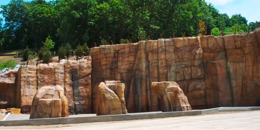
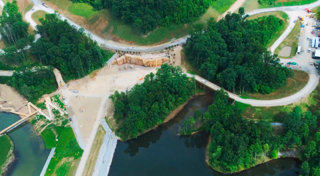
That's the "Boulder Cove" climbing wall under construction.


Did you seriously think that was a wall that went around the whole camp?
 
Last edited:
Insofar as the debate here is concerned, doubt has of course been asserted with respect to the entire idea, whether that pertains to DoD and army involvement in the jamboree, any orders or policies in place at local level and any idea of military or federal drills of any kind taking place at all, let alone within real life scenerios, as have any notions that the area is currently heavily militarised. To counter this I have demonstrated that in fact the DoD and army are heavily involved in the jamboree and at most senior levels, and that the jamboree is a top priority for FEMA Region 3, with exercises and CONOPS provisionally planned for one of three areas approximating to the camp site, and at a concurrent time; and that in fact an Executive Order 1-12 was issued by local government, allowing for federal involvement and that further to that, since the claim was initiated, a State of Emergency was in fact declared in the two counties in which the event is taking place as well as seven other surrounding counties, which has delegated emergency power to unelected executives within federal authorities, namely James Gianato and his team from the Department of Homeland Security. There ensued a debate as to the necessity of such action, and the semantic value of terms such as 'martial law'. And that's pretty much where "we are at" on this thread.:)

The last paragraph is where you make the most of your Gish Gallup and in the interest of debunking I will remove the bunk.

To counter this I have demonstrated that in fact the DoD and army are heavily involved in the jamboree and at most senior levels,
Content from External Source
DoD and the army are not heavily involved in the Jamboree. As you said here:


Landru said:
It's on their radar because it's a planned event. To say it's a priority is a stretch. It's not a National Special Security Event (NSSE).
I only meant a priority for Philly DCE.
Content from External Source
As was pointed out to you from one of the pdf files you provided the Region III Defense Coordinating Element is 10 guys led by a Col. Williams. A search for Col. Williams and you will find he is probably a nice guy but is not striding the corridors of the E ring updating the joint chiefs.

and that the jamboree is a top priority for FEMA Region 3,
Content from External Source
The DCE is not synonymous with FEMA. Its role as describe here is be a coordinating element, a liaison between DoD and FEMA to bring assets into play in the event of a disaster. You have provided zero evidence that the BSJ is a top priority for FEMA Region III (it seems FEMA uses roman numerals for their region naming).

with exercises and CONOPS provisionally planned for one of three areas approximating to the camp site, and at a concurrent time;
Content from External Source
No proof of any exercises in West Virginia by FEMA or DoD. The "CONOPS" you claim is the identification of staging areas should they be needed in the event of a disaster. Normal contingency planning.

nd that in fact an Executive Order 1-12 was issued by local government, allowing for federal involvement and that further to that, since the claim was initiated, a State of Emergency was in fact declared in the two counties in which the event is taking place as well as seven other surrounding counties, which has delegated emergency power to unelected executives within federal authorities, namely James Gianato and his team from the Department of Homeland Security.
Content from External Source
James Gianato is a State of West Virginia employee as is proven elsewhere in this thread and here. The emergency management office for West Virginia is called the West Virginia Division of Homeland Security and Emergency Management. Again, this is a State agency and is not affiliated with the US Government's Department of Homeland Security.

Go back to message #111 where I lay out all the restrictions to your martial law scenario and provide a context for the Governor declaring a state of emergency (something I also point he does frequently without civil liberties going by the wayside). You never answered my post #111 btw.

As for you wall
Project Description: The Summit Bechtel Family National Scout Reserve located in Mount Hope, West Virginia is one of four facilities managed by the National Council of the Boy Scouts of America. The Summit is the future home of the National Scout Jamboree, the Summit High Adventure Base, and the National Center for Scouting Excellence. The Reserve is 10,600 acres in size and will house several different “zones” which will provide a variety of activities for campers. One such “zone” – Boulder Cove – will consist of several rock walls, both natural and manmade, for climbing. McCrossin’s scope of work for the above referenced project included drilling for 43-each solider beams, drilling and installing 69-each permanent tiebacks, and testing 69-each permanent tiebacks for the 6,250-square foot climbing wall. Soldier beam drilling took place from the top of wall with drill depths up to 35-feet. Tieback drilling took place from benches created in front of the wall with drill depths in excess of 45-feet. Geologic conditions encountered included mine spoil, lean clay, coal seams, shale, and sandstone with unconfined compressive strength up to 27,000. Once the bottom row of tiebacks was installed, tiebacks were tested to 25% design strength and locked off. The upper row of tiebacks was then installed, tested to 100% design strength and locked off. Once all of the bench material was removed, the bottom row of tiebacks were tested to 100% design strength and locked off.
Content from External Source
 
Last edited by a moderator:
That's what I'm interested in, so I'm confused as to why you are asking me.


That's the "Boulder Cove" climbing wall under construction.


Did you seriously think that was a wall that went around the whole camp?

Sorry, now I'm confused. You said you are interested in what motivates such ideas, I have asked for your view insofar as what motivates such ideas (since it interests you), and this confuses you? If perhaps then I could reiterate, what motivates such ideas? If it is a self-professed point of interest I would just assume you have a view. I have postulated an ad hoc one myself, concerning pyschological motivations.

Insofar as the wall is concerned the source site page seems to have changed, though there is no record of the page on Internet Archive. I recall it being referred to as a boundary. Two images were formerly on the same page, now only one, another image, which is also entitled summit-bechtel-3.jpg, but with dimensional values added. I note upon clicking the image the javascript enlarges the 'wrong' image, the one I placed here (the other McCrossin projects enlarge the same photograph, at least, the few examples I checked, and this is as would be expected with a piece of javascript specifically designed to enlarge the image upon which one clicks). Slight anomaly there, but no matter.

Yes, it would not surprise me in the least if there was a boundary wall, why would it? Okay, it is a very large area but it is a phased development over 15 to 100 years. The tickets for the event are over a $1000 and security is tight. Why not build a fence? At the Glastonbury Festival in Somerset, England, the concrete fence is now comparable to what is pictured (whether a retaining wall or a fence) and must be 18 foot high by now! Goes up in a matter of weeks. It is a relatively simple exercise for engineers to construct a perimeter concrete wall, and easier still to expand it.
 
Last edited by a moderator:
Sorry, now I'm confused. You said you are interested in what motivates such ideas, I have asked for your view insofar as what motivates such ideas (since it interests you), and this confuses you? If perhaps then I could reiterate, what motivates such ideas? If it is a self-professed point of interest I would just assume you have a view. I have postulated an ad hoc one myself, concerning pyschological motivations.

Insofar as the wall is concerned the source site page seems to have changed, though there is no record of the page on Internet Archive. I recall it being referred to as a boundary. Two images were formerly on the same page, now only one, another image, which is also entitled summit-bechtel-3.jpg, but with dimensional values added. I note upon clicking the image the javascript enlarges the 'wrong' image, the one I placed here (the other McCrossin projects enlarge the same photograph, as would be expected with a piece of javascript specifically designed to enlarge the image upon which one clicks. Slight anomaly there, but no matter.

Yes, it would not surprise me in the least if there was a boundary wall, why would it? Okay, it is a very large area but it is a phased development over 15 to 100 years. The tickets for the event are over a $1000 and security is tight. Why not build a fence? At the Glastonbury Festival in Somerset, England, the concrete fence is now comparable to what is pictured (whether a retaining wall or a fence) and must be 18 foot high by now! Goes up in a matter of weeks. It is a relatively simple exercise for engineers to construct.

Do you have any evidence for any of your claims?
 
Sorry, now I'm confused. You said you are interested in what motivates such ideas, I have asked for your view insofar as what motivates such ideas (since it interests you), and this confuses you? If perhaps then I could reiterate, what motivates such ideas? If it is a self-professed point of interest I would just assume you have a view. I have postulated an ad hoc one myself, concerning pyschological motivations.

I don't know what motivates such ideas, which is why I'm interested in finding out.

Insofar as the wall is concerned the source site seems to have changed, though there is no record of the page on Internet Archive. I recall it being referred to as a boundary. Two images were formerly on the same page, now only another. which is also summit-bechtel-3.jpg but with dimensional values added. I note upon clicking the image the javascript enlarges the wrong image (the other McCrossin projects enlarge the same photograph, as would be expected with a piece of javascript specifically designed to enlarge the image upon which one clicks. Slight anomaly there, but no matter.

Yes, it would not surprise me in the least if there was a boundary wall, why would it? Okay, it is a very large area but it is a phased development over 15 to 100 years. The tickets for the event are over a $1000 and security is tight. Why not build a fence? At the Glastonbury Festival in Somerset, England, the concrete fence is now comparable to what is pictured (whether a retaining wall or a fence, must be 18 foot high now! Goes up in a matter of weeks. It is a relatively simple exercise for engineers to construct.

A 15 mile long forty foot high concrete and steel wall? I'm sorry, but that's utterly ridiculous. It's quite clearly what it's labeled as - a climbing wall. Don't you think if such a wall existed then someone would have noticed it?
 
992905_410693369050378_1473512761_n.jpeg

This arguably unusual notice from the Division for Infectious Disease Epidemiology within West Virginia Bureau for Public Health, recently circulated to shops and public spaces in Beckley, West Virginia, and nearby areas, when combined with the heavy military presence and medical health based rumours surrounding the event, is compounding a sense of concern among many residents.
 
Considering the ease of foodborn illness that makes some sense. I would really like more evidence than being posted on Facebook. A TV report would be nice. the phone # is correct.

http://www.dailymail.com/News/Kanawha/201306260090?page=1&build=cache

We're looking at the potential impact on the medical community," said Dave Ramsey, CAMC's president and chief executive officer. "I've been told that at the last Jamboree, about 700 sought emergency room care ... and about 300 of those were admitted to a hospital. A lot of that will be handled down in the Beckley area, but we may have some ... we're just trying to go through the what-ifs: if we do see a lot of patients, how would we handle them."

CAMC, along with other hospitals in the region, held drills in April to prepare for various Scout-related scenarios, said Dale Witte, CAMC spokesman.

Women & Children's Hospital reacted to a scenario in which they would receive an onslaught of patients with an infectious disease -- in this case, meningitis.

Memorial's scenario concerned trauma related to a mock bus accident.

"Overall, all three CAMC hospitals have been planning for an increase in patients of all types," Witte said.
Content from External Source
 
The last paragraph is where you make the most of your Gish Gallup and in the interest of debunking I will remove the bunk.

Easy Tiger. Gish gallup is commonly bandied around here, huh? I'd suggest saving it for appropriate usage. I am not seeking to deceive anyone with a torrent of verbiage. Indeed, it was a simple response to a simple if perhaps tongue-in-cheek request for a recap, from Pete Tar, and not an altogether inaccurate summation either. I do like the phrase though. Can imagine it sounds good in a New England accent, "Gish Gallaaaarrrp", but not so good in an old England one. You won't find many factual errors in what I have asserted, not enough to merit such a derogatory term. Those errors that are there, are conceded. As I have already stated thrice over, I am crafting thoughts from a small, useless phone, and if I had a proper computer to hand I would be altogether more able to respond with detail and to verify and evidence facts as I proceed.

You never answered my post #111 btw.

I know, I realise that and have already explained why I have not, but I will, eventually.

I might add that in terms of your counter-arguments you have thus far provided two sources of information that I had not already read and digested prior to you presenting them to me as though perhaps unknown to me, and for those two things I am grateful. Insofar as the rest is concerned, I have already been there, beforehand, and you may be preaching to the converted.

By the way, I like your avatar, gives you an air of authority.
 
Last edited:
992905_410693369050378_1473512761_n.jpeg

This arguably unusual notice from the Division for Infectious Disease Epidemiology within West Virginia Bureau for Public Health, recently circulated to shops and public spaces in Beckley, West Virginia, and nearby areas, when combined with the heavy military presence and medical health based rumours surrounding the event, is compounding a sense of concern among many residents.

Seems like a perfectly reasonable notice to me. The department doing their job. There's a similar notice online here:
http://ohiocountyhealth.com/newsandnotices.php?id=915

The most likely things would be stuff like norovirus.

I'm wondering what the next predicted "false flag" event will become popular in the conspiracy culture. Probably some sporting event.

[ETA] I'm going to predict Rio 2016 will eventually become the new 2012-style predicted disaster, until nothing happend. You read it here first!

[ETA2] Bugger!
http://forum.bodybuilding.com/showthread.php?t=147308223&page=1

The illuminati and a false flag attack at Rio Olympics 2016

Just thought I'd get in early.
Ermm... The logo looks like people mutating because of nuclear radiation from the fall out of a false flag nuking of Rio.
Anyone got anything else? Im sure we can come up with some conspiracy theories to do with the writing style too... Like the R doesnt close up, or the 16 is connected for some reason...
Content from External Source
 
Last edited:
Do you have evidence that burial vaults are being moved to the National Scout Jamboree site?

Uh, no. Why? Did someone suggest I had? Folks are saying all sorts of shit about me and it's hard to keep up with it all, so I may have missed that one. But I never said that, I assure you

Yes, no one here has suggested burial vaults were moved to the jamboree site. I said there was an initial first hand account, and that should be retracted to a second hand account that burial vaults were at the site. It was this:

Jerry | May 28, 2013
I will tell you that there were two guys sneaking around up there trying to look at some black coffin like boxes they brought in on trucks and were covering up with tarps, and a military chopper flew over them with light and ran them out of there. I don't know why or whatever but I do know it is policed by the military instead of local law enforcement.
Content from External Source
Further discussion, second and first hand accounts (forgive the copy please, Topix participants in West Virginia):


resident at glen jean | Friday Jul 12
Why the hell would they have all those caskets for? I'm getting really scared.

Conspiracy | Saturday Jul 13
No morgues. No casket. Just a Jamboree. Sheesh.

Sketchy | Saturday Jul 13
Read the FEMA page for this jamboree, it clearly states mortuary services station. I believe the stories of caskets. What the hell are they for?

resident at glen jean | Saturday Jul 13
I have talked to the workers and there is something else besides a damn jamboree going on. You don't need 10000 caskets and a damn portable morgue unless they know some thing's going to happen.

Conspiracy | Saturday Jul 13
Has anyone taken any photos of these "caskets" or "morgues"? Anyone can start rumours or conspiracies.

resident at glen jean | Saturday Jul 13
Yes they are up there, all the workers have seen them, it's even on the map, and yes, I have seen the pictures of them, they are black. That's why I'm getting my family and getting the hell out of here I live right beside the camp I know something is wrong with this picture.

Conspiracy | Saturday Jul 13
Can you get a link to this map? Because it's funny I've never seen them. There are no caskets.

resident at glen jean | Saturday Jul 13
Why the hell would all the workers lie? Go look it up, Google it, it tells all about it, type in 'Why are caskets needed for the boy scouts 2013', it says 'for a drill', yeah my ass a drill, that's going to turn into pure chaos.

Conspiracy | Saturday Jul 13
They are not actually caskets.

resident at glen jean | Saturday Jul 13
Then what the hell would you call over 1000 black plastic boxes with lids? - And explain the damn morgue.

Conspiracy | Saturday Jul 13
Why would FEMA let workers see these things? Also, even if they were to exist it would be a precautionary measure in case a disaster were to happen. Again, it all falls back to expecting the best, but preparing for the worst.

gun owner | Saturday Jul 13
We have Bridge Day here with over 100 thousand people. The scouts are bringing in roughly 30 thousand. Why not all this for Bridge Day? How come the governor doesn't declare a state of emergency for Bridge Day? You don't see Apache helicopters flying around with guns and stuff. Temporary morgues and caskets by the thousands , people have actually seen these things.

Wrong Answer | Saturday Jul 13
As a veteran I see absolutely nothing out of the ordinary. It just so happens this is the perfect scenario to actually do a major military training drill in the event of a terrorist attack. And some of what's going on is there in case there is one. It's both a good opportunity for one to happen, and it's a great opportunity to train for such an event.

WOW | Saturday Jul 13
Temporary morgues? Lmao. Do you have proof of this? No, of course you don't.

spunsk8er | Saturday Jul 13
I work at a restaraunt in Beckley. We all got a pamphlet from the health dept. asking us to report if we saw any customers or groups with weird rashes or complaining of nausea during and after the event, but not before. I thought that was kinda strange.

Mossy | Saturday Jul 13
The caskets you are speaking of are actually septic tanks, and grey water tanks, for the bath and shower houses.

resident at glen jean | Saturday Jul 13
Yeah we [received a health department notification about skin rashes and nausea at our premises] too. Get a [look at] these people on here [who] think it's a joke, well it's not, and yes, the workers at the camp have no reason to lie, that stuff is over there whether you believe it or not. They all come in and say the same thing. It's not that much of a coincidence that they all say the very same thing. They have better things to do than make shit up. I mean why the hell would they? There are strange things going on up there, you people need to open your eyes because when you live right beside the camp [as I do] then you would know what us dumb ass Hill-Billy's are talking about. Well I don't think we are so dumb about this one, right now a helicopter is so close to my roof I can't even hear the damn TV over this bull shit.

resident at glen jean | Saturday Jul 13
Why did FEMA purchase the portable morgues and caskets from Threes and have a section reserved at Blue Ridge? I know this is true, it isn't no damn septic tank, get real! We aren't that dumb how do you take a 6 foot long box with a lid and make it a septic tank? Yeah right, that's just a cover up, so there are caskets up there being used as septic tanks lmao

Mike | Saturday Jul 13
You have quite the imagination lol. I don't care how close you live, I work there and you know what's there? A BOY SCOUT CAMP. The helicopter flies over 'cause it's the National Guard and it's a national event.

Mossy | Saturday Jul 13
The 6 ft tanks with lids are a filter system for the grey water made by Advantex. How do I know? Because I've been here going through each system making sure they're working properly. I have all access to the entire place and there is no morgue, no one from the military has stopped me from going anywhere. There are a couple hundred of those tanks.

AX20RTCutaway display_01.jpg
[Orenco's AdvanTex-AX Treatment System for onsite treatment of wastewater.]

resident at glen jean | Saturday Jul 13
Well aren't there areas you're not allowed in? I do believe so, so how do you know exactly what the hell is up there 'cause there is a certain area nobody but the damn military is allowed at. If you work there then you know I'm telling the truth.

resident at glen jean | Saturday Jul 13
Then why do all the workers I have talked to say there is a secured area nobody is allowed into except military?And I am also told there is a bunker bomb shelter up there and was told there are snipers surrounding the perimeter in the woods. I'm just trying to figure all this out is all I have kids and I don't want anything bad to happen just for them to be safe but I have heard so much it's made me very paranoid, and yes, I am worried.

mike | Saturday Jul 13
Designated work areas. Not just military but all the companies. Everyone would drive past the military to get to their areas. Never had any problem.

Mossy | Saturday Jul 13
If there is a secure place here I haven't found it yet. I've been to the presidential heli-pad. I really doubt there is a bunker here.

Sketchy | Saturday Jul 13
There are caskets, oh I'm sorry vaults, behind Blue Ridge Cemetery, in Oak Hill, guarded by the state police. Not 'well I just saw a picture of it on [Facebook] a good friend took it'. I don't care if they are for drills, I wouldn't want my kid to have a drill with thousands of caskets. Our government should have at least warned us about some of this stuff, so as not to creat panic. No conspiracy. Fact. There are 1000s of caskets being unloaded in Oak Hill [Blue Ridge Cemetery] now. I have seen it. So fuck their drills, if they are expecting something big to happen cancel this thing.

Mike | Saturday Jul 13
Yea what's wrong with them for not realizing this thing is being built around some incredibly stupid people. Next time a business comes, something recreational or organization wants to build something we will warn them that the retarded people in the area will be scared.

sketchy | Sunday Jul 14
Have a few 1000 caskets sitting in your back yard, bringing them in now as in my other post. Is it smart or stupid to ask questions? I never said something is going to happen, they make it look like [something is going to happen] so maybe they should have told us what to expect.

Mike | Sunday Jul 14
It's stupid to ask obvious questions... Those are not caskets...

sketchy | Sunday Jul 14
I told you where [Blue Ridge Cemetery in Oak Hill]. Go see for yourself. Are you saying I'm lying? I figure a person like you would argue that what you are seeing that is black, 6 ft long, with a lid and sitting stacked up behind the funeral home is NOT what it looks like. You take care.

resident at glen jean | Sunday Jul 14
Yeah there are caskets back there. There are certain areas you're not allowed in. We live here, we know the truth, whether it's for a drill, or not, they are there, and I believe what the workers are telling [me], they have no reason to make shit up.

http://topix.net/forum/city/beckley-wv/T9SUMIVU5I3V7H105

Content from External Source
Conclusions:

Person I would hire to fill my tax return: Conspiracy
Person I would hire to fit my Advantex graywater filtering tank: Mossy
Person I probably wouldn't let into my house: Mike
Person I would entrust with the care of my eight year daughter: Resident at Glen Jean


http://blueridgefuneralhome.com
(304) 256 - 8625
 
Last edited:
If you predict a false flag for everything, sooner or later something will happen. Sort of like a psychic's prediction or a fortune cookie, "You will meet a tall, dark stranger'.
 
Status
Not open for further replies.
Back
Top