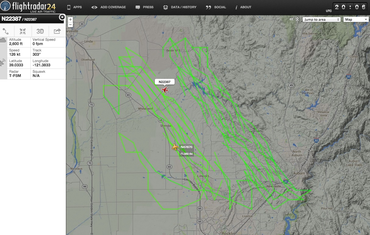
N22387 Zig-Zig flight path near Sacramento [LIDAR data collection]

Mick West

Administrator
Staff member


That's an odd looking flight path. Interesting though that it's only at 2,600 feet. It certanly won't be leaving any contrails.

My first though was cloud seeding, but it seemed like rather too much flying for that. Then I though maybe a rather over-zealous flight student practicing turns. However looking at the registration of the plane:

http://flightaware.com/resources/registration/N22387

We see it's a 1977 Piper PA-23-250 registered to "Richard Crouse and Associates". A quick google of that gets us to:
http://www.richardcrouse.com/
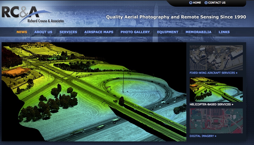

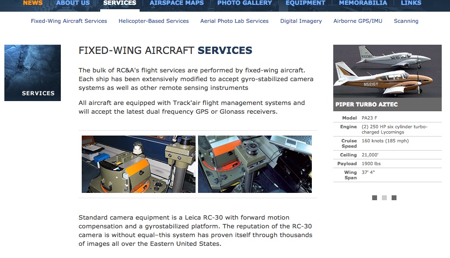
RC&A provides photogrammetric stereo aerial photography and remote sensing from our fleet of 10 aircraft, which serve as platforms for six Leica RC-30 film cameras, 2 Zeiss RMK Top film cameras, three Intergraph Digital Mapping Cameras and one Optech DiMAC digital camera.

Additionally we now offer LiDAR data collection using a state of the art system that couples a Riegl LiDAR sensor with a Leica RCD-30 medium format digital camera. LiDAR data and imagery can be collected simultaneously or independently of one another, and the system can be mounted in our helicopter or one of our Piper twin engine aircraft.
Content from External Source

(N22387 is shows in this image, at the back)

It's doing LiDAR scanning, which combines taking photographs with scanning the ground and building contours with a laser. This is how you get 3D buildings in Apple Maps etc.
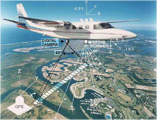
 
Collecting data for a GIS! (geographic information system). Often times they have to monitor changes in topography and land use. It could have had something to do with the recent earthquake near San Fransisco and the possible changes in topography in outlying areas. Or from a recent forest fire event and/or landslide. Though I don't think that there have been any recent fires in that area according to CalFire.

http://www.fire.ca.gov/general/firemaps.php

One of the topics in my remote sensing class this semester will be Lidar, and I can't wait to get into it. Remote sensing is a really cool subject indeed..
FEMA uses LIDAR for flood mapping.
https://catalog.data.gov/dataset/20...-lidar-merrimack-river-watershed-massachf5c72

These data are the lidar points collected for FEMA Risk Mapping, Assessment, and Planning (Risk MAP) for the Merrimack River Watershed. This area falls in portions of Hillsborough, Belknap, Merrimack, Rockingham and Strafford counties in New Hampshire and portions of Essex, Middlesex and Worcester counties in Massachusetts.
Content from External Source
 
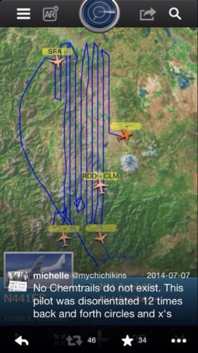
A similar flight path doing the rounds on Twitter:

image.jpg

N441FS is a Cessna registered to Surdex Corporation in Chesterfield, Missouri.


Surdex is a leading provider of geospatial data services to a diverse client base. We are committed to accurate services that are of the highest quality. We have served clients since 1954.
Content from External Source
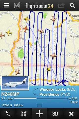
And another:

image.jpg

N246MP is registered to Quantum Spatial, another geospatial surveying firm.
 
Last edited:
Back
Top