Rory
Closed Account
A youtube video claims a discrepancy in the observed relative heights of four peaks in the Blue Ridge Mountains of North Carolina, supporting the flat earth hypothesis, however:
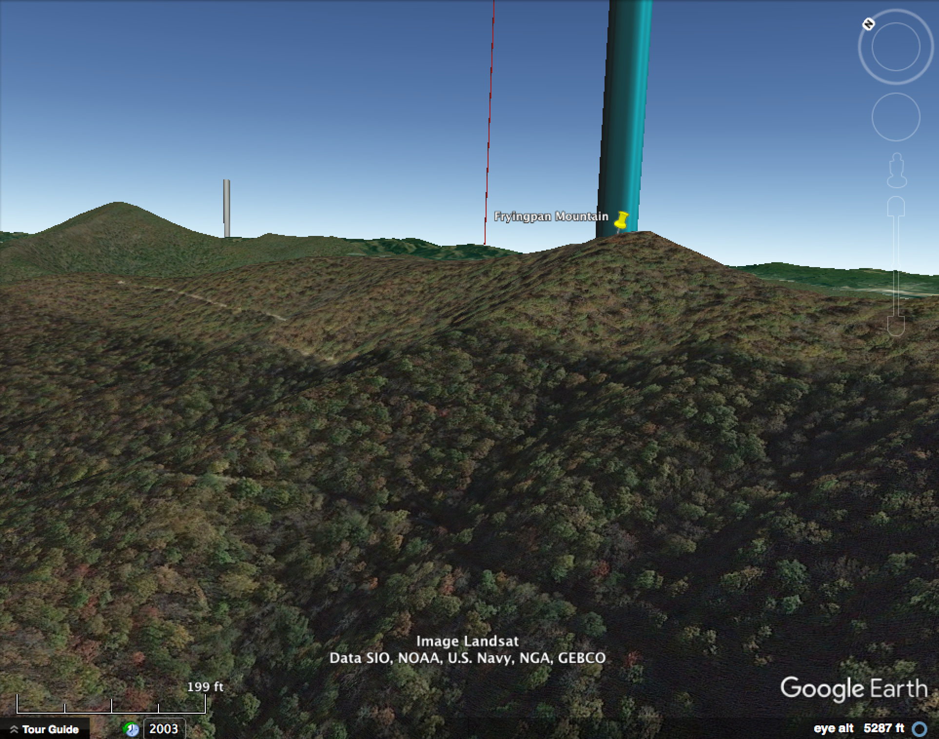
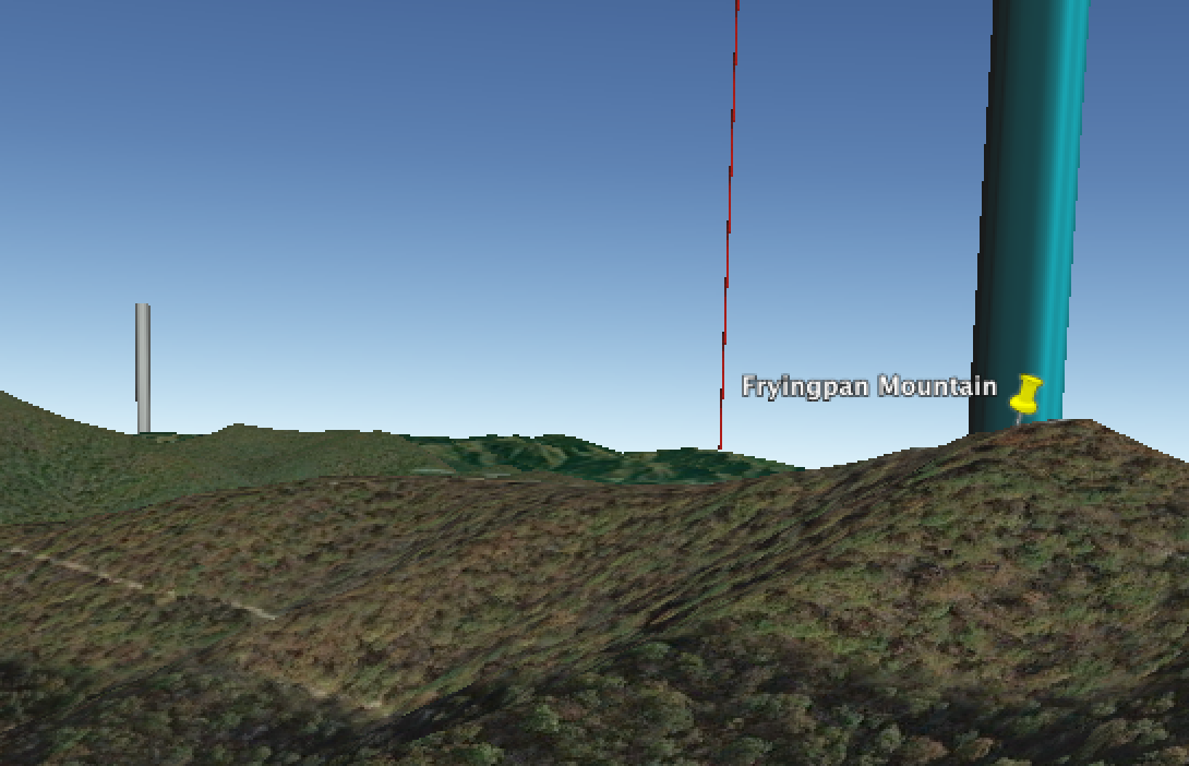
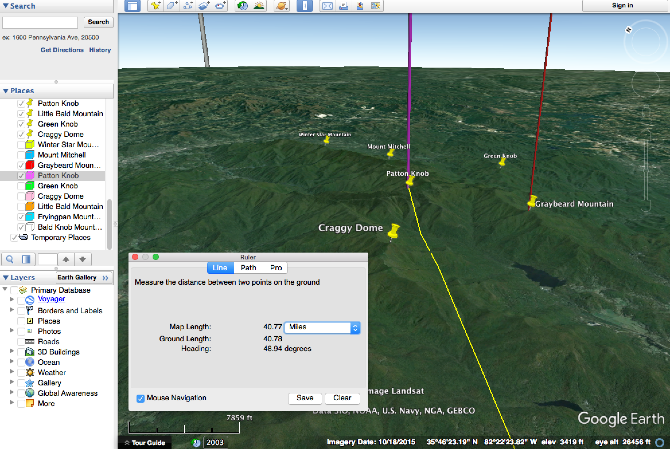
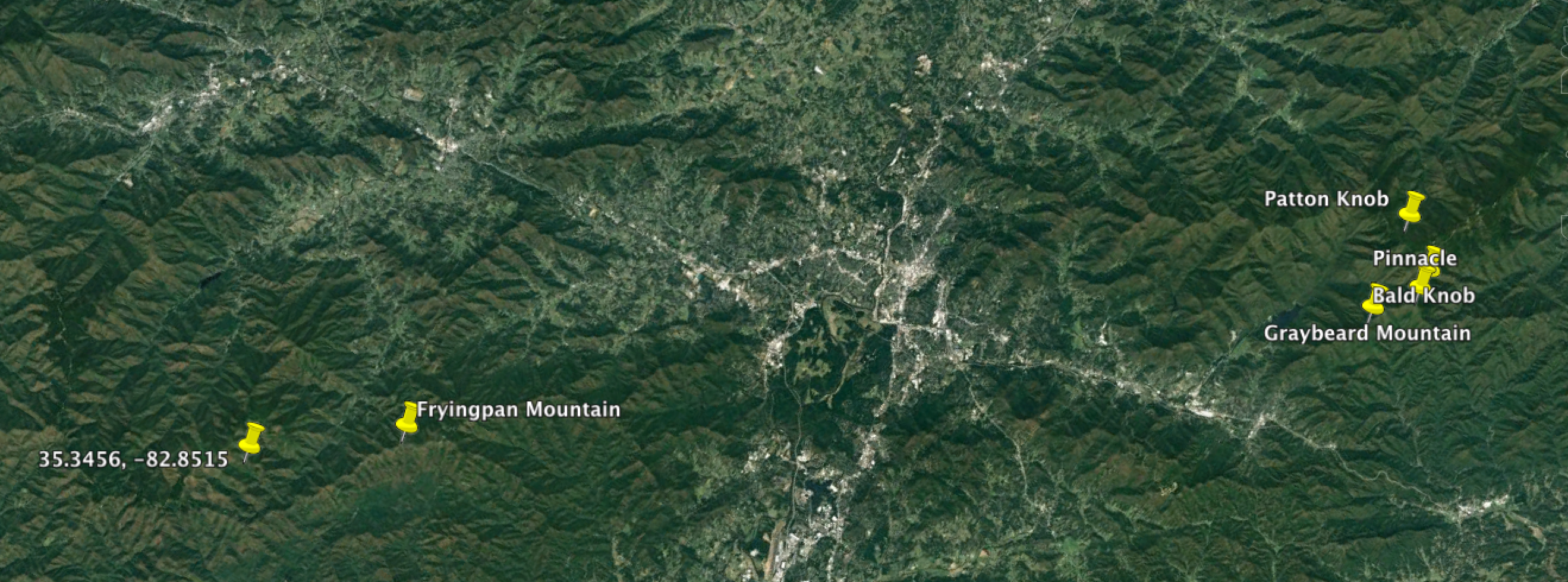
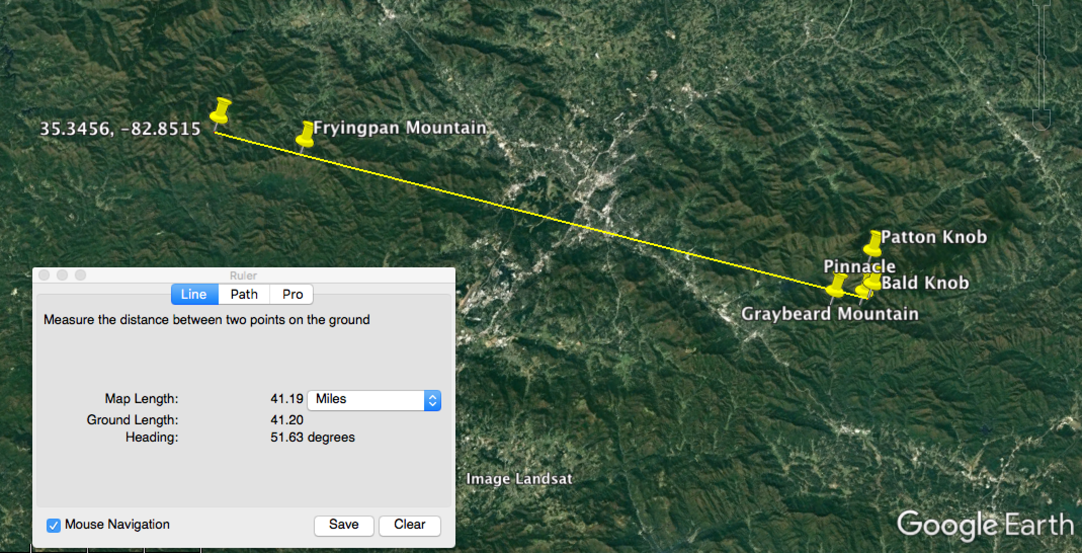
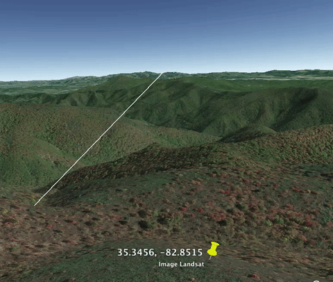
- The viewpoint indicated in the video does not match the actual viewpoint, as can be verified by looking at a map. By drawing a line from where he says he was, passing to the left of Fryingpan Mountain, Graybeard Mountain will be on the right of it, not on the left, as in his photo
- His stated altitude is wrong. Not only because the camera is not where he thought it was, but because he is relying on a cheap altimeter for his figures, whereas even good altimeters can often be 200-300 feet out
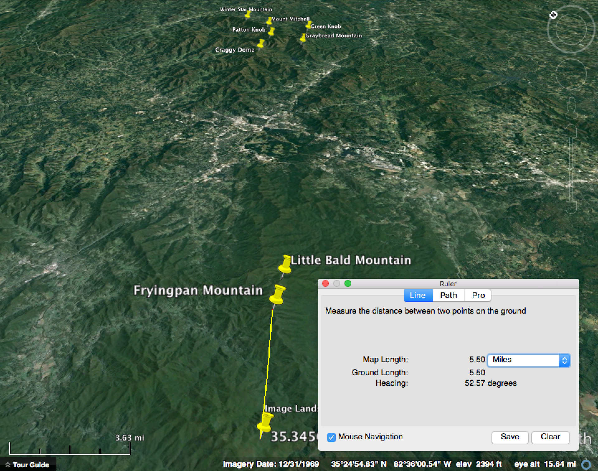
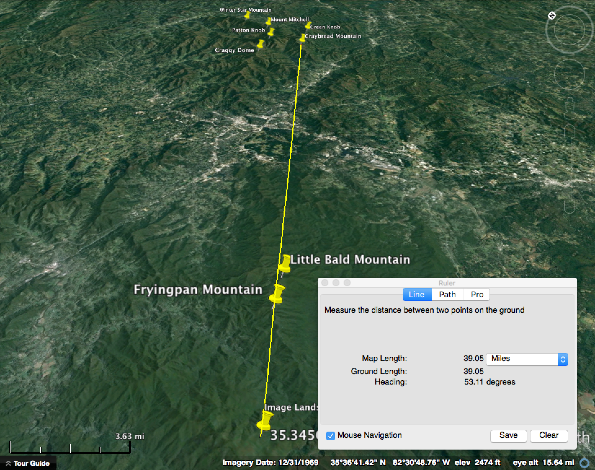
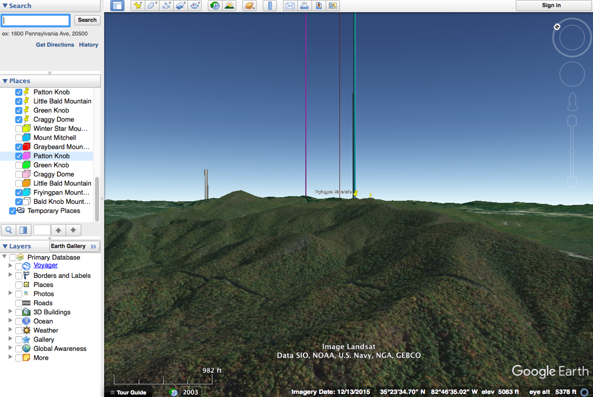
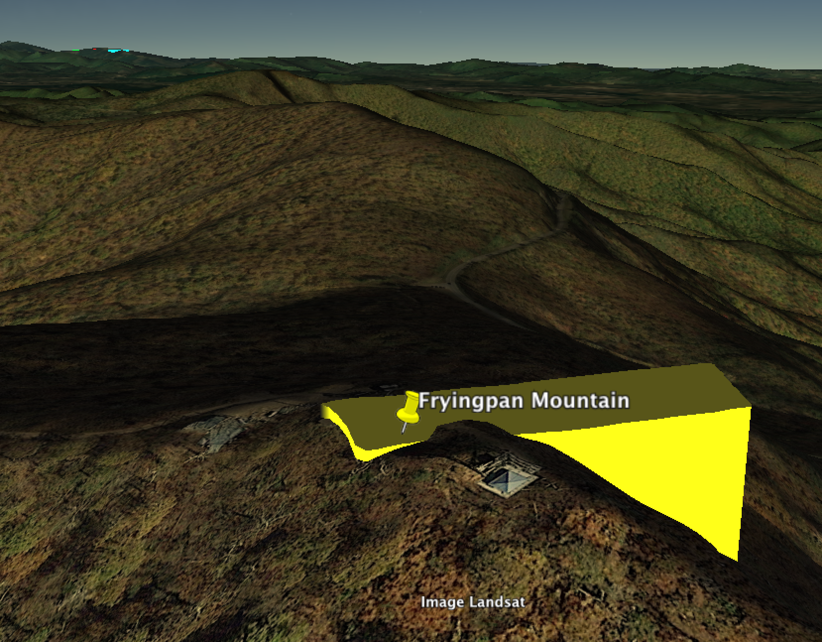
- His correct camera position and altitude can be found using image matching on Google Earth. He was actually a little to the north and west of where he says he was, and about 100 feet higher
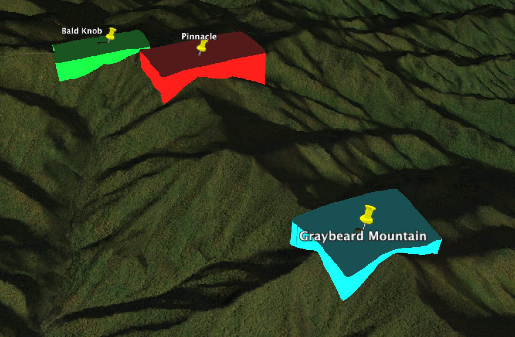
- Some of the summit elevations given are incorrect
- When calculations are applied to the correct elevations, there is no discrepancy with the globe earth model.
Original OP
The video below shows a view of the Blue Ridge Mountains in North Carolina that, it is claimed, should be impossible on the spherical earth. The video is 1 hour long, but most of the first 45 minutes is background and methodology. The video maker is (seemingly) very thorough in his calculations and research, as shown in the first part of the video.
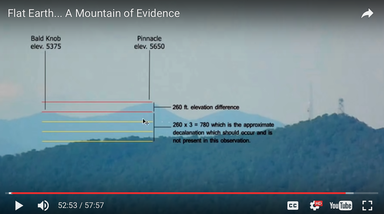
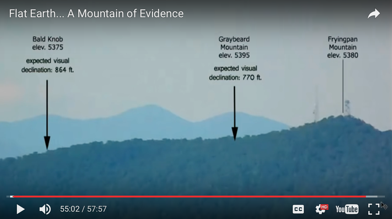
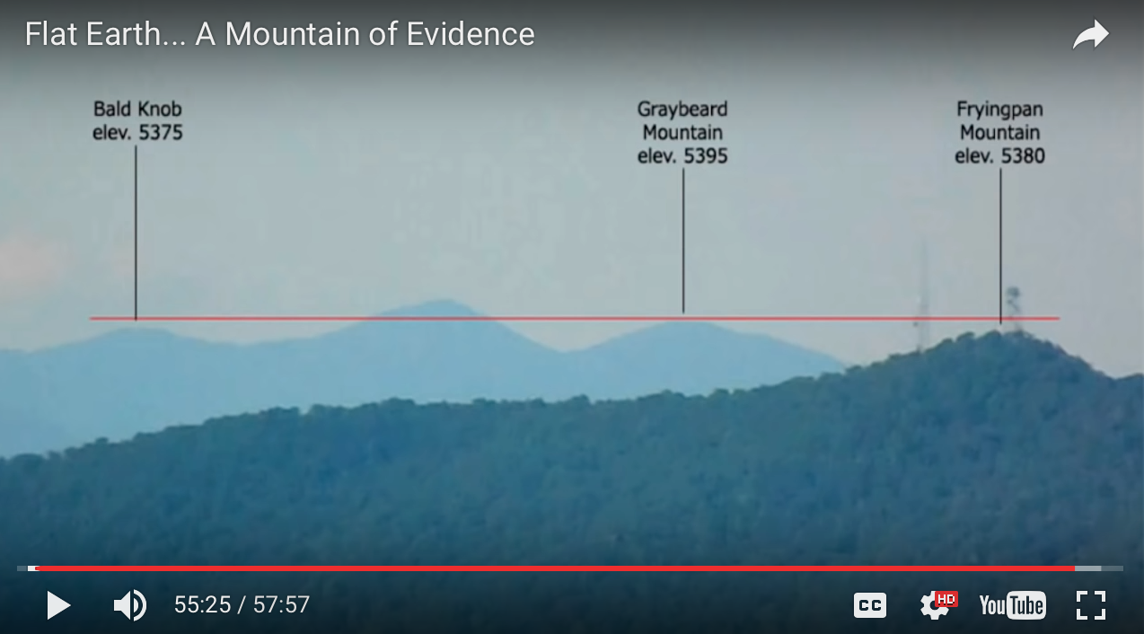
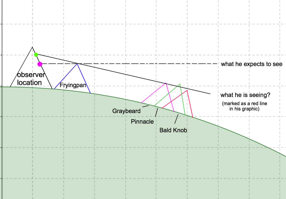
Ultimately, his claim resides on apparently being able to see mountain summits of similar heights but varying distances (6-41 miles) mostly aligned on the horizontal, whereas those that are 30+ miles away "should show substantial declination".
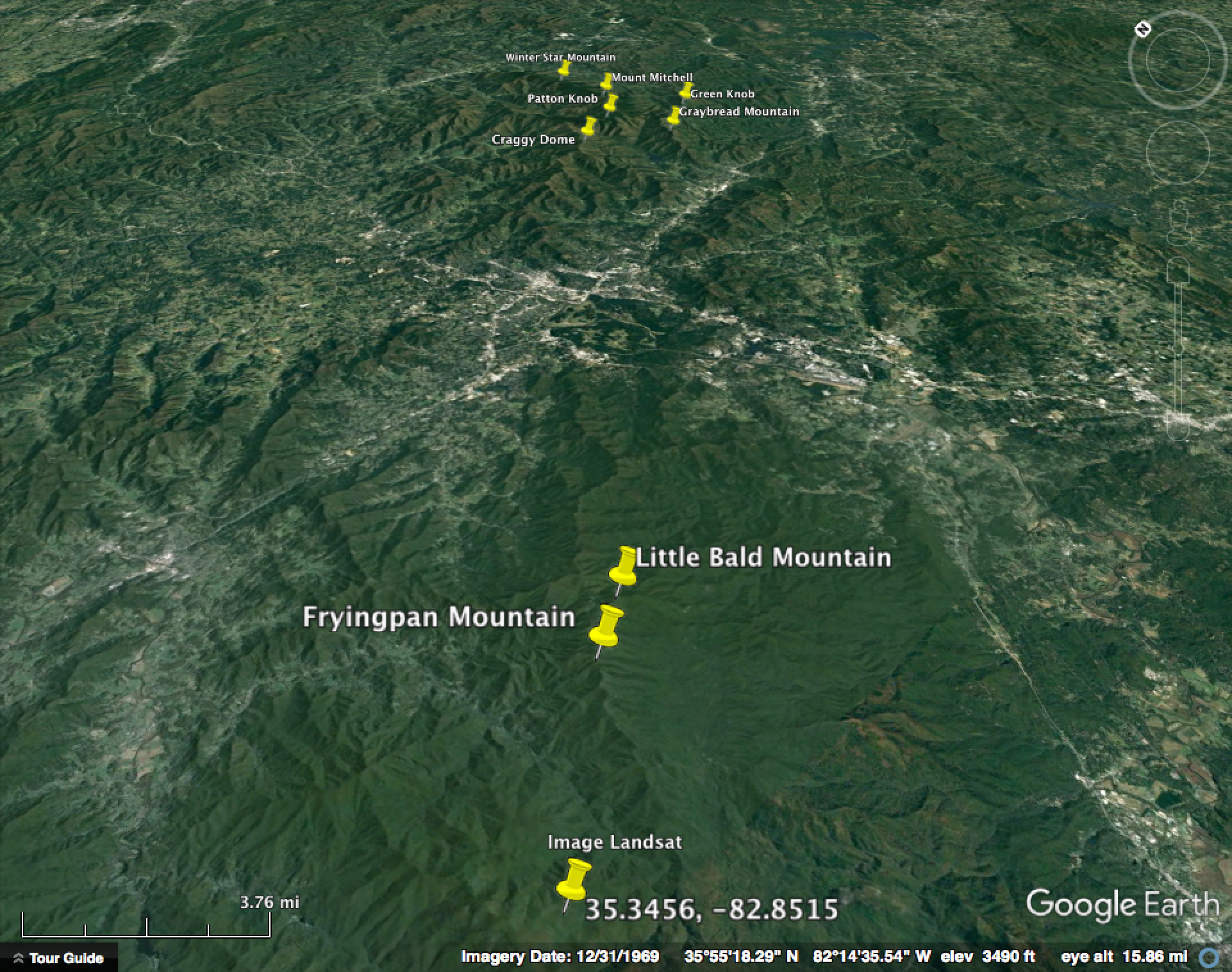
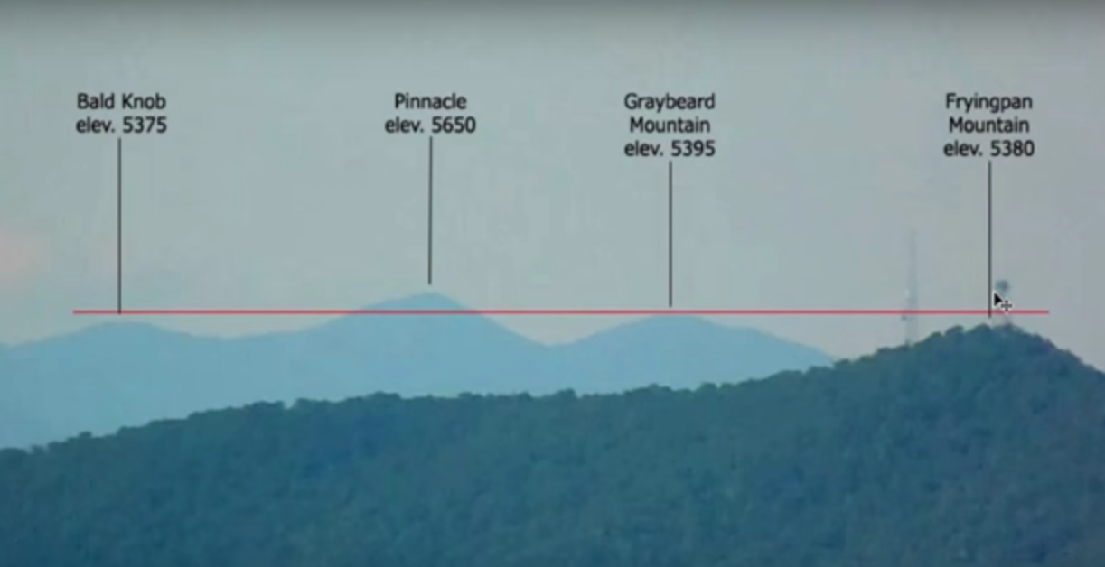
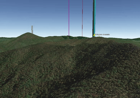
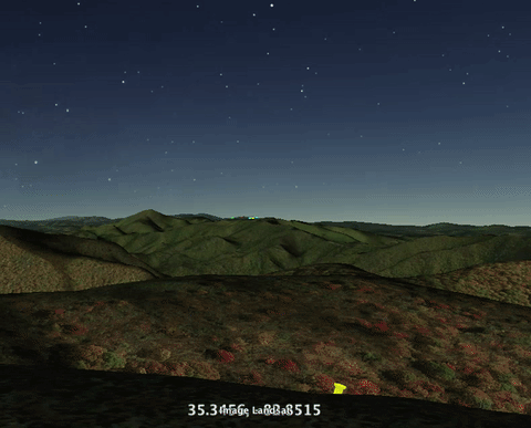
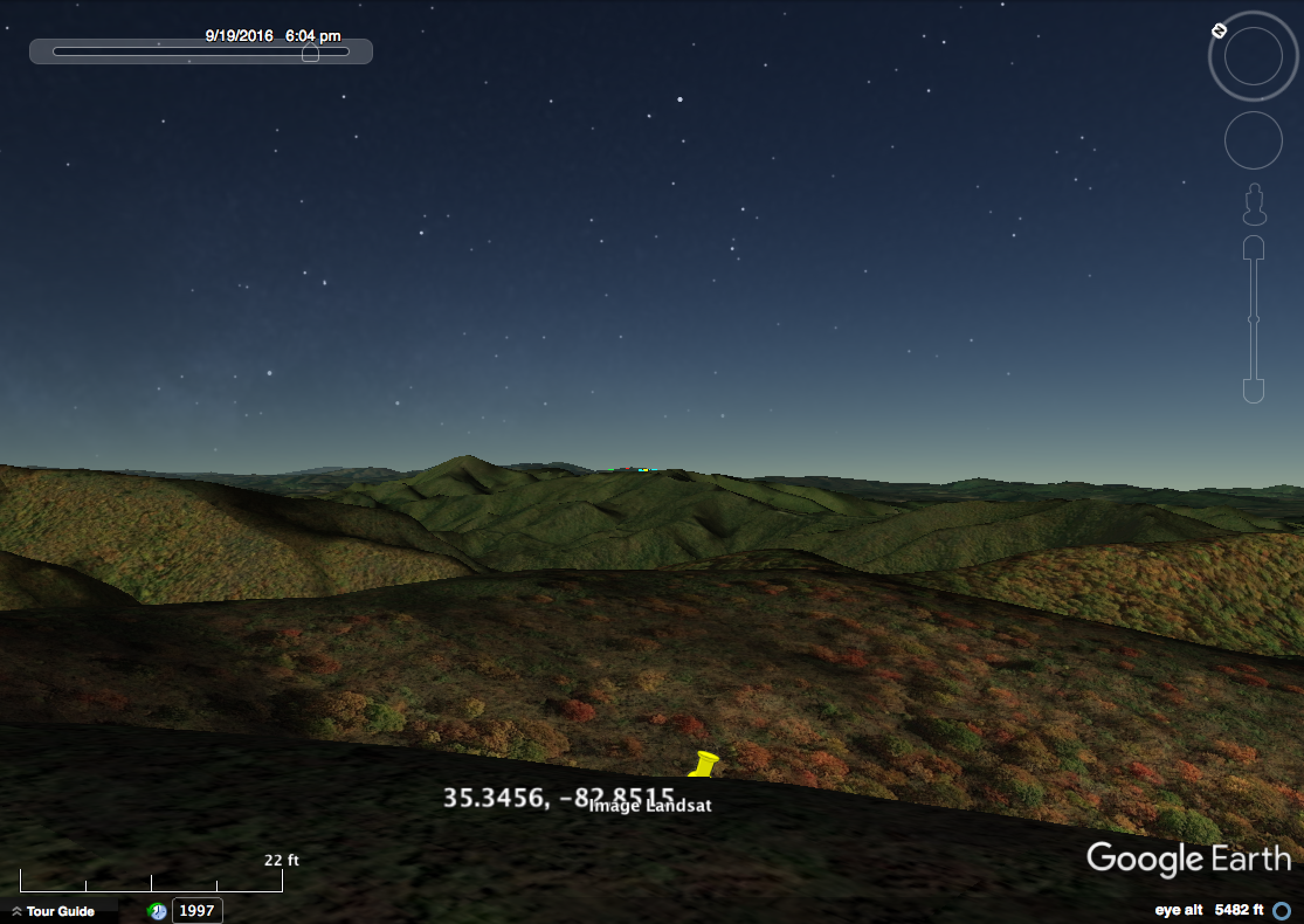
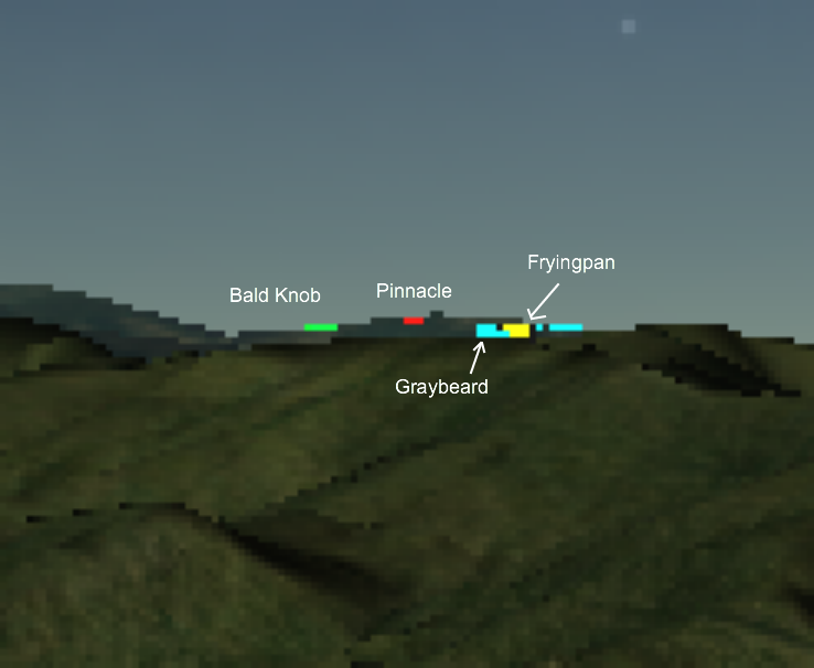
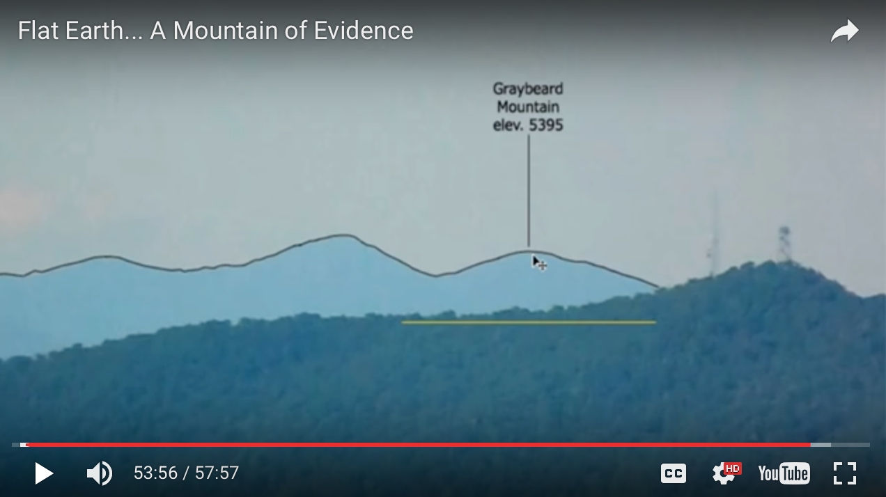
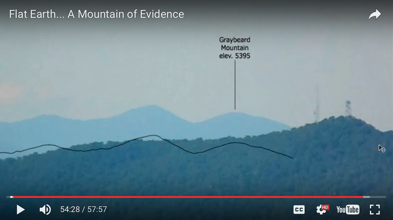
The key image is probably this one, from 51:30 of the video:
This shows an image of 4 summits taken from his vantage point, which he says is at an elevation of 5,382 feet. He doesn't give coordinates for where he is, but as explained below, I calculated his stated viewpoint to be at 35.345686, -82.851524.
The summits for those mountains from there are, in order from left to right, 41, 40.8, 39.1, and 5.5 miles away.
The premise then is that, given that the three distant summits should "drop" around 770 feet further than the nearby Fryingpan Mountain, the view is impossible on a spherical earth, and actually supports the flat earth model, if the posted elevations are correct.
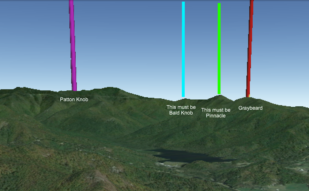
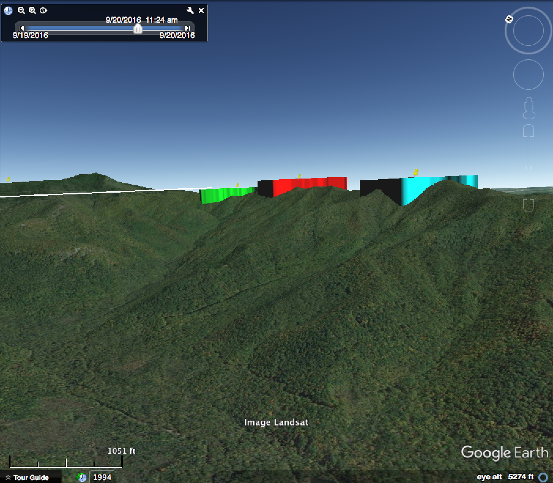
Hypothesis #1: He's looking at the wrong mountains.
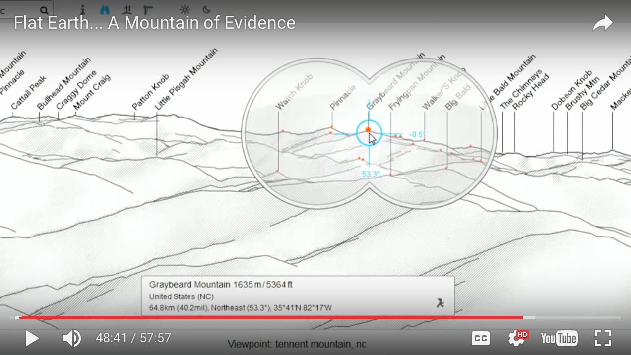
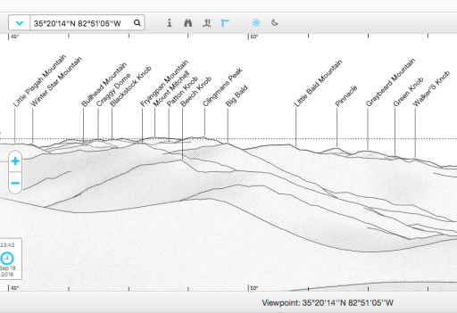
Because he was near the summit of Tennent Mountain he entered that as a location into peakfinder and received the following view:

Although he has said he was only 1.2 miles from the summit of Tennent Mountain - though over 650 feet lower - entering his actual viewpoint changes the picture substantially:

Link to this viewpoint here.
UPDATE: THE ABOVE VIEWPOINT IS WRONG. WHAT I'VE SUBSEQUENTLY LEARNED IS THAT WHEN INPUTTING GPS COORDINATES INTO PEAKFINDER, EVEN THOUGH IT SHOWS THEM IN THE BOX, IT ACTUALLY SWITCHES TO THE NEAREST AVAILABLE VIEWPOINT, WHICH CAN BE SOME DISTANCE AWAY
In this viewpoint there are several mountains to the west of Fryingpan Mountain that summit at around 6,600 feet, including some not named above which you can see if you click on the link and use the binoculars tool, such as Mount Craig, Big Tom, and Balsam Cone (around 45 miles in the distance).
40 miles further from Fryingpan, but 1200 feet higher, would put them roughly level from the viewing point of the photographer, and explain the "impossible view".
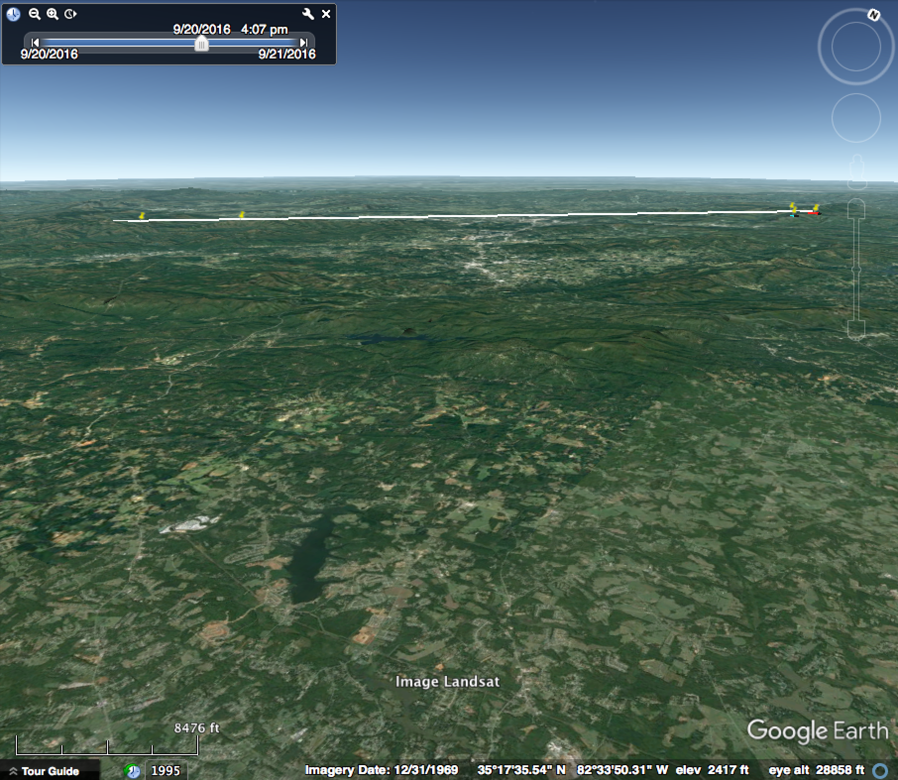
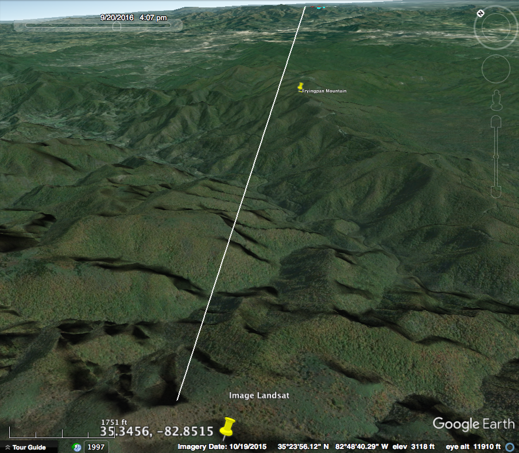
Determining his actual location
At 30:40 in his video he shows the camera location on a topo map:

Which is easily identified by following the elevation lines from Grassy Cove Gap:

In addition to the incorrect view shown in Peakfinder, if we draw a line from the camera location so that it passes to the west/left of Fryingpan, we can see that Greybeard is actually to the east/right of Fryingpan.
So it's quite possible he's mislabelling the three peaks, and actually looking at peaks with summits substantially higher. Or that his stated location is incorrect, and that the view from the right location works out just fine on the spherical earth.
Or, that the earth is flat.
But I need help figuring out which.
Attachments
Last edited: